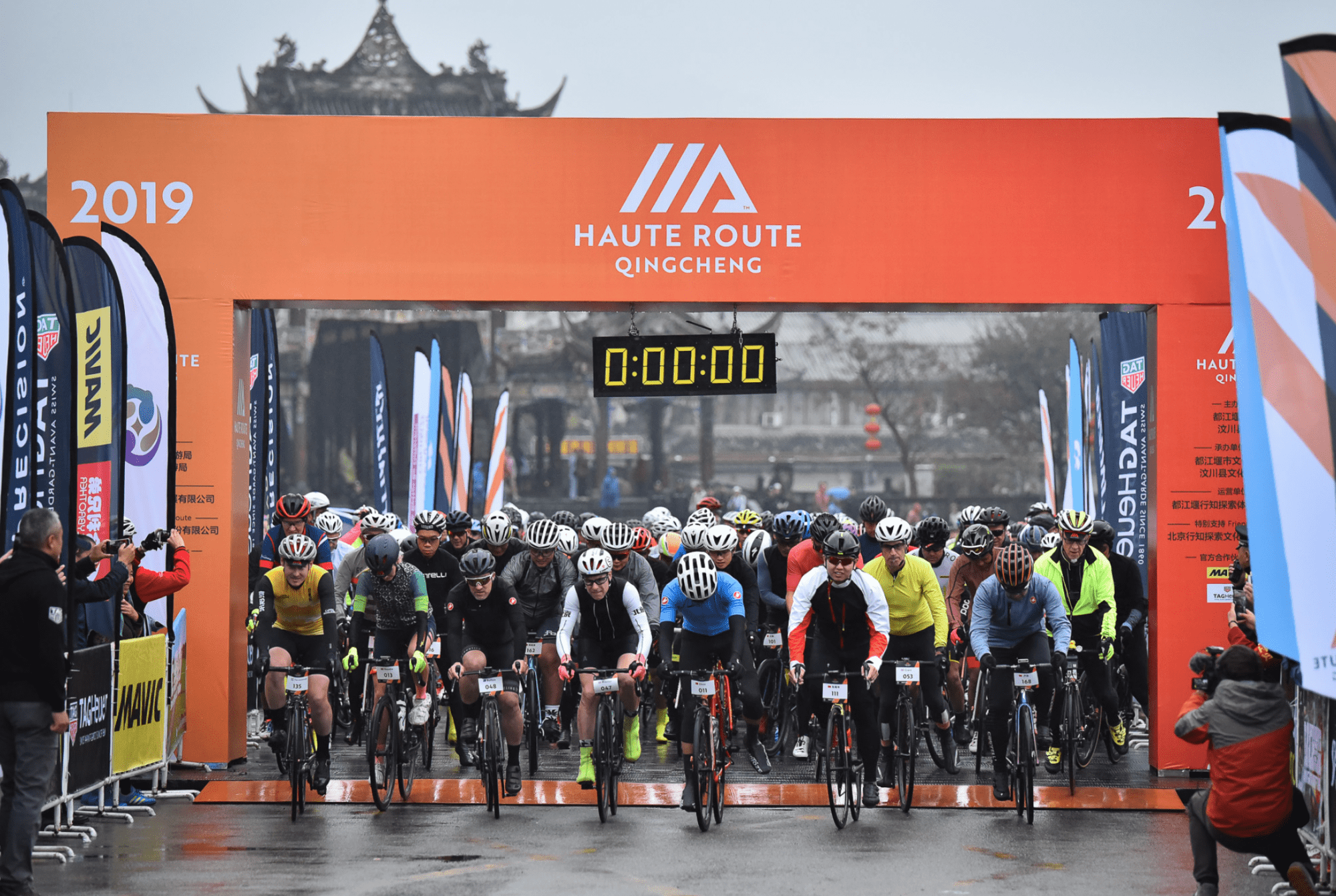
Haute Route Qingcheng, China
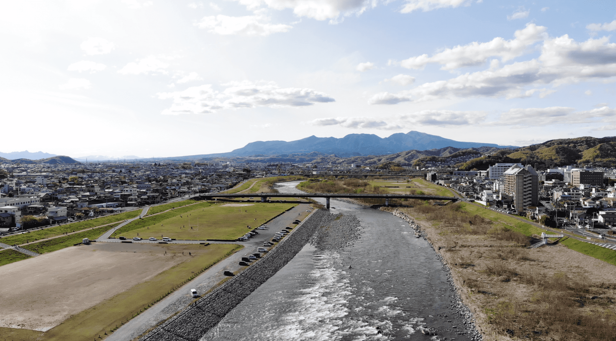
Other countries had been considered for the first Haute Route in East Asia, but the opportunity to help develop the vast, largely untapped market for top-end cycling events in China was too big of a lure to ignore. With that decision made, the Swiss-based outfit that has transformed the amateur road racing sector since it debuted the Haute Route Alps in 2011 then had to find an ideal location, and from a large list of potential locations they settled on the city of Dujiangyan to host the October 25-27 event. It proved to be a good choice.
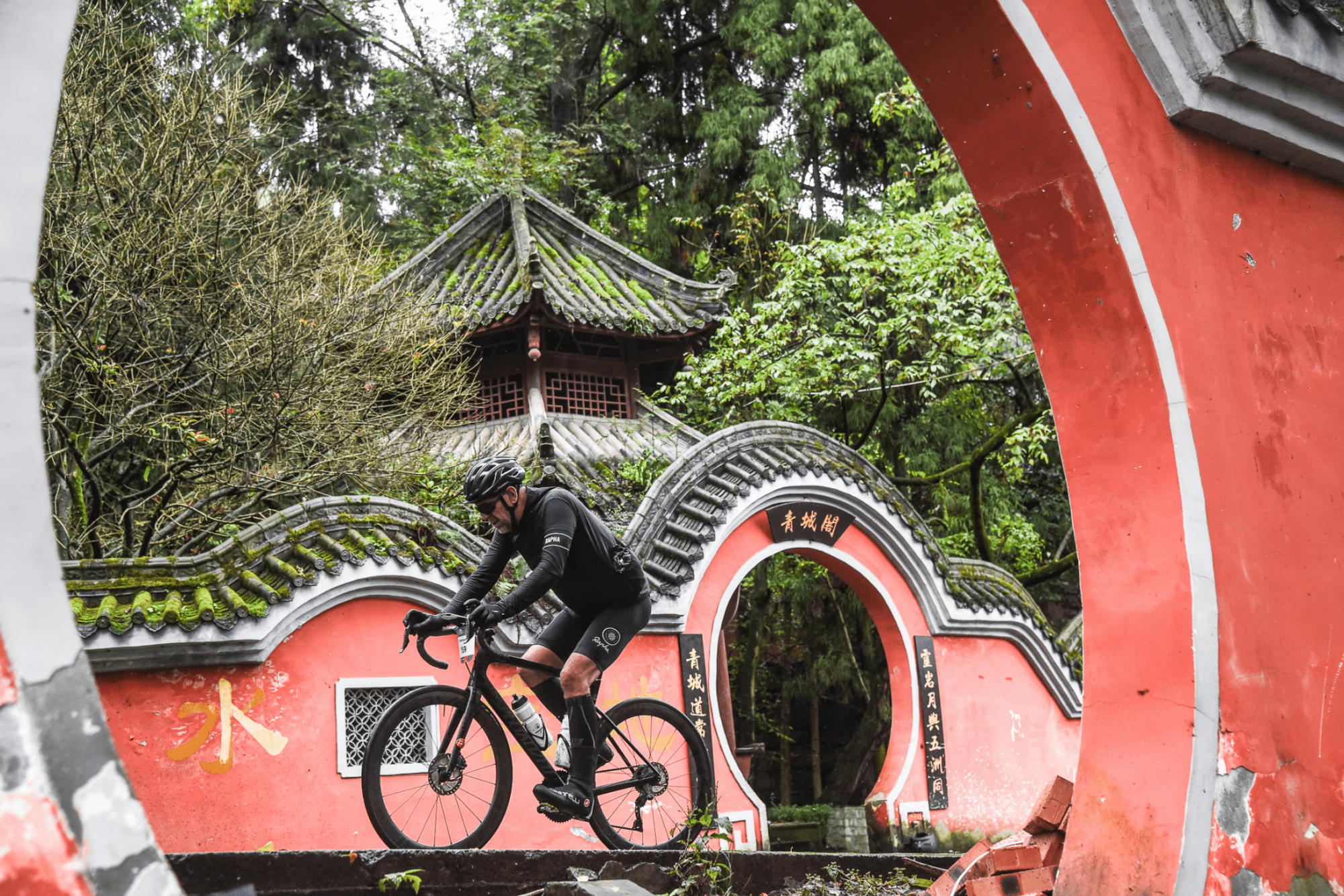
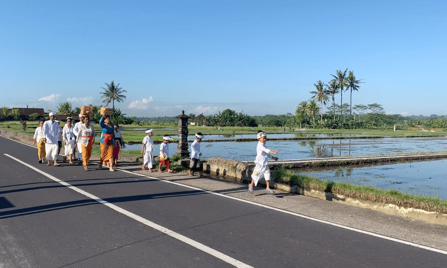
For one, Dujiangyan has mountains aplenty, the key geographical element for any Haute Route event. The city sits at the foot of an endless range of peaks and valleys that lead up to the mighty Qinhai-Tibet plateau. Within that range is a very special mountain that gave the three-day race its name: Mount Qingcheng, a peak revered within the ancient religion of Taoism. Its densely wooded slopes host a rich cultural kaleidoscope, from temples, palaces, pagodas, caves and other places of worship, to a diverse collection of unique flora and fauna, perhaps most famously the bamboo forests and the giant pandas who live among them.
Dujiangyan was also an ideal location in terms of logistics as it is less than an hour’s drive from Chengdu, the capital of Sichuan province. Chengdu is one of China’s biggest cities and its international airport is an aviation hub offering direct flights to/from most of Asia’s major population centres, as well as numerous daily links to Beijing and Shanghai; ideal to shuttle in the overseas riders who registered for the event.
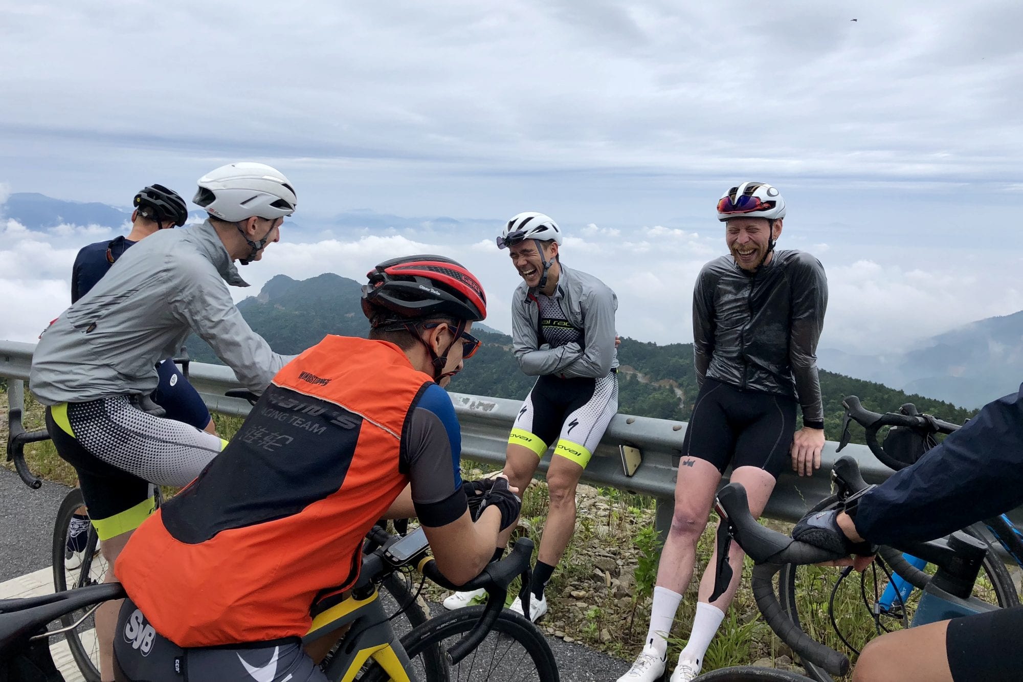
While many of the 200+ competitors who gathered in Dujiangyan had come from afar (21 countries were represented), the lion’s share of the field were Chinese, which is exactly what the Haute Route people had been hoping for when they made the decision to come to China. It seemed like most of the foreign visitors were old Haute Route hands, but for the majority of the local riders this was their first exposure to the brand.
Haute Route began in 2011 as just a single event, the now classic seven-day trip down the spine of Alps from Geneva in Switzerland to Nice on the French Riveria. It then expanded into a series that centred around such iconic cycling destinations as the Pyrenees, the Italian Dolomites, l’Alpe d’Huez, Mont Ventoux and the Rocky Mountains of the United States. Knowing that riders were flying from all over the world to these events, the organisers then decided to cast their net much wider and this year saw Haute Route races in Oman, Mexico and now China. Next year the expansion continues with the inaugural Haute Route Brazil as one of 11 destinations on the 2020 calendar, and readers from Southeast Asia will be glad to know that plans for an event in that region are in the works.
Translating from French as “high road”, the Haute Route series delivers events that give amateur cyclists a glimpse of what it might be like to ride the mountain stages of the Tour de France and other pro races. Long, arduous days in the saddle are guaranteed in any Haute Route event, but so are stunning landscapes, superbly executed logistics, good accommodation, nutritious and tasty post-stage meals, professional level mechanical support, feed zones, a live timing system, daily post-race massages and much more. And while Haute Route Qingcheng might have been the latest baby in the series, it offered something than none of its elder siblings had ever done before … completely closed roads.
The scope of this was extraordinary.
Most amateur cycling events around the world secure varying levels of support from local authorities and police to try and keep their participants safe, but it’s almost unheard of to have closed roads. Instead volunteer marshalls and police outriders will try to shield the riders into a lane or two, but rarely are restrictions imposed on vehicular traffic coming in the other direction. For races that include a lot of climbing and descending, e.g. all Haute Route events, this can make going downhill precarious at times as the temptation to take the apex line and drift over the central divider is ever-present.
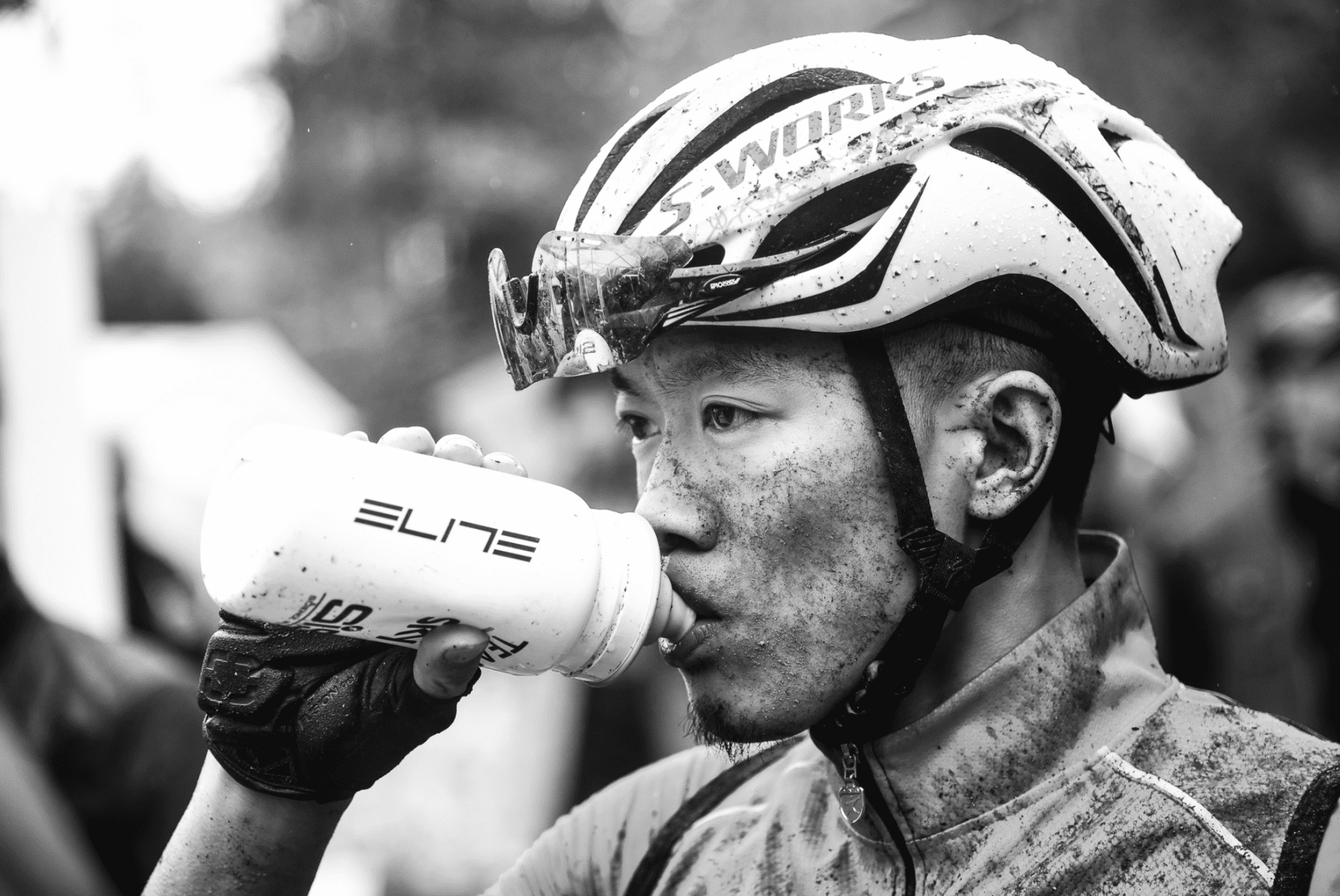
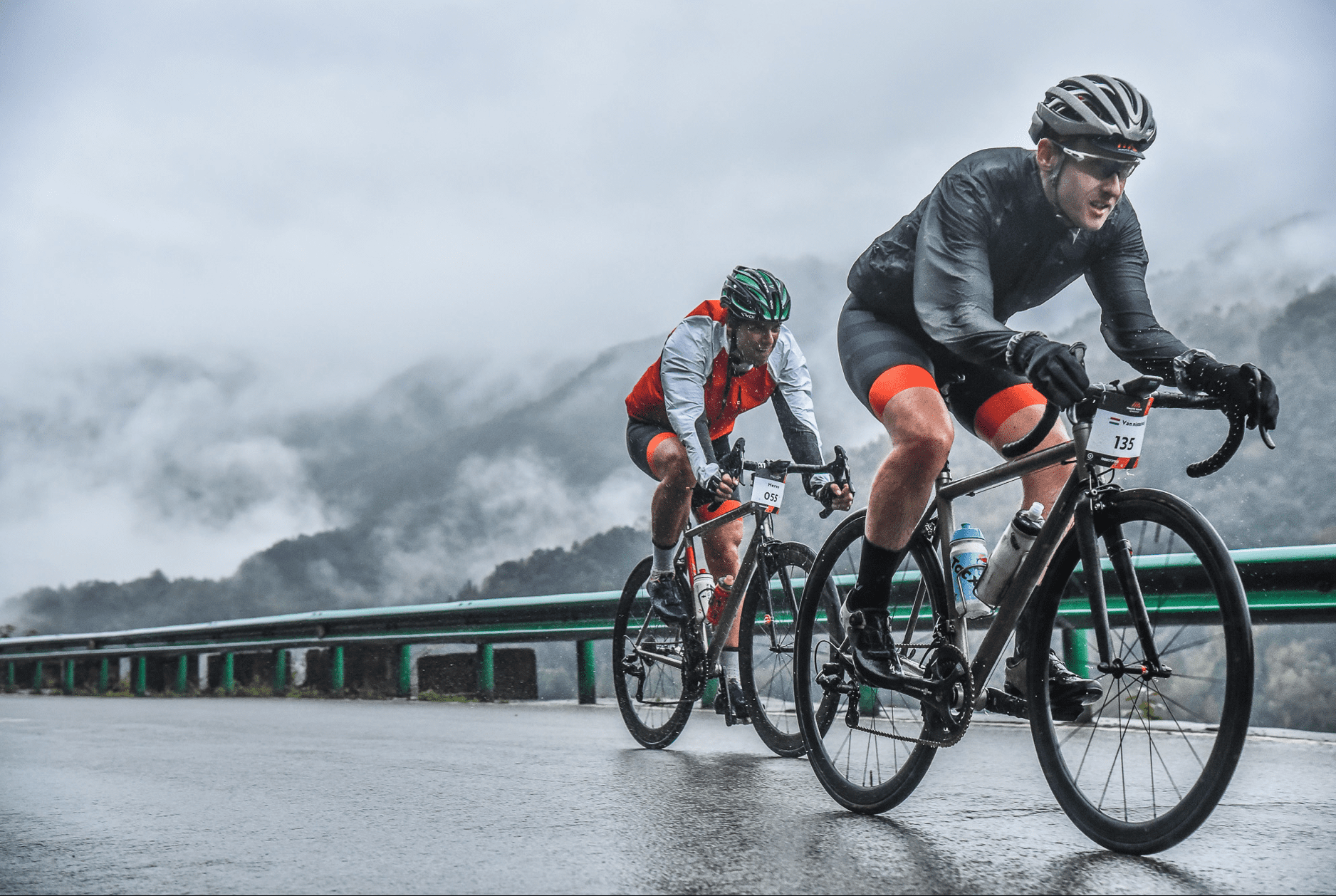
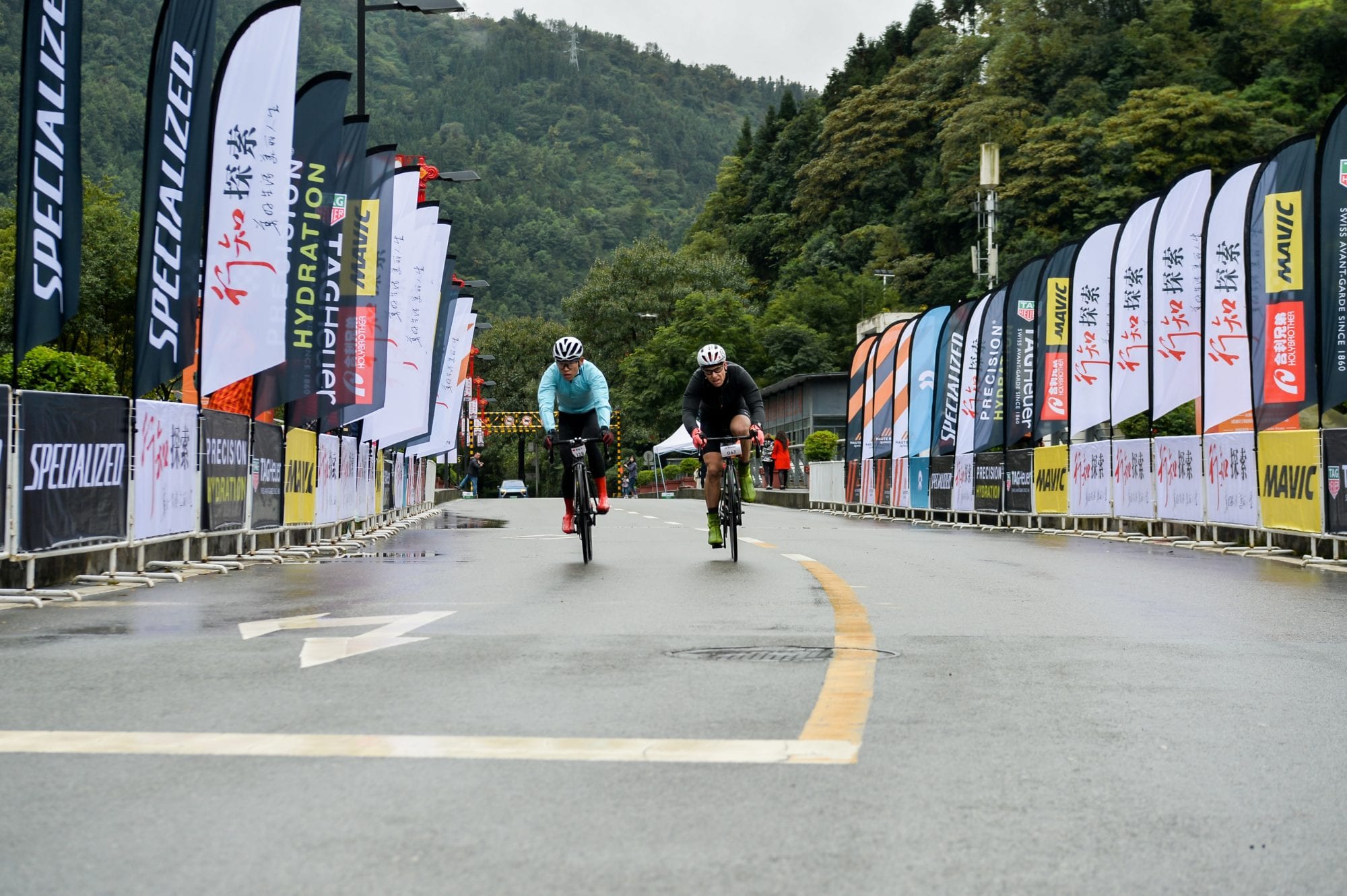
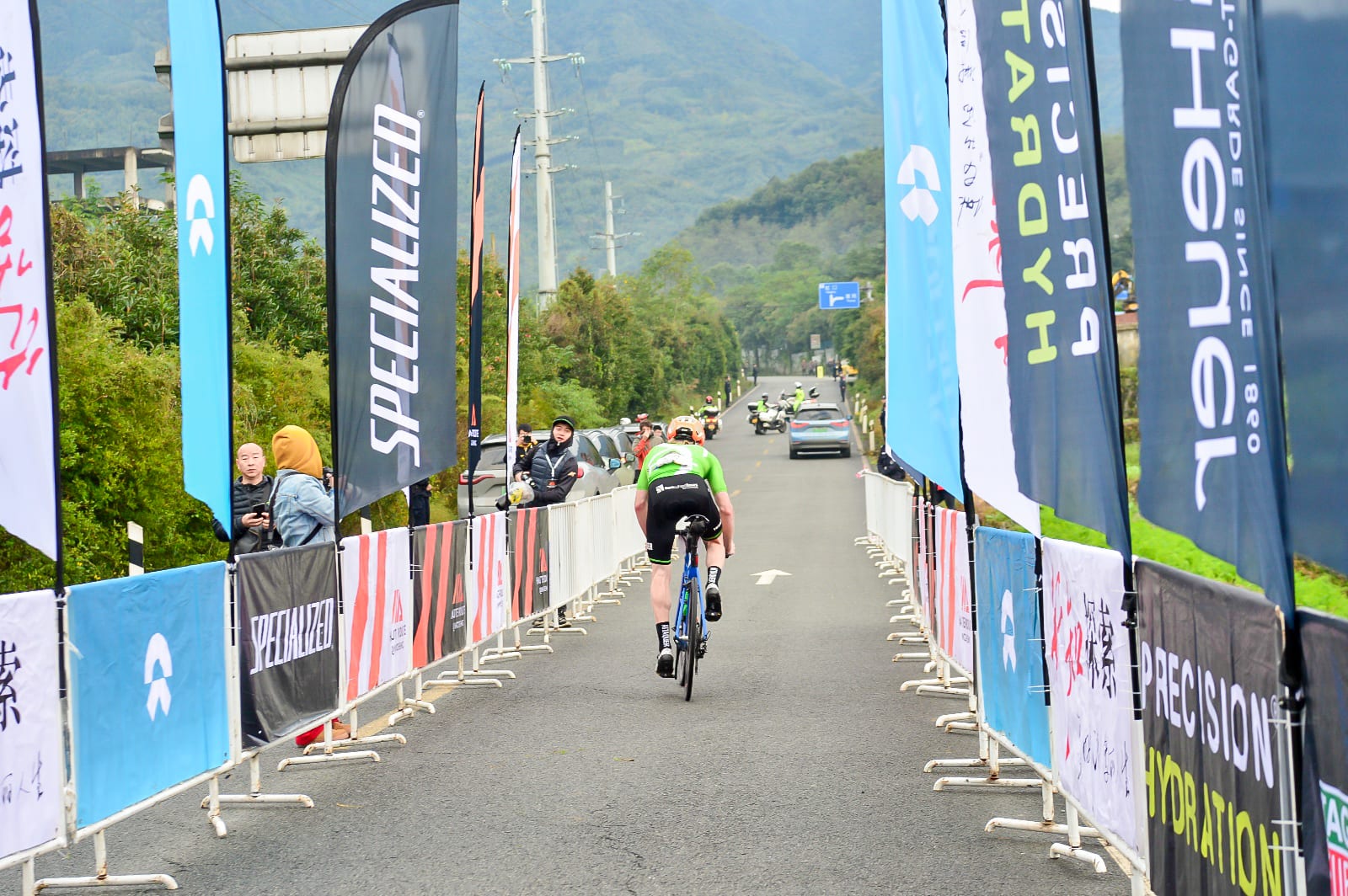
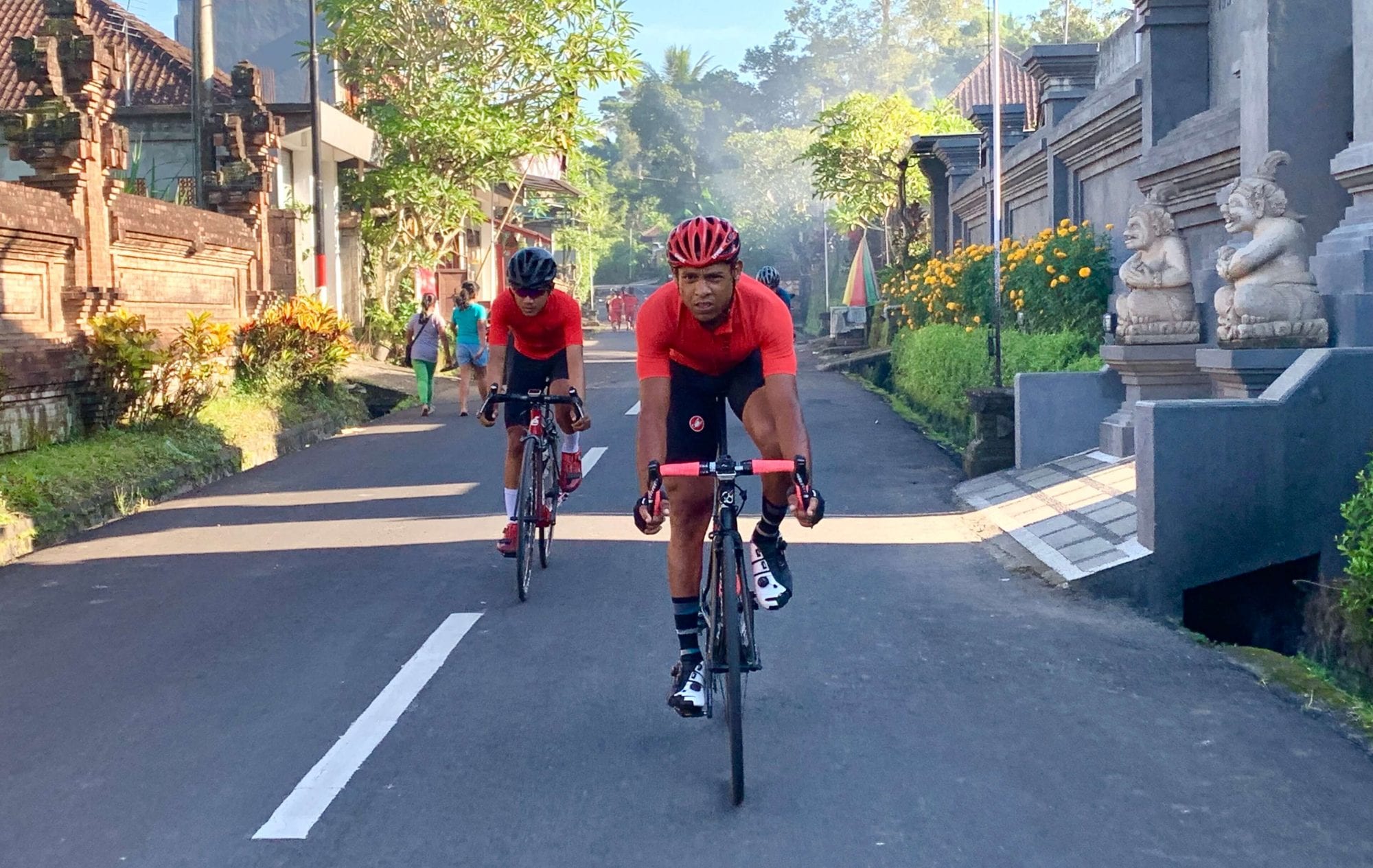
For Haute Route Qingcheng, the authorities in Dujiangyan and the other districts the race travelled through had got behind the event 100 percent and every major junction was blocked off and guarded by police or army officers. But even more impressive was the army of ordinary people, at least one of whom stood at every little road or lane that led onto the race routes. No cars, tractors, farm animals or errant pedestrians were going to spoil the show (although a few dogs did wander into the line of fire). The organisers estimated there were around 900 of these red-vested volunteers manning the routes on Stages 1 and 2, and it seemed as if every one of them had a smile and a shout of encouragement as the racers roared by, more often than not in the pouring rain. The marshalls weren’t the only ones lending vocal support, as what must have been the entire populations of each village and hamlet on the routes were standing roadside chanting “jaiyou, jaiyou” (go go!)

The Racing
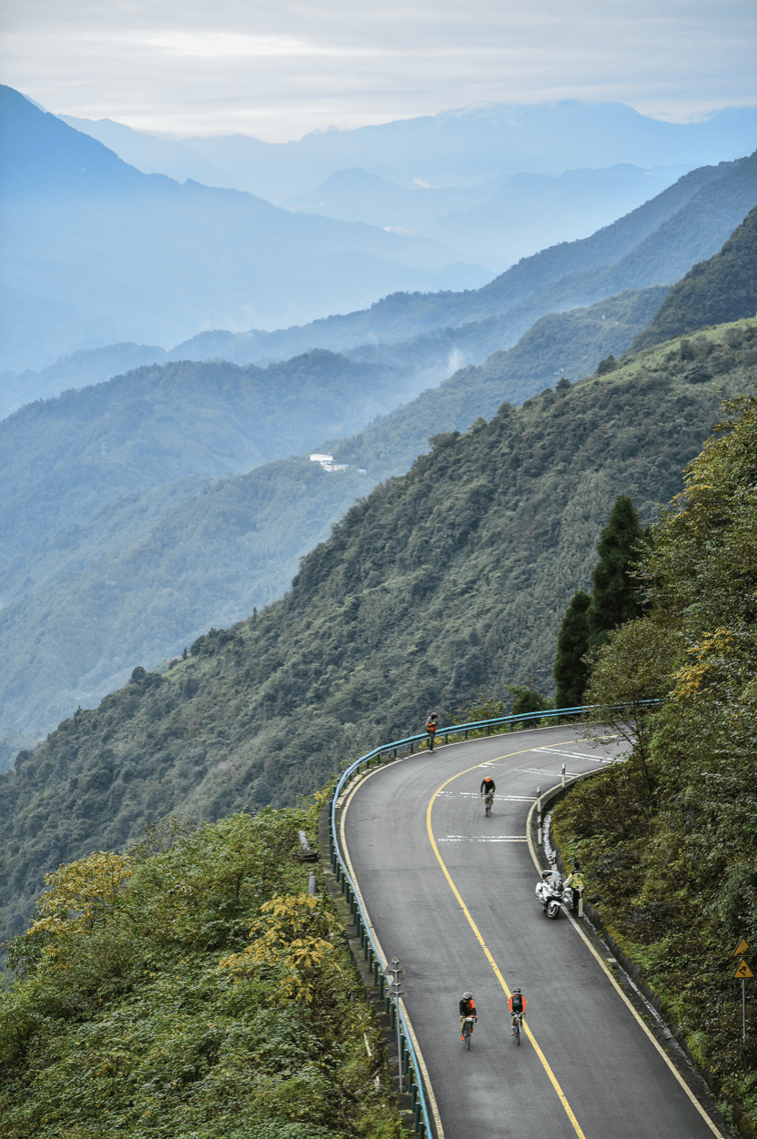
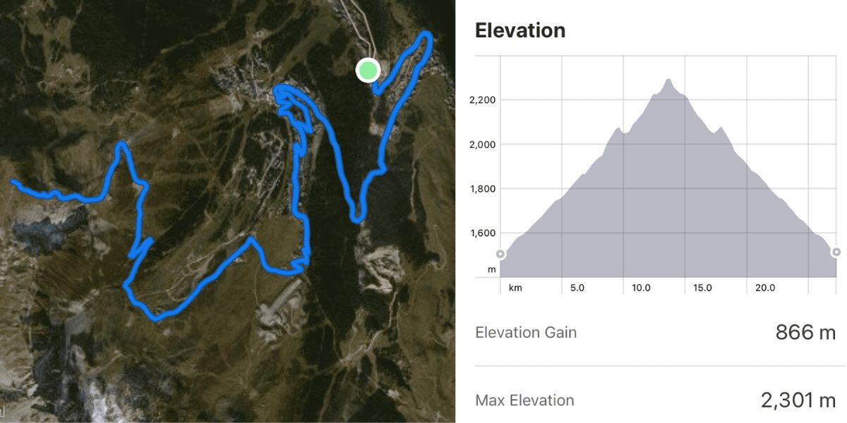
Like all the “compact races” in the series, Haute Route Qingcheng comprised of three stages; two mass-start road races and an individual time trial. The total accumulative elevation gain for the three days was around 5,000m, with the highest point of the race the Stage 3 finish at 1,435 metres. By Haute Route standards neither of those numbers was exceptional but it still promised to be a challenging three days. Stage 1 covered 82km with 1,600m of climbing, Stage 2 was a proper queen stage at 132km and 2,400m of elevation gain, while the Stage 3 mountain individual time trial climbed over 700m in just over 13km, making it a fitting test on which to finish the race.
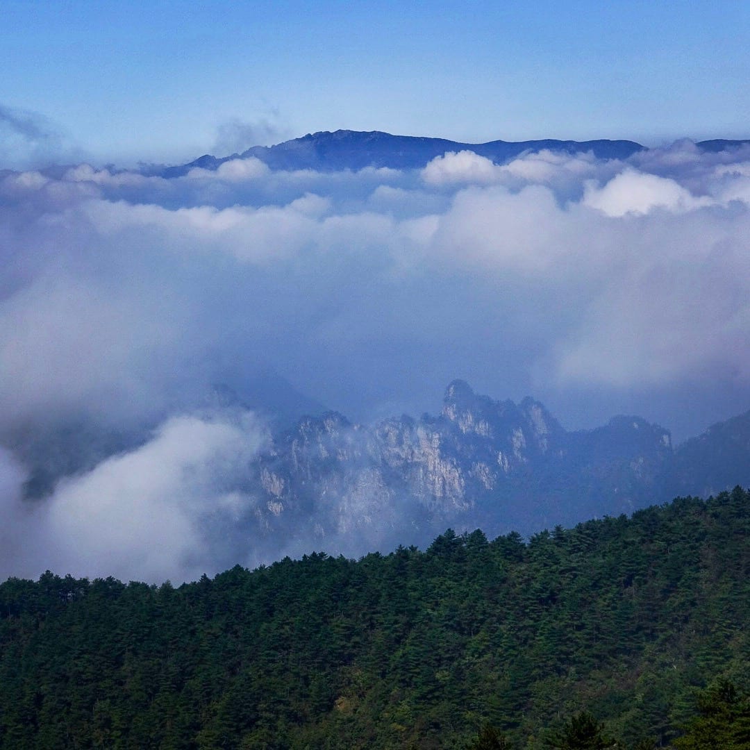
More than a year of preparations had gone into making sure the race was a success, including a test event in 2018 which saw a small group of riders tackle some of the roads that have made it into the final routes. That ground work paid off as the participants were provided with a set of superb racing parcoursand an unforgettable cultural experience. The scenery on all three stages was breathtaking, even when the clouds and rain were hiding the full majesty of the mountain vistas. That Haute Route Qingcheng would feature picturesque peaks and valleys was a given, but a network of raging rivers provided an unexpected visual and aural spectacle. The very best of Chinese hospitality on the course and in the city of Dujiangyan, and a first-class host hotel in the shape of the Minjiang Xinhao added to the event’s lustre … but there was nothing the Haute Route people could do about the weather.
As the participants began to gather at the Minjiang Xinhao on the day before the race began, they were, like this writer, wondering where the mountains were. It was cold, it rained the entire day and the dark clouds from which the precipitation fell also kept the nearby peaks shrouded in a foreboding cloak. Unfortunately, the short-term forecast was for more of the same.
Still, people had travelled to the race from afar, both internally from all over China and from those 20 other countries, and so there was no real choice but to suck it up. At least the advances in wet- and cold-weather cycling gear in recent times meant that some protection from the elements was readily available … if, that is, people remembered to bring their knee- and arm-warmers, rain jackets, full-fingered gloves, overshoes, etc, with them. Some poor souls didn’t, or the fact they were riding unprotected from the elements meant they were just super hard.
Stage 1
While the hills were still hidden from view when the riders gathered in front of the hotel at 7am on race day, the heavy rain of the day before had been replaced by something more akin to drizzle. But it was still fairly miserable as the peloton made its way to the Southbridge area of Dujiangyan where a pro-level stage-start infrastructure had been set up. A short, neutralised section led to the first climb at the 3km mark and from there the racing was on. A group numbering about a dozen riders got away on this punchy 1.5km climb and it was from this bunch that the stage honours were contested.
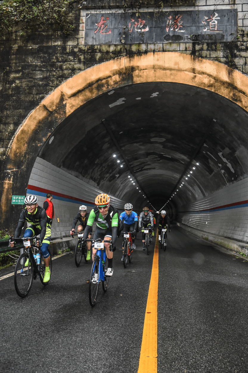
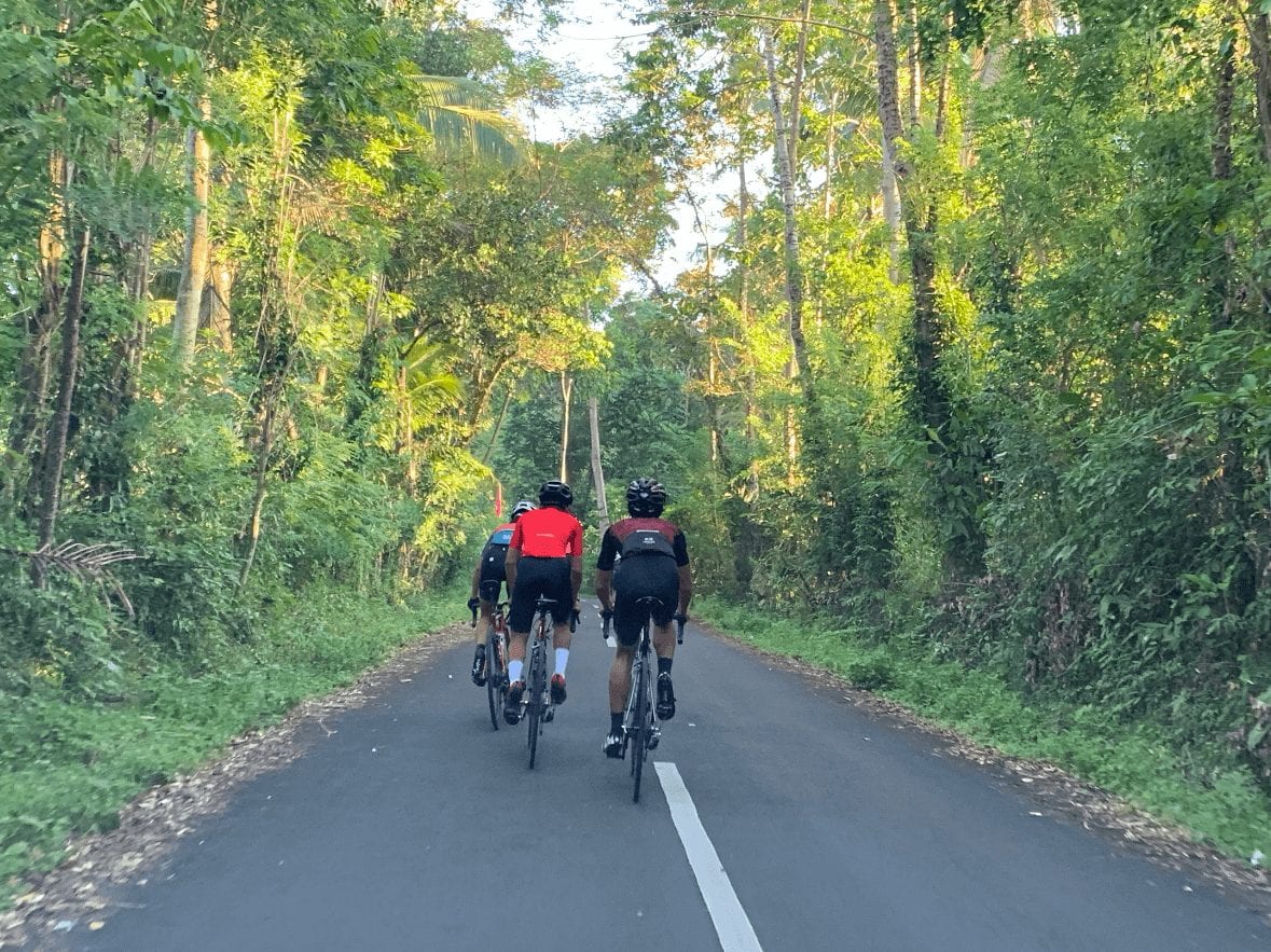
Like in all Haute Route races, though, the majority of the riders aren’t there to win, they’re there to challenge themselves on what they know will be exceptional routes. This relatively short stage had it all; short punchy climbs, longer uphill slogs, more than a few eerie tunnels, magnificent bridges spanning the roaring rivers, and a mix of fast, straight and twisty, technical descents. The feed zone at the 57km was a highlight too. Situated at the centre of the ancient town of Shuimo, riding bikes through its narrow, cobbled alleyways was like stepping back in time. The best of Stage 1 was to come immediately after leaving Shuimo, though, with the section known as the Balcony Road. This was a climb that twisted its way up narrow, tree-lined roads and through a series of small villages and had a picture-postcard stunning view of the valley, river and mountains to the right, even if the image was still partly shrouded in clouds. Aside from a few short downhills, the climb was about 7km in length and was followed by another sweeping descent before a short run into the finish in Yingxiu village, where miraculously the rain had stopped.
Stage 2
The Saturday morning saw the queen stage and a fittingly grand opening ceremony at the Southbridge square start area had been organised. The local authorities had even put on an additional event so that some 500 Dujiangyan cyclists of all stripes and sizes could take advantage of the closed roads in their city on a shortened version of the Haute Route race. Unfortunately, the rain was much heavier than the drizzle of the previous day and with the first 40km basically flat, the riders struggled to warm up. But the first of the hills, a 4km climb, did that job well enough and also split up the field again. A short but tricky descent followed and then it was onto the main course of the day, an 8km-long climb to the Xiange-Hongkou Pass, the high point of the stage at 1,268m. The route of the climb meandered up a tiny road half hidden by foliage and included a few super steep ramps where getting out of the saddle wasn’t an option due to the slippery conditions under tread. A feed zone just over the summit was a place to rest, refuel and recover, and then it was a long, fast 20km descent, which while no doubt was a relief and a thrill for all after the punishing climb, was also a bone-chilling affair. Another 20km of flat followed before a final set of five hills brought the riders to within 10km of the finish. A right-hand corner with 200m to go revealed a downhill roll to the finish under the impressive Qingcheng Mountain Gateway. The conditions really had been miserable throughout the day, so kudos to all the riders who finished the 132km course.
Stage 3
It was announced at the Stage 3 briefing on the Saturday night that the Sunday morning ITT course had been cut from the advertised 24km length to just over 13km. What was chopped was 11km of flat, urban roads leading to the main climb up the Puhong Road Pass, which was unaffected. No big loss to a race that is built around the “high roads”. Those 13km rose at an average grade of 5 percent, which classified it as a Cat 1 climb, and topped out at 1,435m, the high point of the entire race. Like most mountain ascents, hidden within that relatively tame 5 percent were shallower sections, false flats and steep ramps. And as is the case with all time trials, the course was as tough as the individual riders made it.
The weather finally played nice and while it was still a chilly morning for the competitors as they waited for their turn to climb onto the famous Haute Route time trial ramp, the rain had finally stopped. The much clearer skies, with even the odd touch of blue peeking through, allowed Dujiangyan to show off the full splendour of the mountains that had been mostly hidden for the previous few days. Despite the short, sharp dose of pain the riders had just gone through, a festive vibe hung in the air at the top of the climb, with the cyclists happy to be have completed what was a challenging but rewarding cycling experience.

And so, the inaugural Haute Route Qingcheng was over bar the closing ceremony and one last Sichuan feast back at the Minjiang Xinhao. Despite the weather, the event was a success and a second edition is already on the 2020 Haute Route Calendar, although there is a rumour it might move from the published October 16-18 dates. And with the promise of further events to come in China and the wider region, it looks like Haute Route is in Asia for the long haul. Chapeau mesdames et messieurs
*The three GPX files have been combined for the three stages. The statistics underneath the map are not accurate.
If you build it, will they come?
Over the course of summer 2018 I heard a few rumours buzzing around our local ski resort of Courchevel: they were laying a “road”………a fresh line of tarmac snaking its way up through the ski fields to 2,300 m and it was to be for cyclists only?! My initial thought was “really”? ***environmentally that is awful…
As summer was heading to a close and autumn was upon us I heard that the road was finished. Our Alpcycles season was winding down and the last trips had been run. The cyclist in me won the battle against all of the environmental arguments mulling over in my mind and my only thought was “I’ve got to ride up it!” One quick phone call to a riding buddy and a quick assessment of the coming weather, it was the 28thOctober 2018 and there was snow forecast at the weekend. We agreed “let’s get up there today and check it out” and the decision was made.
We jumped on the bikes and headed up the Courchevel climb to find the start of this new road. We had heard that it kicked off just below Courchevel Altiport. The full Courchevel to Altiport climb is 18 km and was last used in the Tour de France 2005, so it is well known by visiting cyclists, and is also the climb on which our local TT is held in the summer months, so it is a well-trodden route for locals. But this new strip of tarmac was going to be an altogether new adventure.
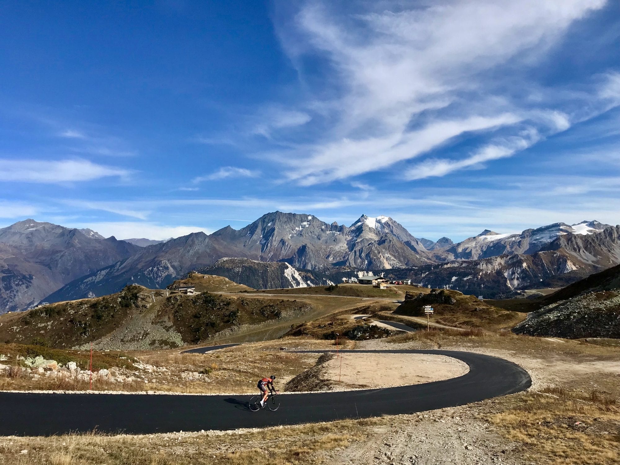
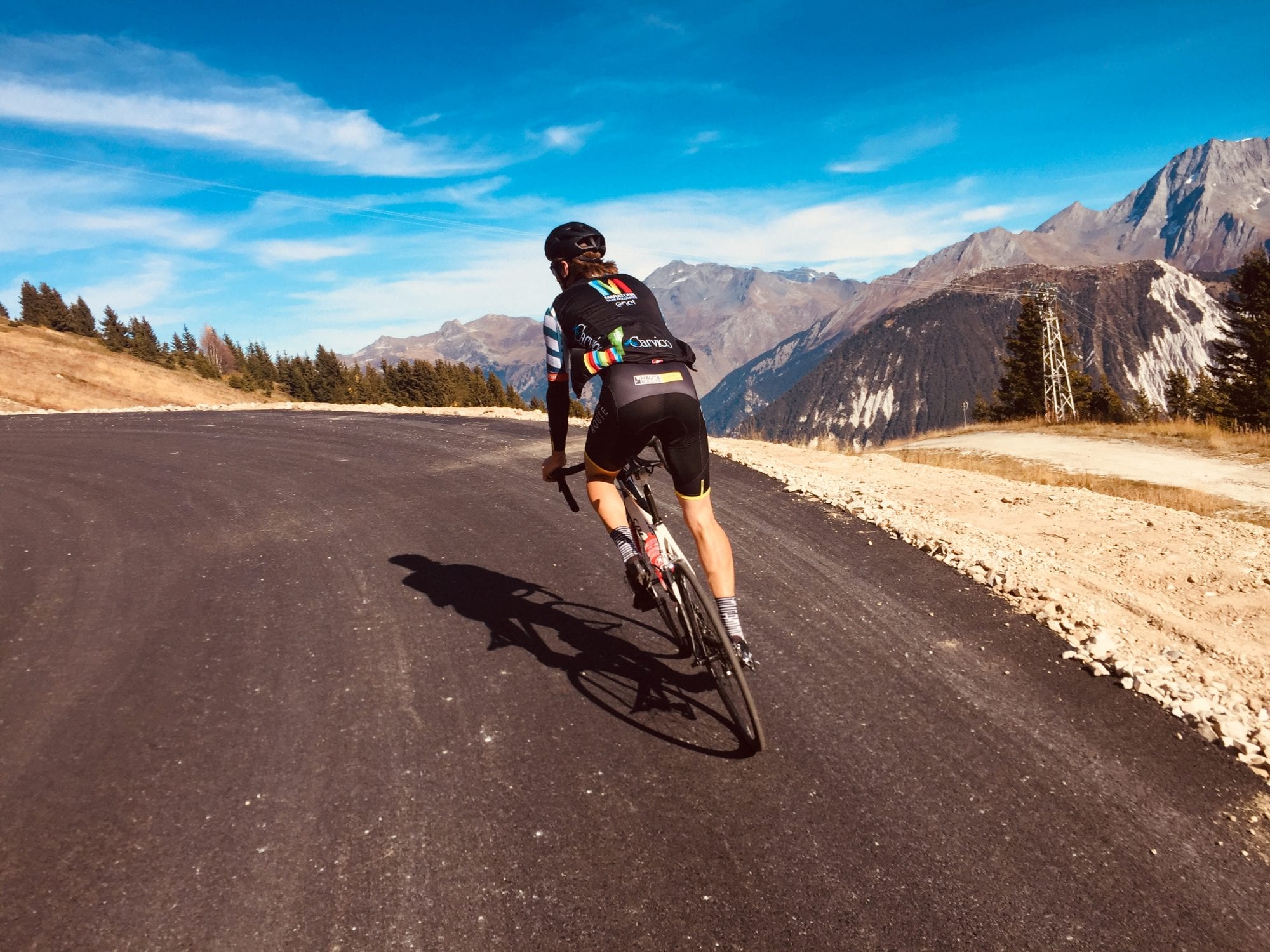
Just before the tunnel below the Altiport we see this fresh ribbon of black silk running off into the ski fields and just headed off to test it out. The first kilometre rolled nicely and then the route pitched up at 17% and then cut its way past the world-famous Verdon/Saulire cable car. Again, another easier section snaked up through the pistes that thousands of skiers and boarders spend the winter months sliding down! Here we were on a perfect clear blue autumn day climbing higher and steeper towards the Col de la Loze. The panorama was truly breathtaking. Eventually we hit the last crazy steep pitch at Col de la Loze where the lift station hits 2,300 m. There was tranquillity and silence that you only experience miles away from zero traffic (bliss).

So what’s all the fuss about? Well, most mountain passes have existed since Medieval and Roman times so were originally created for human necessity and then throughout the years have been updated and provide access for both people and vehicles. This road is different. It will eventually link Courchevel with its neighbour Meribel (the tarmac on that side has yet to be completed) and will then graduate into a “pass”. A new col which in turn will open up some great new access to higher adventures. But more importantly and uniquely, this new pass will be traffic free. You heard me. It will only be open to cyclists of all types, roller skiers and walkers. As far as I know there is no other traffic free mountain road like this in the French Alps?
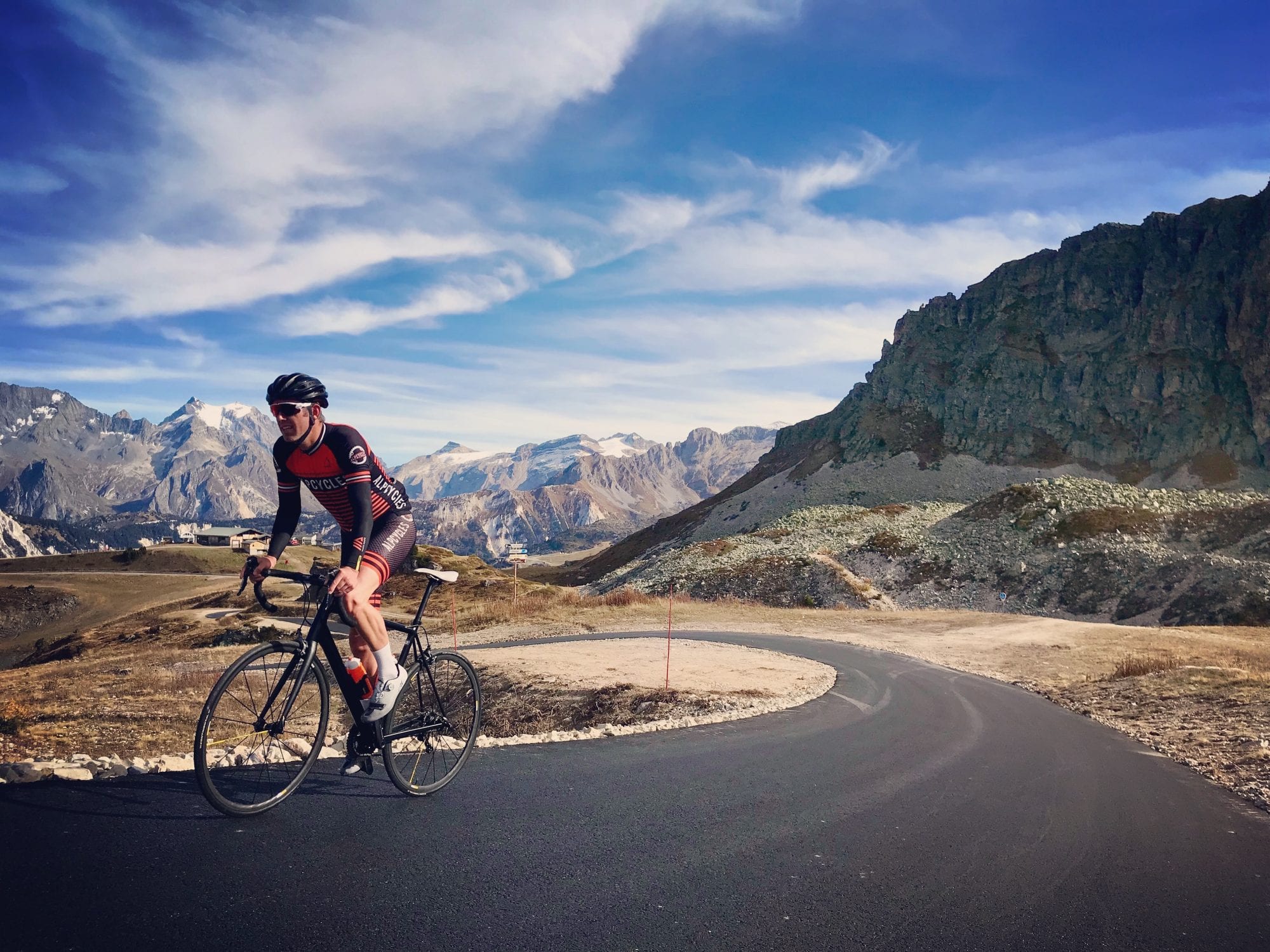
This summer if you are heading to this part of the Alps you must experience it. Many others will as both the Haute Route Alps multiple stage event will summit here for their Courchevel stage, meaning hundreds of amateur riders getting a real treat and then the Under 23’s Tour de France, the Tour de Avenir, will allow the Under 23 riders in the world to smash each other to the finish. I am certain that before long the Criterium Dauphine and the Tour de France will follow, so why not get there first and check it out. It appears “if you build it, they will come”. It is set to be big news over the next few years and you could be one of the ones who got there first…well after me anyway.
Summer Solstice with Le Bezy Pyrenees
I met up with my good friend Mike and we set off. Neither of us had ridden the majority of the route that was planned for the day or done much over 200 km. Although I had a gilet and arm warmers on, the temperature was good at around 18 degrees. We took it easy as we made our way cross country at a relaxed chatty pace towards Castelnaudary where the famous French dish of cassoulet originates from. Often the aroma from the dish can be smelled across the town.
From here it is not far to where we thought we’d make our first stop of the day and cross a departmental border into the Tarn to the town of Revel. Easy inclines and rolling hills were the order of the moment.
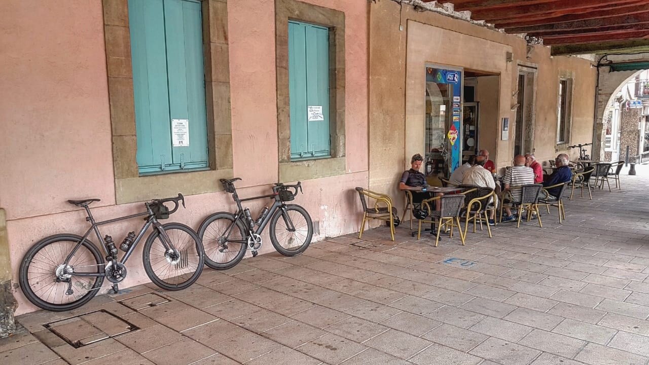
We rolled into a sleepy Revel down quintessentially French plane tree lined roads and into the main square. There is a large covered market space in the centre that dates back to the 14th Century. No market traders this morning as that is on Saturdays, just the one cafe open. It’s about 7.30 am and as we get our coffees a group of older gents sit at the table next to us. Catching up on the week and maybe months since they last saw eachother due to the COVID pandemic. This part of France luckily saw very few cases, no bisous (kiss on each cheek) but hands were shaken, and social distancing was not observed. C’est la vie.
Coffees sunk we rolled out of Revel and the Black Mountains loomed ahead. The next village we came to was Soreze which is a beauty with its tree lined boulevard and picture-perfect bakeries, something that is a bit of a theme in these parts. We knew our route wasn’t taking us into the Black Mountains just yet, today wasn’t about big climbing, which they can provide, rather we were skirting around them until we got to Mazamet. The riding was still rolling hills but we slowly picked up altitude as the foothills grew larger and the trees and ancient forest that gave the mountains their name watched over our every pedal stroke.
Terrain changes quickly and the farmed sunflower and wheat fields were gone and this north western side of the Black Mountains felt dark, almost oppressive yet still stunningly beautiful. By now we were getting towards Mazamet as we traversed some lower slopes that hugged the northern edge of the mountains.
Mazamet known formerly for its wool industry, looked big as we descended down and eventually found what was a bustling part of town. A couple of pain aux raisins from the market and a coffee later we climbed out of Mazamet past a masked congregation as the church chucked out. Foolishly still in gilet and arm warmers even though my Garmin and forehead telling me it was 25 degrees we rose and within a flash were deep in forest on a steady incline.
For some reason we didn’t get lunch provisions in the last big town and the time was getting on for the French lunch window (between 12-2 pm). With the mountains still on our right we yearned for a pizzeria. We faffed outside a few that looked like they had seen better days and decided to press on hoping the next village would produce the goods! The wind had just started to pick up, but it was on our backs and probably lulled us into a false sense of security. Getting hungrier and with the window closing we stopped at what can only be described as a roadside bread / sandwich shop. Opening hours were long and although it was deserted apart from the owner we felt we had little choice.
Alarm bells maybe should have rung with the taxidermised badger hung over the counter but we ordered saucisse, frites and salad x2. The food came and looked more like school dinner rather than haute cuisine but the frites were salty…. the saucisse was hot and the thick French mayo made it all good! We checked our route and knew that we had to press on. Wind was picking up and that plucked at seeds of fear in the back of my mind that we’d be turning into it in just a few hours time. Imagine our dismay that not 3 km down the road after lunch we sped past a beautiful pizza restaurant! We live and learn! It just shows not everything is on Google!!
We soon turned off our current road that was heading towards the coastal town of Beziers and up our first long climb of the day – the Pic de Montibergues. A steady 6 or 7% we both settled into a rhythm and spun our way when Mike’s new Wahoo Roam took us off the main climb and into an odd mountain hamlet. These are numerous and some look like they’ve seen better days but we blindly followed the technology and ended up on a narrow rough road of about 14% incline.
Cursing, or at least I was, it seemed like we crested that climb back onto our original road. My sense of direction was off as I tend to use the Pyrénées as a landmark on most rides and couldn’t really tell which direction we were facing. With the wind either on our sides or back I still felt assured we were going in the right direction. The temperature was in the 30’s and rather worryingly we’d not filled up our bidons in the last two cafes. We’re both used to the numerous water taps dotted about in the Pyrénées and surrounding foothills but the Black Mountains seemed to have less and what was there seemed to be off or not for drinking.
Any fatigue we were feeling as we crested the climb was soon abolished as the descent was wide and fast. Almost immediately the dark mixed forest of deciduous trees and strong-smelling pines started to give way to more pine and smaller almost scrub like terrain. Big views are to be had up here and we could see back into numerous valleys as we railed around corners at full speed on empty roads!
I can’t remember if we went off instinct or Wahoo instruction but we turned off the main route down the mountain and onto a narrow almost bike path sized road. No more tall trees just scrub, blazing heat, and deafening cicadas greeted us as we ourselves blazed down the descent on almost perfect tarmac.
It turned out it wasn’t a bike a path as a car passed us, it was the only one we’d seen for a while. You almost forget they use the roads too when you feel so isolated up there. We were heavily into wine country now and feelings of Spain washed over me – the smell from the vines is very distinctive and the grapes were easily visible even if a bit blurry as we whizzed through. Finally, a water stop. A rather morbid one …. a graveyard. The French do graveyards well if that’s a thing and almost always have a tap.
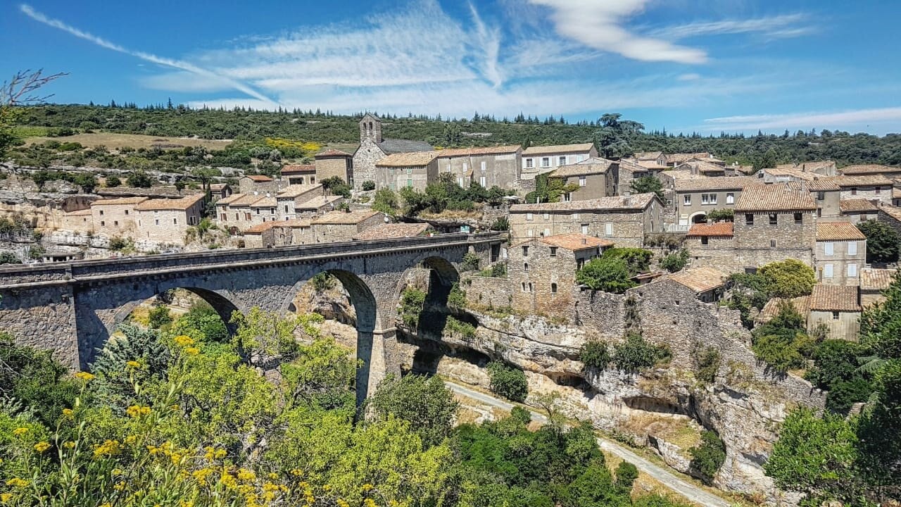
Bidons brimmed and some more gramming done we set off again. Our next target in mind was a village or town called Lagrasse. But we had a way to go. Our more familiar Pyrénées in our sites to the south, quicker descending took us into the valley close to the stunning Minerve which nestles amid breathtaking scenery within gorges carved into the Limestone causses. We were making slow progress now as we’d turned into that wind that was so ever present earlier. We crested what was our last Black Mountain climb of the day …. it wasn’t overly tough or steep but the wind made it so!
Through more vineyards we passed through some roads and villages I’d last been on in 2018 when we were house hunting…. I hadn’t ridden them then it was all by metal box on wheels and although familiar they felt hard today in the heat and wind. It reminded me of the years I’d spent riding in Abu Dhabi where that was the norm. We crossed the valley between the Black Mountains and the Pyrénées and were running low on enthusiasm and strength due to the toll the wind and heat was taking. Who said riding over 300 km was going to be easy.

We had a brief pit stop in a cafe for a coke (other drinks were available). Karaoke seems to be a thing in this region for the French and a rather inebriated local was doing his best to clear the bar. Onwards… Time was getting on and it was clear we weren’t going to make it home before dark. Praying for the wind to ease we were westward bound to Lagrasse.
More climbing greeted us, it was wide, windy and with spectacular views into the gorge that the river L’Orbieu runs through – averaging no more than 6% we spun up and finally Lagrassse in the corbieres came into view down in the gorge to our right. Another postcard medieval town which is classed as one of Frances’ most beautiful, it felt a shame to not have time to stop at the many busy restaurants that lined it’s streets. The scene was perfect. Not sure why Lagrasse felt like a milestone …. maybe as it was a village Mike had planned to go through due to its splendour.
With easily 85/90 km to go and the time approaching 7.45 pm it felt like the pressure was on. We chatted and accepted the fact we’d be riding long into darkness. More new climbs awaited…. the next was the Col de Taurize at only 498 m it doesn’t sound much but at this stage of the ride and running low on fuel it felt arduous despite the views it offered over rocky and forested mountains above and below us. Mountains can make you feel small at the best of times let alone when fatigue starts setting in. The climb wound through the mountain side and through what seemed like an impenetrable mass. We were back into the Aude now!
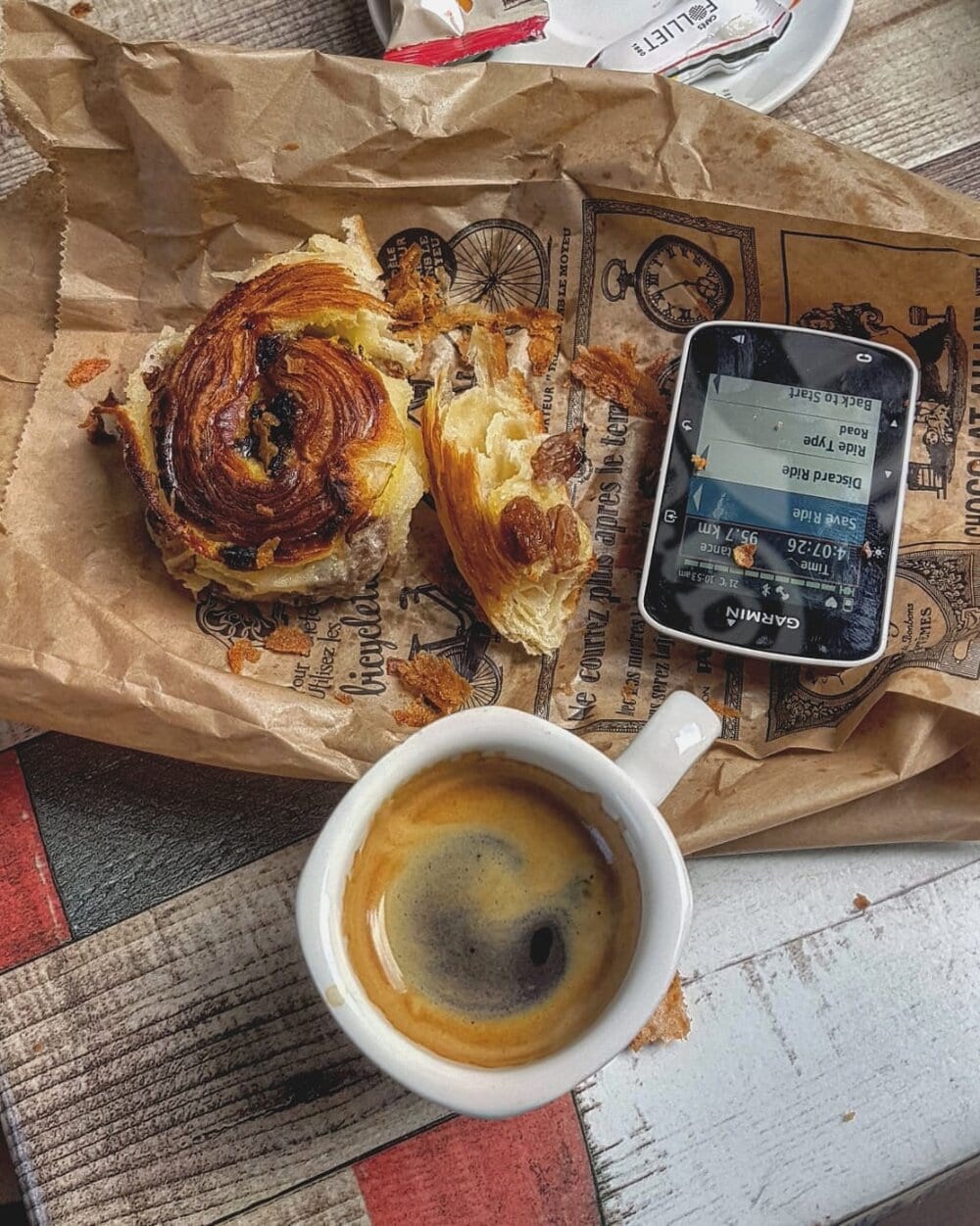
Limoux famous for its blanquette, familiar to us as a frequent stop on our rides, was the next port of call and the mention of a dirty McDonalds spurred us on. Light fading as we climbed it was perfect for #lightbro insta pics but my phone remained in my trusty Rapha handlebar bag on charge. A narrow exciting descent hampered by the sun in our eyes was tackled in silence and concentration. We didn’t want any issues this late on in the day. Limoux seemed to be getting further away. Google maps had it at 24 km away a while back and Mike was having teething problems with the Wahoo. Finally, a roadside sign appeared – Limoux 35 km…. wtf! Miffed and desperate for some food we settled in. Spirits remained high and we vowed to head back to this side of Limoux on an exploro ride in a few weeks time without the detour of the Black Mountains in our legs.
We came to the village of Saint-Hilaire, the road pitched up through the village centre and as we danced on the pedals (laboured out the saddle) a local shouted there was only 300 m til the top. He lied … it felt more like 3 km. Eventually after a few more ups and downs over the worryingly named Col du Loup (loup is wolf in French) we descended into a side of Limoux we’d not seen before. A dash to McDonalds was hampered by neither of us having a face mask to go in – no worries – went in the drive through! Burgers, fries and a mega coke sunk in record quick time the clock ticked past 10 pm.
We know a few ways back from Limoux, but we decided against the lumpier route via Mirepoix and headed out towards Fanjeaux. Night was upon us and with the food swirling in our stomachs with any hard effort the rolling hills felt kind to us. The wind had dropped and we felt like Fanjeaux was the home stretch.
Paranoid our lights wouldn’t hold out til home we pressed on the gas and surprisingly the legs felt good – stomachs not so much. The final climb into Fanjeaux is easy any other day…. but now in the dark it’s bends felt like they went on forever!
Out of Fanjeaux the home leg sped past, a rolling straight road towards Belpech has been used in the Tour de France as recently as 2018, usually adorned either side by sunflowers was tonight, in blackness. We had no idea what was there tonight – we didn’t care either.
We got into Belpech as the church chimed midnight. Mike went left towards his place in Gaudies. There’s not many other people I’d rather be riding for 15 hours with, he provides excellent banter – you can’t want for much more. I turn right for the last 10 km back to the farmhouse at Le Bezy Pyrenees. It’s mainly flat, my legs feel incredibly good but the amount of snot running from my nose reminds me of the tough day that’s all but behind me. I huff up the 300 m climb to the house, the glow of lights in the window reassure me that there’s still life awake inside. Bike put away, Garmin primed for upload, I take a hot shower grab a beer and crawl into bed.
Winter solstice awaits!
Welcome to le bezy pyrénées
Five bed Boutique B&B located in the Occitanie region of the Pyrénées.
Under 50 km south of Toulouse ✈
50 km west of Carcassonne ✈
In the Aude department with easy access to the Ariege, Haute-Garonne and Tarn.
Discover the real South of France
Col du Sanetsch, Switzerland
It all starts in the flat valley floor before the road starts threading its way through the neat vineyards. A series of tight switchbacks as the trees disperse, and it becomes more alpine meadows; with cows and the famous Swiss cowbells encouraging you to the top. What was once a glacier is now rock and scree, it’s worth stopping for a breather to appreciate the scenery.
Three dark tunnels impressively cut into the rock, and have to be navigated before the final push to the summit at 2,252 m (and the Tsanfleuron glacier). Enjoy a well-deserved coffee in the mountain refuge before the small cable car down to the village of Gsteig. (There is no road down which means fewer cars).

From here, a gentile 6 km climb up to Col du Pillon, between Gstaad and Les Diablerets. With a Glacier 3,000 m high above, you’ll take to a long descent back down to the valley floor, and a return to the surrounding vineyards of the Rhone Valley.
The loop is, without doubt, one of the best in Switzerland and is regularly named in top five climbs lists.
Extras
- Tsanfleuron Glacier and the Lac de Sanetsch.
- A Cable Car can take you to the other side of the valley where you will reach Gsteig bei Gstaad in the canton of Bern. Make sure you check it is operating! 20chf
- You can see five famous Swiss mountain peaks over 4,000 m called: Weisshorn, Zinalrothorn, Dent-Blanche, Matterhorn and Dent d’Hérens.
- L’Auberge du Sanetsch for a coffee or lunch.
About Kudos Cycling
Kudos Cycling is the premier cycling experience brand in Switzerland. Offering world-class performance training camps, and bespoke guided holidays.
Created to enable us to share the finest cycling experiences the region has to offer, whilst giving the best on and off the road cycling training. All this, alongside expert sports scientists and Swiss Olympic facilities.
Depending on your ability, goals and time available, we can design a bespoke package to suit you. Whether that’s a day cycling with a professional cyclist or a full exploration on gravel roads. You can be sure that you’ll have an unforgettable experience, this is peak-to-peak perfection.
‘A lap of France’, Andalucia, Spain
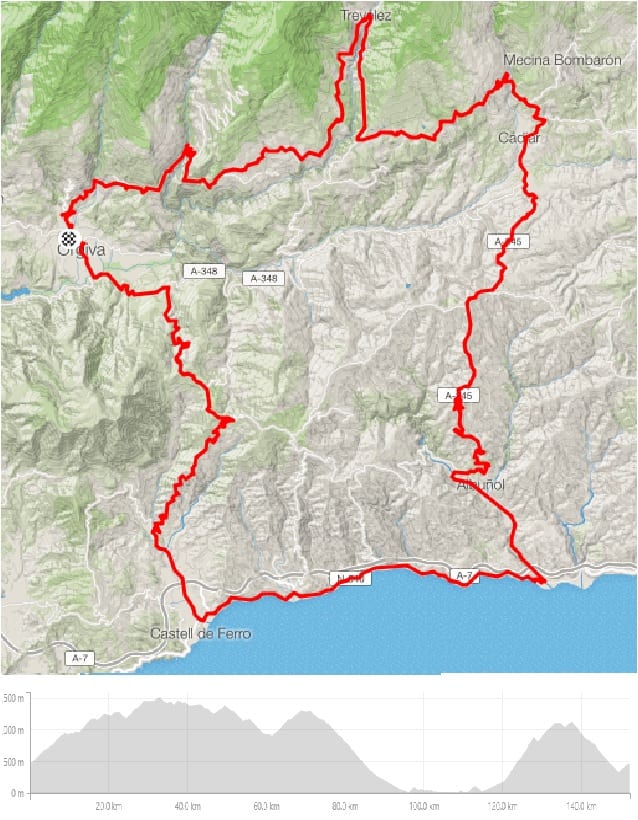
‘A lap of France’
While the roads are smooth and the weather inviting, the climbing on this ride makes it a tough one, but with a bit of everything! As we include a stop or two it’s an all-day affair, but one that will leave you satisfied and ready for a slap up three course meal back at the hotel, maybe via the bakery or a tapas bar…
We start out a bit earlier than usual to fit in a big day, beginning with a gradual climb out of our base in the town of Orgiva. In 2015 these roads featured as the final climb of a stage in the Vuelta Espana, but we don’t turn left for the final steep 5 km stretch up to the finish line, still visible just before the tarmac ends. Instead we continue up the kinder gradients to Spain’s highest permanently inhabited village, Trevelez. The snowline is often visible from here, but despite the altitude reaching over 1,500 m, being south facing the snow rarely gets this low, and even in the winter the sun feels warm. One thing that you can’t escape in Trevelez is the main industry; some of Spain’s finest hams are dried here in the high altitude ‘secaderos’. The famous pigs graze on acorns further up the mountain, so you rarely see them here. Indeed the only livestock you might see in this mountain terrain are goats, herded as they have been for centuries by a man and his dog, as they wander the area cutting the grass on the steep slopes. This is definitely a ride for the Mountain goats.

The Vuelta line
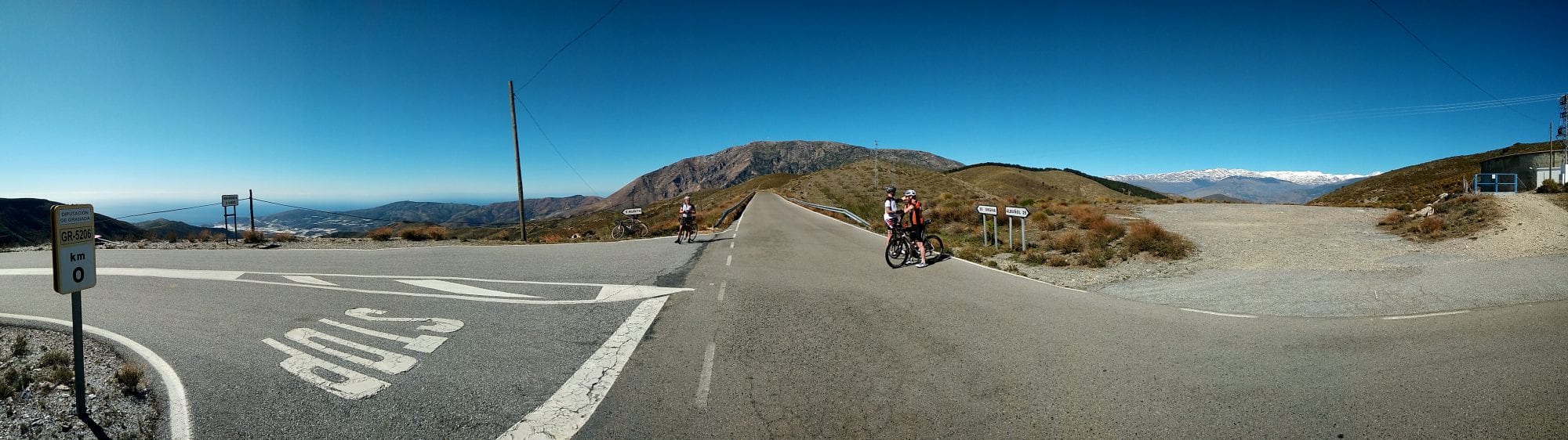
Once you hit Trevelez you continue along the ridge, with the Sierra Nevada off to your left. While you might see the odd tourist bus on the road leading up to the village, which seems to be a popular day trip for Spanish pensioners, the other side is almost devoid of traffic. The most human contact you’ll find is likely to be limited to the tiny villages, still sitting up well over 1,000 m high, with their own jamon ‘secaderos’, a bar and not a lot else. They do all however have at least one water fountain, with fresh spring water from the ice melt on the mountains; so even in the heat you are never far from some fresh, cold water.
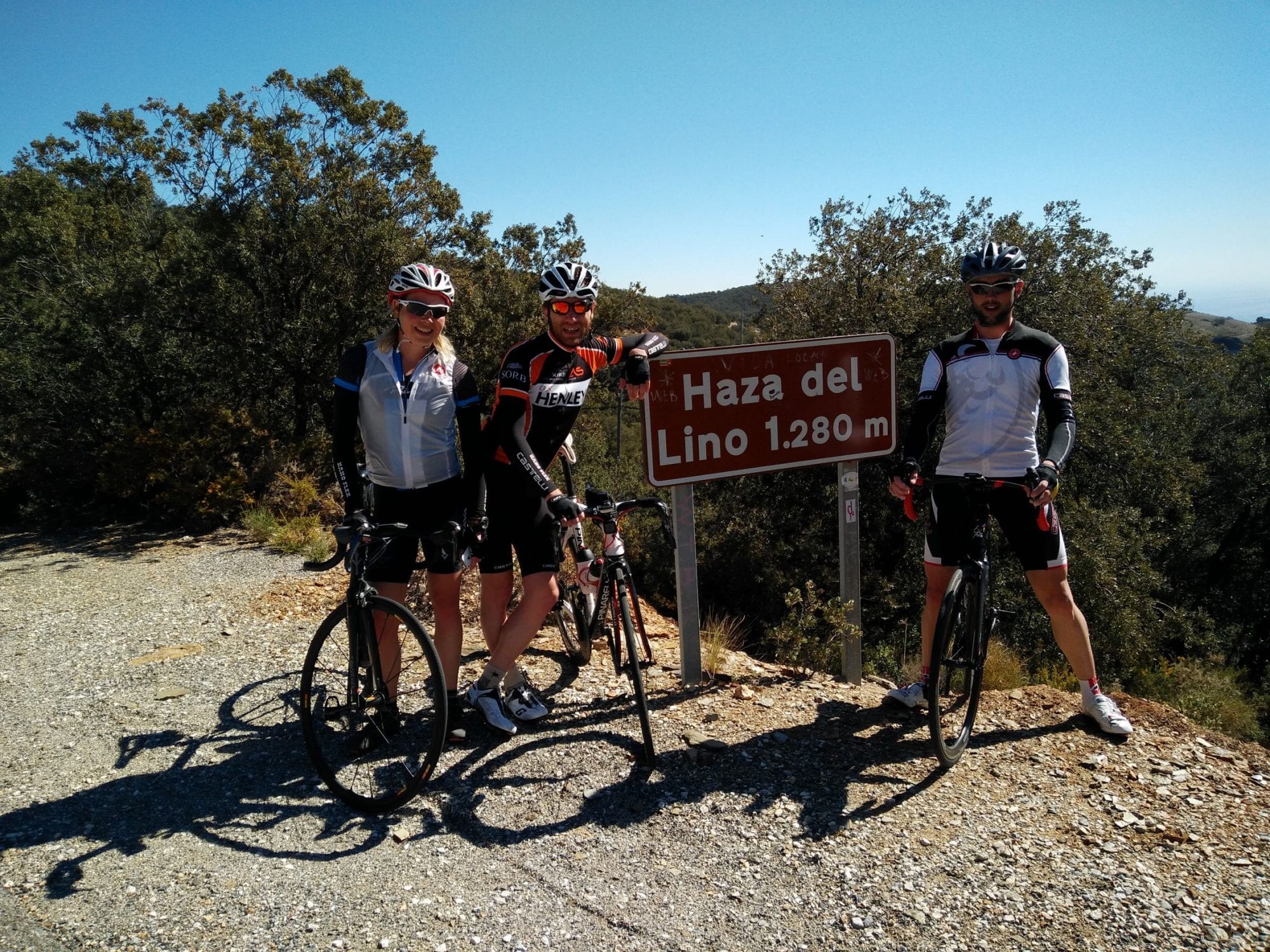
After a gradual descent off the ridge you are rewarded with a short, hairpinned, descent to Cadiar, an excellent cafe stop opportunity; but we normally push on for the reward of the coast! To reach that however you need to get over the next mountain ridge. Another 7 km climb up to the ‘Haza de Lino’ before the reward of a fantastic descent, with twists and hairpins through yet another ‘village in the sky’ into longer straight sections. Then comes the true reward for all that climbing earlier in the day: a long, straight, gradual downhill just begging for some through and off and your best Peter Sagan impression in a sprint, reaching pro-speeds on this final run-in to the coast.
Trevelez in the distance
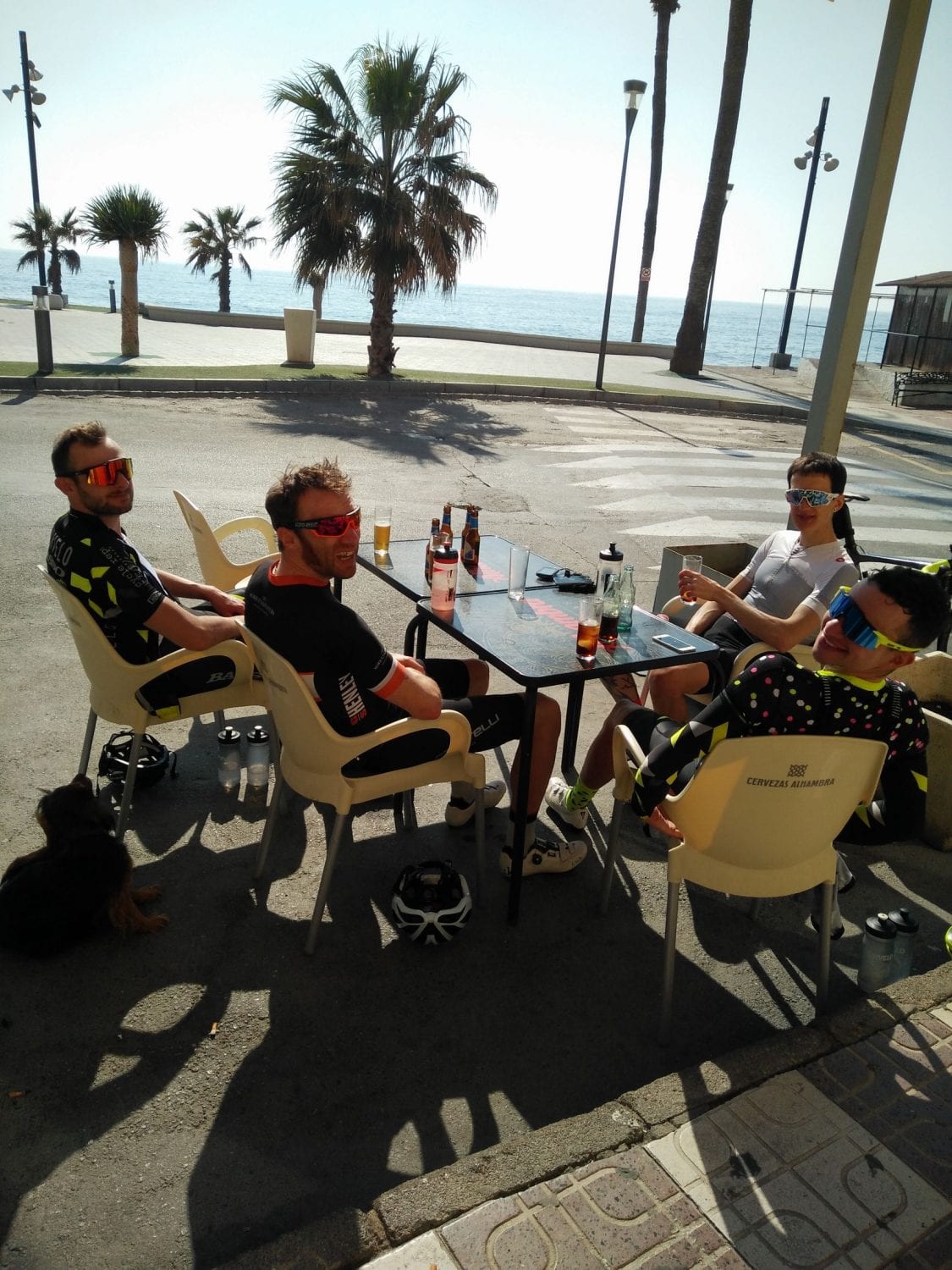
In a couple of hours you’ve descended from Spain’s highest village to the Mediterranean Sea, on the ‘Costa Tropical’; Europe’s greenhouse for tomatoes, avocados and many more tropical fruits and vegetables. We usually stop here for lunch, or maybe push on to another coastal town, fuelling up on ‘bocadillos’, cokes and coffee. If you’re more hungry, a full on ‘menu del dia’ is on the cards, costing 10-12 Euros and requiring a fair bit of digestion time! I have made, and subsequently regretted, that choice a few times!
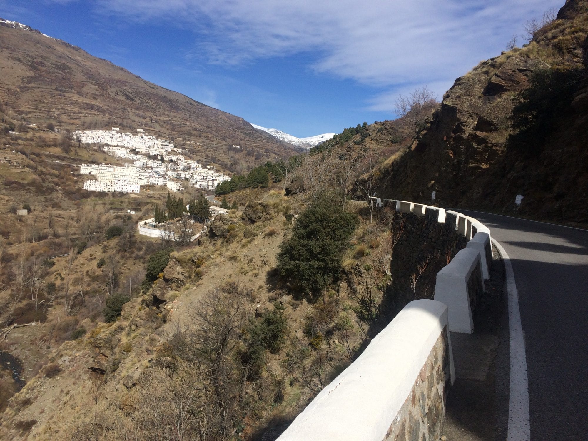
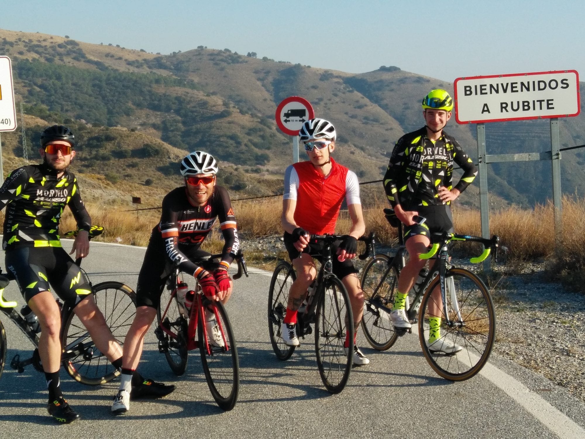
From the lunch stop the final sting in the tail of the day’s riding awaits. While there are other routes back (if you don’t mind extending an already long day in the saddle) the ‘classic’ route back involves one of the toughest climbs in the area to the village of Rubite. It’s not that long, at 8 km for the main part of the climb, but this averages 8%, with pitches up to 14% on the hairpins. The climb takes even former Spanish national champ and Vuelta podium finisher Francisco Mancebo (a regular in the Orgiva cafés during his training rides) half an hour according to Strava. The real difficulty however is the road surface. After being spoilt with pristine tarmac for 99% of your trip in Andalucia, the rough surface feels like being back in the Worcestershire lanes after a winter’s freeze-thaw cycle! On a hot day you may well be out of water after the previous refill at the coast, but like all the villages in the area, Rubite has a fresh water fountain; the downside being a slight downhill detour into the village itself, and well, what goes down… After a well deserved pit stop we regroup and switch to smooth tarmac again for the final bit of climbing of the day back up to the ridge of the Haza de Lino, which boasts amazing views of snow topped peaks on one side and the Mediterranean Sea on the other, maybe even the coast of Africa on a really clear day.
After all the hard work is done and you’ve taken advantage of the photo opportunities, it’s time for the reward of the final drop back down into Orgiva. Again, this is a descent of two halves, with the bends concentrated at the top before meeting the straighter valley road back to base. After a big day in the saddle it’s time to ride into town and enjoy something from the selection available at the bakery, or maybe a beer and tapas (why not both, you’ve earned it!), depending on your priorities!
An epic day out for everyone and a very satisfying one to complete. And it becomes even more satisfying that night when you sit to the ample dinner provided at the hotel, where the sore legs are relieved by a glass of the local wine, a bellyful of hearty local grub, and talk turns to next year’s ride!
About Custom Cycle Coaching
Custom Cycle Coaching is a progressive coaching and lifestyle consultancy based in Birmingham, U.K. run by Tom Kirk. We use our years of cycling experience and scientific background to develop training programmes customised to our clients goals and time availability. We passionately believe that successful training programmes are those that adapt continuously as the athlete progresses. As such we aim to provide exceptional service by customising all plans to your individual requirements and continuously monitoring your improvement and adapting the plans as necessary.
We work with cyclists of all ages and levels and with Custom Cycle Coaching you can guarantee the attention to detail and feedback that brings results, not just in the short term but for your long term development as a cyclist, whatever your goals.
Bali 144 Challenge, Bali, Indonesia
Bali 144 Challenge is a four-member team adventure event, designed to encourage a culture of helping and supporting your teammates. Teams can decide whether they wish to ride or race the route, with prizes up for grabs for those who choose to race. Those wishing not to compete can take the challenge as an opportunity to complete a stunning bucket list ride in cycling heaven with their mates (within an eight hour cut-off time) with the support of road marshals, food/drink stations, medic, support vehicles, and in the company of fellow cyclists from the region.

Starting and ending in Ubud, in the foothills of the majestic Kintamani, the 144 km (12 Squared) 2,400 meter elevation route has been painstakingly designed by experienced cyclists to take riders through some of the best – if lesser known – areas for cycling in Bali. A lot of thought and research has been put into the design of the route to ensure that the roads used are as traffic free and smooth as possible.
The 144 Challenge starts at Sens Hotel and your first left turn is just before the bustling Ubud Market, straight down south through the main drag with its quaint cafes and restaurants. The riders may find it a little cold as Ubud will be around 17 degrees in the morning but the overall temperature will be comfortable – averaging 31 at the highest and 22 at the lowest.
As you head west and pass a popular river rafting drop off point, you will be greeted with gradual climbs, lush paddy fields, villages, sleeping dogs, and Mount Batur in the distance.
After you turn right up north, you might see people showering, doing morning ‘rituals’ and washing clothes by the river. You can ‘high five’ school kids who always get excited to see so many cyclists passing through, or even witness a mapeed (ceremonial walk bringing offerings to the Gods).
Coming up towards Petang, you will head back down south for a stretch of fast downhills and rollers after turning right by Sangeh Monkey forest. Unfortunately those little critters hang out a little further into the forest so you will not get to see them. It is however worth a visit after you finish the challenge.
Some cultural things you might notice when you’re cycling across Bali are offerings left on the roads, the locals call it “Sesajen”; big temples in Kintamani, a lot of statues that represent the Gods, Deities, and animals which are sacred to the locals.

Many interesting mixes of road surfaces and rollers will keep you entertained before making your way back north to Plaga, where your eyes can enjoy marigold fields. This is where the climbs get a little steeper, around 20 km from Plaga Bridge to Pura Puncak Penulisan. You will then have a little kicker as you pass a waterfall with lots of highly dense areas to keep you cool as the day progresses.
What can you do post-ride?
If you still have the legs after the challenge, you can stumble into Ubud Market to get that one shirt you’ve always wanted, gift-shopping for your friends, try some rujak buah (fruit salad with peanut sauce), eat Babi Guling (Bali’s infamous roasted pig) and also buy a wooden ‘lolok’ bottle opener. We bet everybody will try opening a bottle with it.
About Twelve Squared
Twelve Squared is an Indonesia-based premium cycling apparel and accessories brand.
Our activities are centred around creating fun avenues for cyclists to push their limits, whether through embarking on cycling adventures over challenging terrain or distances, or exploring new ideas and concepts in the world of cycling. As the sport of cycling is constantly changing, we believe cyclists should try to stay ahead of the game by thinking outside the box, challenging existing norms, and in the process growing in depth as cyclists.
With ‘Get Out of Your Square’ as our motto, we would like to challenge cyclists in their passion of cycling and getting out of their comfort zone.
Mount Akagi – The Red Fortress Volcano, Japan
Just an hour and a half from central Tokyo lies an unimaginable playground for cyclists. Though much of Japan is coastal, the landlocked prefecture of Gunma offers riding unlike no other in Japan. With towering volcanic mountains, long river valleys, fantastic tarmac, and forest roads where you can get lost for hours to the sweet sounds of car free nature.
At the centre of all this is one of the most iconic mountains in Gunma, Mount Akagi. Part of the 三名山 or three famous mountains of Gunma (Mt Akagi, Mt Haruna, Mt Miyogi), it is said that from any point in the Gunma plains you can see these three famous peaks. Mt Akagi is a massive stratovolcano starting from the Tone River (60 m above sea) to its highest peak Kurobi at 1,828 m above sea. For the cyclist though Akagi is home to three epic roads up into its large caldera, to two caldera lakes, and a perfectly designed course for cyclists.
Though Akagi is home to an annual hill climb race on the main road to the caldera each summer our favorite route takes you up the seldom travelled old road. Where the main road may be closed for the race each year, any other time of the year this road has a steady amount of cars on it making for a less than ideal climb. That said, the old road is home to a seldom driven narrower rindo (forest road) that has 100 numbered turns to the summit topping out at over 1,500 m!
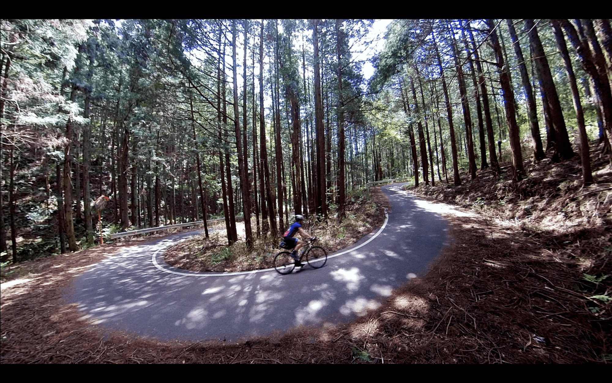
From Akagi Station the ride leaves Omama Town and the climb begins. Weaving through rice fields and small country towns you gain the first 500 m in the first 15 km traversing the agricultural heartland of Japan. Then, take a quick stop and offer a prayer to the kami gods of this massive volcono in the dappled forest light of the Akagi Miyosawa Shrine. From here it’s off on the 100 turns to the top. Switchback after switchback the road climbs as the dense pine forest gives way to highland bamboos. With the road so seldom travelled by car be sure to keep your eyes peeled for monkeys in the trees or the mystical Kamoshika (Japanese Serow).
At an average of 8.6% for 10 km from the shrine you pass turn 88 before a small descent to the final 1 km to enter the caldera. At turn 90 you reach the summit and the last ten turns are downhill, a fitting reward as you dive into the centre of the caldera.
Once inside take a victory lap around the caldera lake Onuma and spot the large red bridge to the Akagi Shrine in the center of the lake. With your prayers answered at the bottom now is a perfect time to offer your prayers for safety, or speed, on your descent. Stop by the sandy beach town for some local eats and a coffee to warm up before taking the main road out of the caldera to start the thrilling descent.
With near pristine pavement and two full lanes descending Akagi’s main road is something of heaven for cyclists. Fly down the mountain and soak in the panoramic views of the whole of the Tone Valley and the West Alps of Nagano in the distance. If you like descending this road will certainly leave you wanting to come back!
After 14 km and 1,000+ m of descent turn onto the Akagi Panoramic Road for some great rollers and views to warm up the legs again. Then, one last run through the rice fields takes you back to Akagi Station to complete the day.
About Bike Tour Japan
Building an unforgettable cycling adventure is all about the details. We strive to create an immersive journey to the best cycling regions in Japan, not just because they have been mentioned in blogs, but because they are home to incredible nature, history, roads, and culture. Join us where the locals love to explore, and experience ancient traditions, still preserved in secluded small towns. We believe that bicycle touring in Japan truly captures all the wonder, discovery, freedom, and cultural understanding that can only be gained through slow, intentional travel. Hop on the saddle for an unforgettable cycling experience with Bike Tour Japan.
Daming Delights, Anhui, China
The Daming Classic is a local challenge starting at around 200 m, breaking through the clouds and finishing around 1,450 m at a radar / weather station at the top. A good long climb for beginners, nothing too steep – with a 5% grade, makes for an hour to two uphill and a half to one hour downhill. Great views over to Qiandao Lake to the south, Daming and Qingliangfeng (with cool peaks to the north).
Basic Stats: 5 %, 1,250 m elevation gain over the main segment; 25 km up and 25 km down.
Interest: An hour FTP, a father son (or daughter) challenge, an Everest or two, a first proper climb, kudos seriously earned and one hill too many at the end of a very long day.

Surface: Generally ok to good but there can be landslides. Walk over if safe or walk around it.
Technical: Nothing too hard but be careful on the downhill. There have been a few minor crashes with people being too quick on the turns and / or over zealous on their front brakes.
Traffic: Very minimal, careful on the downhill corners. The odd cow and hiker.
Drink stops: At start / end only. A place to buy drinks and what is described by Sam McMorran as the best noodles in Anhui, even if you’re in Zhejiang.
KOM: Normal suspects.

Sir David’s Ascent – Daming South Route
Same mid point at the top of Daming but doing a loop to its east and going up the south side. Taking in hotspring villages, lunch stops, meandering up a river through wild flower meadows followed by bamboo forests to the steep section. Very nice and a personal favourite.
Ariège Pyrénées, France
We leave from our doorstep and ride out along the gorgeous vallée de L’Hers, the imposing grandeur of the high mountains in panoramic view the moment you clip in. We ride due south in the direction of Foix and the first 30 km of the day’s ride are a perfect mix of flat and rolling roads. En route, we give the legs a reminder that the day’s terrain will soon rise high above sea level as we crest two 500 m cols, the Col de Calzan and the Col de Py. Both climbs are intrinsically linked with the Maquis resistance fighters of WWII and a humbling reminder of the sacrifices they made for the freedom of others. The amazing Château de Foix comes into view as we reach the outskirts of the town and we are soon winding our way through its medieval streets and making our approach to the day’s first major climb – the Col de Péguère.
Photo by Camille McMillan
Col de Péguère 1,375 m
Length: 18 km (from La Mouline)
Height Gain: 872 m
Max Gradient: 10%
The side we climb is not to be mistaken for the road used in the Tour de France – that’s the viscious Mur de Péguère and we save that for another day. This ascent is longer and the average gradient far more forgiving. The climb can be split into three distinct sections; first up is a fairly sanguine 10 km along the vallée de L’Arget and an opportunity to chat and enjoy the surrounding countryside. The second section is the toughest and the average kicks up above 7% for the next 4 km. The gradient is taxing but never a suffer fest and it is important to reign in any desire to push on at this point as we’re only now starting the day’s real climbing. The climb has several markers along its route and first up is the Col de Marrous at 1,000 m. There’s a lovely auberge nestled in the trees where we can refill any bidons for those running low. We push on through the dense forest where deer and wild boar roam and as we continue our upward trajectory and the trees begin to thin out, we get our first glimpse of the magnificent views stretching out across the Garonne flood plains towards Toulouse. The gradient has eased right off now and the average is little more than 2.5%; it’s a big ring finish for those feeling strong. As you crest the summit you are rewarded with what I think is one of the best views in the whole of the Pyrénées – a mind-blowing view across the Massat valley where, on a clear day, the whole range appears visible.
Photo by Camille McMillan
We’re up at 1,375 m now and ride west along a ridge past the ancient Laffont tower towards our next marker, the Col du Portel. At 1,432 m there is little in the way of climbing as we pass the summit marker and head down towards the village of Biert. The views are incredible; to the right you can see for miles as the mountains give way to plains and to the left the majestic high peaks of the Pyrénées and the Spanish border beyond. Passing the summit of the Col de la Crouzette, we continue our drop into the valley below. A word of caution – the middle section of the descent is narrow and in sections very steep – descend with caution. As we reach the village of Biert, we prepare ourselves for the day’s next ascent – the Col de Saraillé.
Col de Saraillé 900 m
Length: 5.4 km
Height Gain: 356 m
Max Gradient: 10%
We are very much on roads less travelled now as we head deep into the Massat valley. This climb is everything I love about riding in this part of the Pyrénées – undiscovered and different. The road is narrow with little or no traffic, the sound of mountain streams and birdsong your only company – it’s a real escape. The climb twists and turns through ancient forests, a great shade sail on hot days and the gradient is steady. As we reach the small hamlet of Le Saraille, there’s a break in the trees and the higher peaks show themselves as we close in on the summit. At just over 900 m and a mere 356 m height gain, the climb is a test for the legs but nothing more. The descent into the valley floor below is technical but opens up onto a glorious balcony at Camp de Caou and the old church in the hamlet of Coste sits in a glorious spot looking out across the Garbet valley below. Back on the valley floor we head towards the old spa town of Aulus-Les-Bains. Best known for its thermal springs, spa complex and several wonderful Belle Époque buildings, it’s the perfect place to stop for a shot of caffeine. Next up it’s the Col d’Agnès.
Photo by Camille McMillan
Col d’Agnès 1,570 m
Length: 10.5 km
Height Gain: 820 m
Max Gradient: 10%
From Aulus, it’s a tough climb and the first half particularly so with testing gradients above 8%. The road initially follows the ravine carved out by the river Garbet and for the first five kilometres the bends are long and the grandeur of the high peaks we are heading for dominate the horizon. The sound of cascading water is a welcome distraction from the testing ramps. At the 5 km mark the first of the hairpins begin and height is gained quickly. The reward is a stunning stretch of road around the 7 km mark that hugs the mountain side giving views of Aulus in the valley bottom and the Col de Latrape and Guzet Neige high up on the other side. As the increasing altitude takes the trees out of shot, the vista becomes more impressive with the Pic de Certascan dominating the horizon and the border with Spain. The summit is reached at 1,570 m and a chance to revel in that wonderful feeling you get when you summit a new climb. You can now enjoy a long and super fast descent, flying past the Etang de Lers to the village of Massat before the day’s final climb, the Col de Port.
Photo by Camille McMillan
Col de Port 1,249 m
Length: 12.3 km
Height Gain: 619 m
Max Gradient: 8%
We normally make time for a quick stop in the delightful village of Massat, everyone buzzing after the descent – coffee not needed here. Despite some steeper ramps on its early slopes, the Col de Port is the perfect way to finish the day’s climbing. The steady gradient beyond the small hamlet of Espiés allows you to settle in and spin your way up the mountainside. With plenty to keep your mind occupied, from the old stone houses dotted along the roadside to the glorious views back across the valley, you’d be forgiven for thinking that riding cols is easy. The summit can be viewed from some way down the mountain but the easy gradient means the psychological torture sometimes felt in these situations is held at bay. The final 2 kilometres are fast and there’s a welcoming auberge at the top with a lovely terrace offering spectacular views down the valley which we will soon descend to Tarascon.
Photo by Camille McMillan
The top section of the descent provides photo perfect views and it’s worth knocking the speed off to enjoy them and get some pictures on your phone. On reaching the town of Tarascon the tough stuff is done and it’s a largely downhill run to Foix and for anyone with tired legs, our support car can be on hand to take you back to base. For those riding, it’s steady back to ZeroNeuf. Whether you ride back or drive back a dip in the pool and a craft beer in the bar awaits.
Our Ariège Pyrénées loop is a tough day on the bike but it’s a real favourite amongst guests and a hugely rewarding experience. The amazing thing is it’s merely scratching the surface of the seemingly endless quiet and maintained road network the region offers cyclists (of all abilities and ambitions). It’s surprising how few people have heard about the Ariège, let alone ridden here and we are intent on changing that.
Photo by Camille McMillan
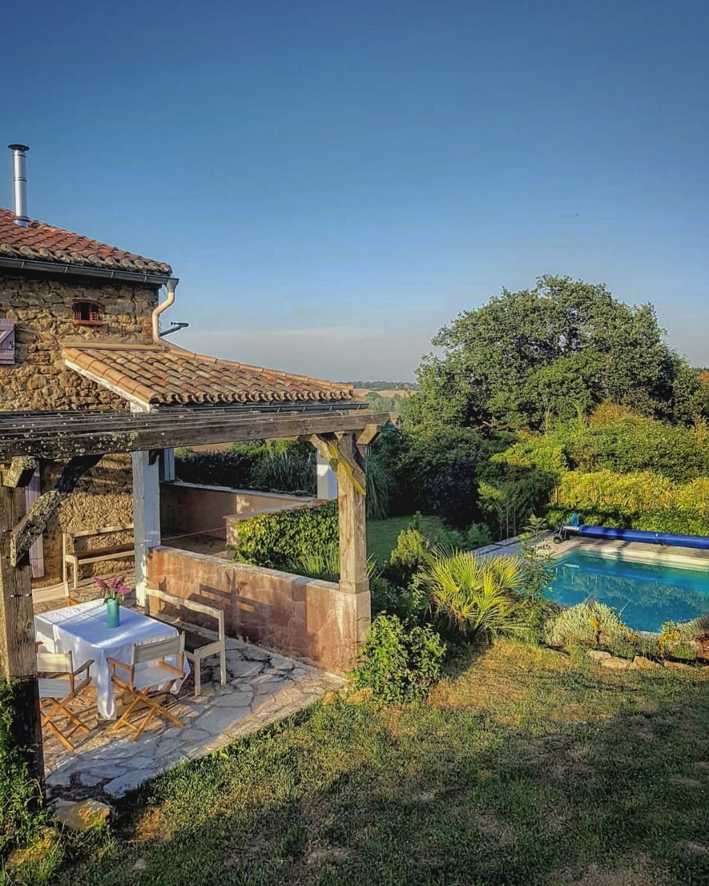
The idea behind ZeroNeuf was a fairly simple one; provide a fabulous base for cyclists but ensure there are ample facilities to entertain non riding partners and families. We have incredible cycling on our doorstep but we also want to make sure people can switch off and relax when they’re off the bike. We have renovated an old Ariège farmstead and it now provides stylish and comfortable accommodation, a swimming pool and garden with panoramic views of the Pyrénées and a café/bar serving fine coffee roasts, local craft beer & wine (and my wife Jocelyn’s amazing homemade cakes and snacks!)
You can choose from one of our tailored cycling escapes, we can build you a custom trip or you can stay and ride on your terms. We can look after groups, families (childcare is available on site), couples and singles on a fully catered, bed & breakfast or self-catered basis. We welcome cyclists of all abilities and ambitions and we adopt a strict no ‘rules’ policy. Our qualified ride leaders can guide you and high quality bikes (Giant TCR Advanced Pro Di2 Disc) are available to rent on site.
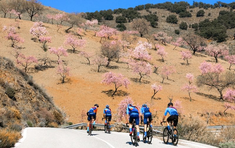
The Goat’s Pass, Granada, Spain
The Goat’s Pass is the old road that connected the coast with the inland and was mainly used by merchants who used to travel on mules bringing fresh fish from the coast to the markets in the city of Granada. The trip used to take several days, sometimes even travelling by night to avoid the hottest hours. Later the pass was used by citizens of Granada to access the beaches in the summertime, since at that time it was the only route down to the coast.

The Goat’s pass starts in the tropical coast and it is open all year long due to its moderate temperatures, even though it goes up to 1,300 m.
The climb itself departs from the Jete junction, around 150 m high and lasts 22 km averaging a 5% incline. The ascent is steady from Otívar, just after a light descent, where the climb averages around 6-7% for 11 km.
At this point we reach a lookout, just where an old gas station and a restaurant now lie abandoned, but still shows the importance of this route in the past.

For the next few kilometers the road gets flatter, alternating short and easy uphill roads with a few light descents before we go into the last and hardest 3 km of the climb along a breathtaking lunar landscape that evokes images like those in the “La Casse Désserte” in Col d’Izoard.
Once we get to the top, and before we start the descent to the city of Granada, we still have to accomplish one last challenge; to ride for a further 10 km of wasteland along a narrow coarse road.
About Ride Granada
Ride Granada offers fully guided tailor made cycling training camps and cycling holidays for road bikes and gravel bikes. We plan each day according to rider ability, preferences and schedule. Consequently all our training camps and cycling holidays can be adjusted according to rider ability.
Our guides are cyclists with extensive experience in guiding and racing. In addition they are also locals so they know the best roads and climbs in Granada and the Sierra Nevada. They know the most quiet routes to ride and to enjoy. Their local insight makes it easy for us to offer our customers the best possible experience on a bike.