If you build it, will they come?
Over the course of summer 2018 I heard a few rumours buzzing around our local ski resort of Courchevel: they were laying a “road”………a fresh line of tarmac snaking its way up through the ski fields to 2,300 m and it was to be for cyclists only?! My initial thought was “really”? ***environmentally that is awful…
As summer was heading to a close and autumn was upon us I heard that the road was finished. Our Alpcycles season was winding down and the last trips had been run. The cyclist in me won the battle against all of the environmental arguments mulling over in my mind and my only thought was “I’ve got to ride up it!” One quick phone call to a riding buddy and a quick assessment of the coming weather, it was the 28thOctober 2018 and there was snow forecast at the weekend. We agreed “let’s get up there today and check it out” and the decision was made.
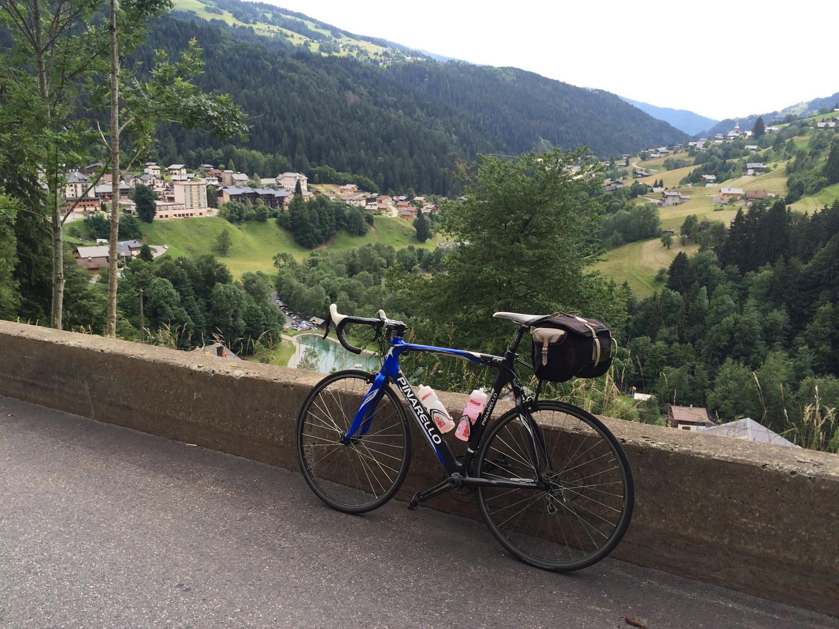
We jumped on the bikes and headed up the Courchevel climb to find the start of this new road. We had heard that it kicked off just below Courchevel Altiport. The full Courchevel to Altiport climb is 18 km and was last used in the Tour de France 2005, so it is well known by visiting cyclists, and is also the climb on which our local TT is held in the summer months, so it is a well-trodden route for locals. But this new strip of tarmac was going to be an altogether new adventure.
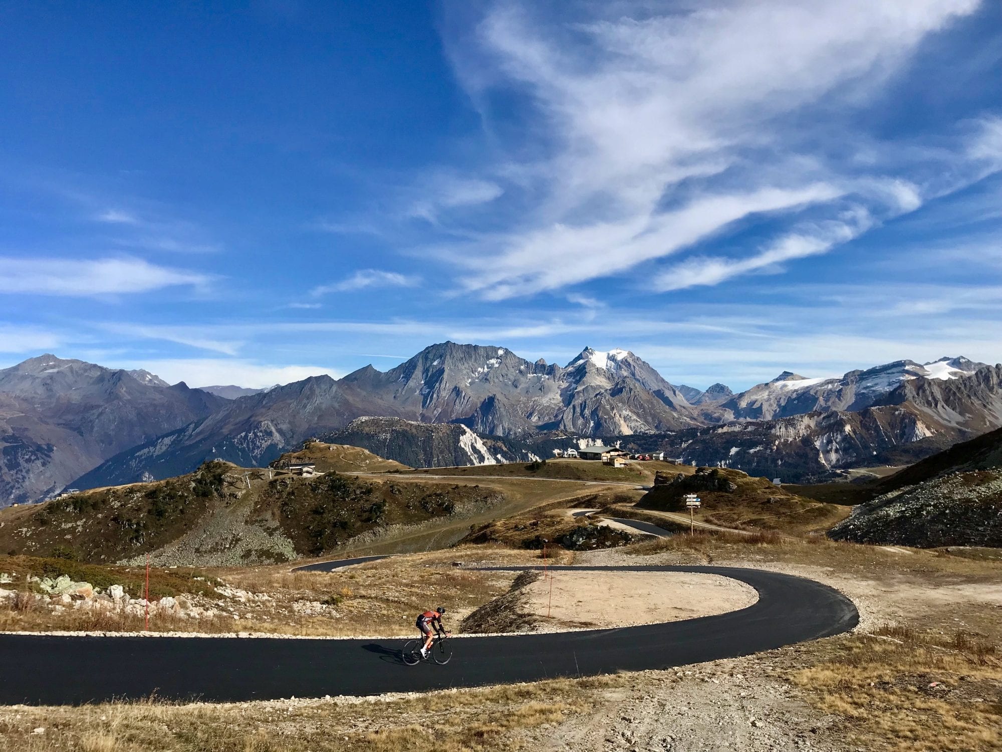
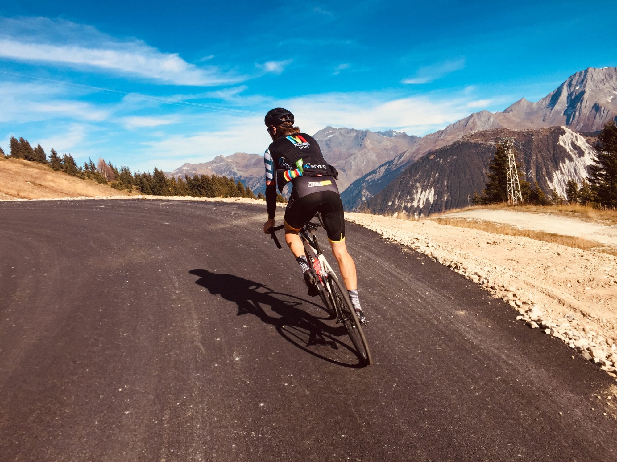
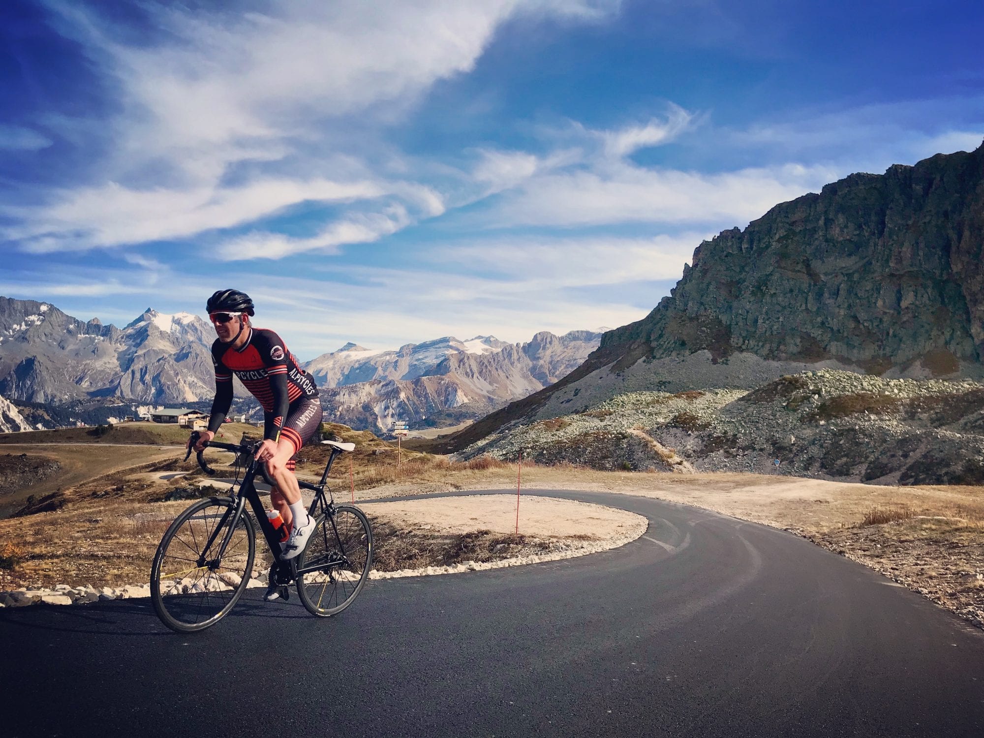
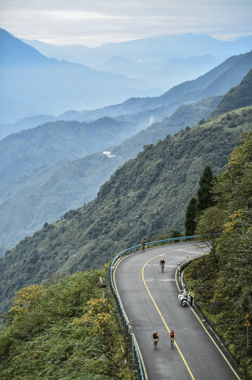
Just before the tunnel below the Altiport we see this fresh ribbon of black silk running off into the ski fields and just headed off to test it out. The first kilometre rolled nicely and then the route pitched up at 17% and then cut its way past the world-famous Verdon/Saulire cable car. Again, another easier section snaked up through the pistes that thousands of skiers and boarders spend the winter months sliding down! Here we were on a perfect clear blue autumn day climbing higher and steeper towards the Col de la Loze. The panorama was truly breathtaking. Eventually we hit the last crazy steep pitch at Col de la Loze where the lift station hits 2,300 m. There was tranquillity and silence that you only experience miles away from zero traffic (bliss).

So what’s all the fuss about? Well, most mountain passes have existed since Medieval and Roman times so were originally created for human necessity and then throughout the years have been updated and provide access for both people and vehicles. This road is different. It will eventually link Courchevel with its neighbour Meribel (the tarmac on that side has yet to be completed) and will then graduate into a “pass”. A new col which in turn will open up some great new access to higher adventures. But more importantly and uniquely, this new pass will be traffic free. You heard me. It will only be open to cyclists of all types, roller skiers and walkers. As far as I know there is no other traffic free mountain road like this in the French Alps?
This summer if you are heading to this part of the Alps you must experience it. Many others will as both the Haute Route Alps multiple stage event will summit here for their Courchevel stage, meaning hundreds of amateur riders getting a real treat and then the Under 23’s Tour de France, the Tour de Avenir, will allow the Under 23 riders in the world to smash each other to the finish. I am certain that before long the Criterium Dauphine and the Tour de France will follow, so why not get there first and check it out. It appears “if you build it, they will come”. It is set to be big news over the next few years and you could be one of the ones who got there first…well after me anyway.
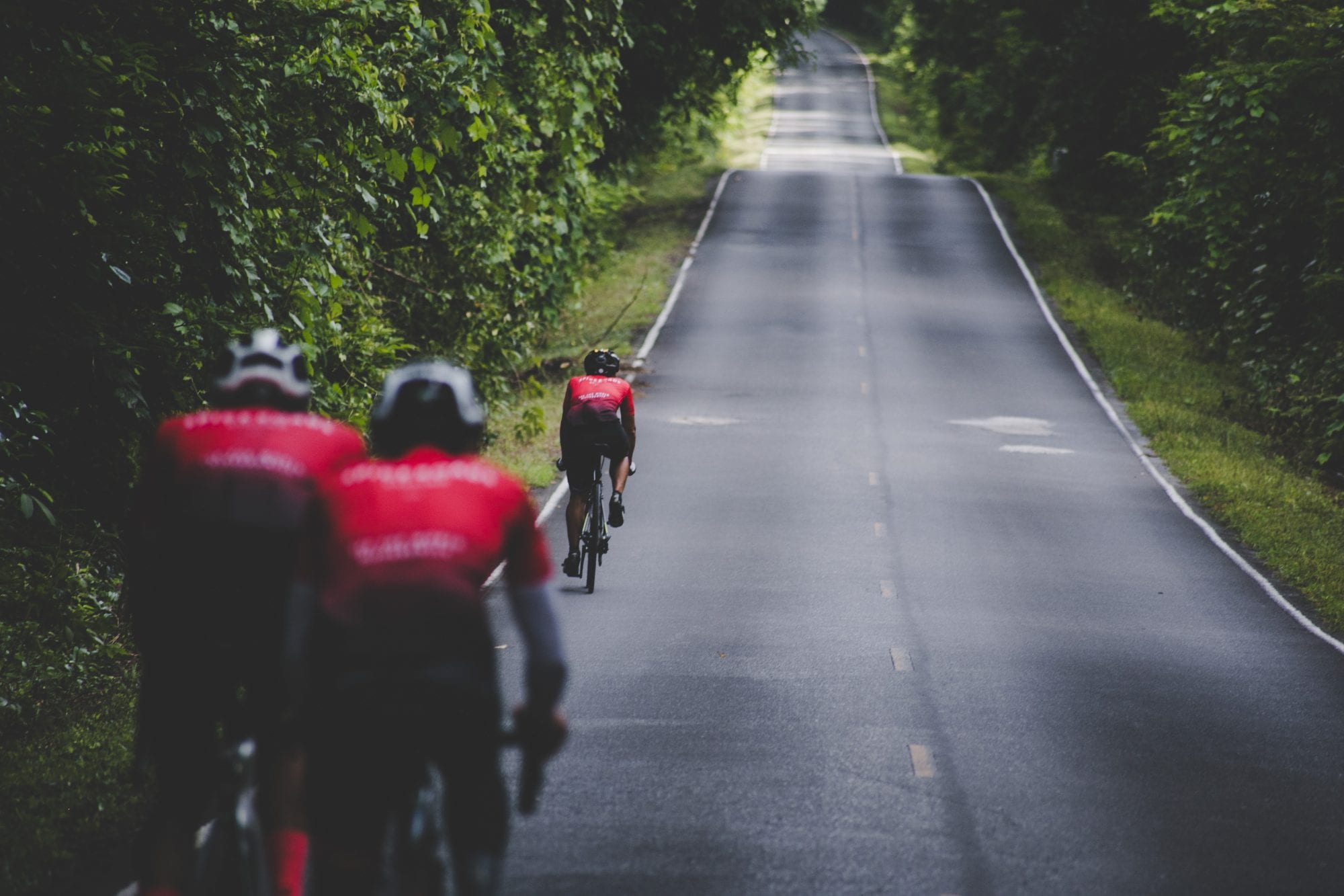
Kuala Lumpur to Fraser’s Hill Loop, Malaysia
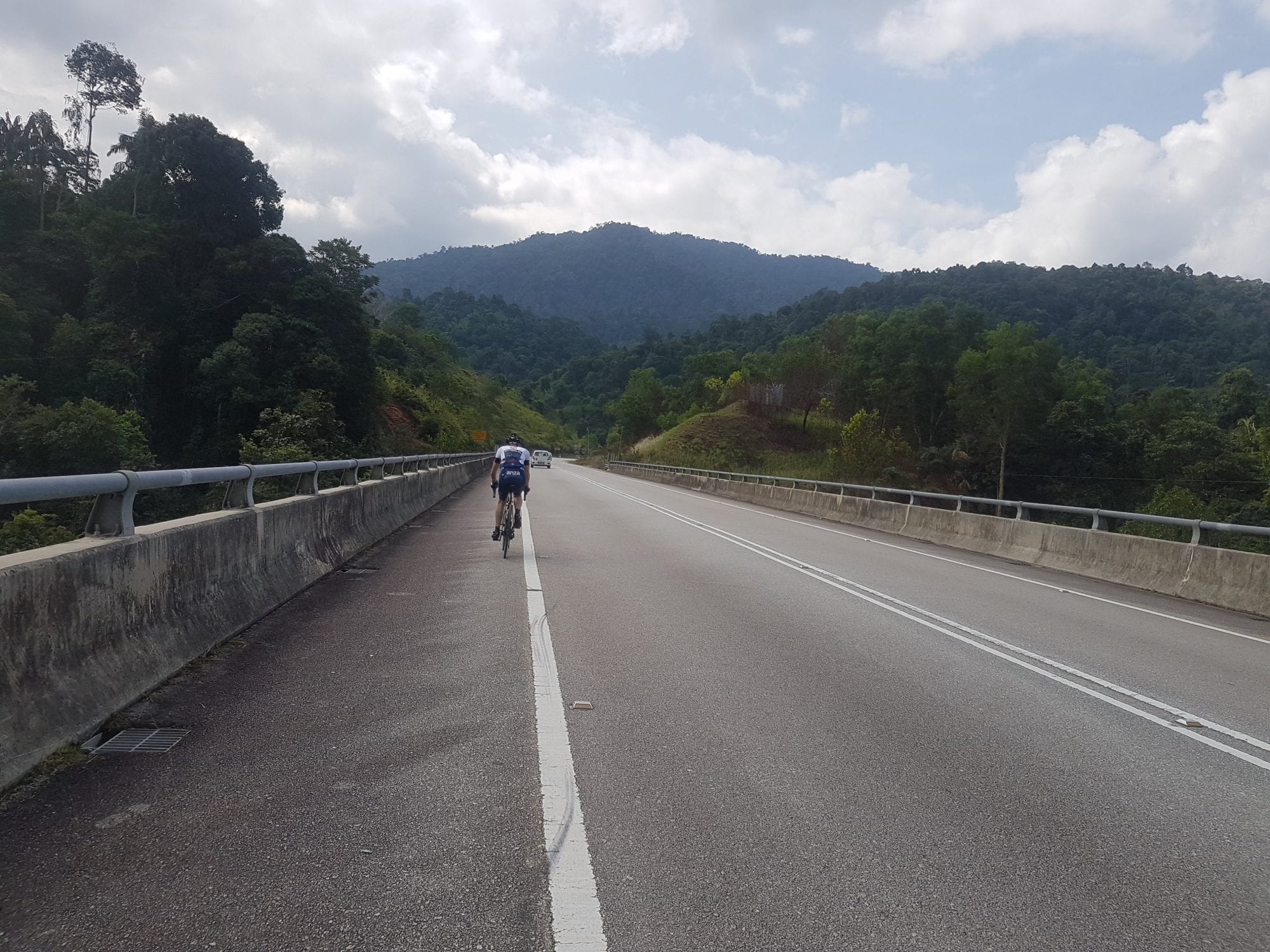
Rolling out of town should be done with caution as the road surface from the inner city to the city limits is variable. Over the last few years the city has been resurfacing the arterial roads in Kuala Lumpur and as a result most of the roads are good quality. However there is still the odd road with weather damage and potholes.
Once you reach Jalan Sungai Tua you are at the city limits. Taking a right turn at the mosque the first climb of the day presents, commonly referred to as “The Wall” for its appearance. The climb is a 1.1 km, Category 4 affair, averaging 8% and gaining 94 vertical metres.
As you crest the wall the road levels before you descend a nice winding road. The corners are open enough you need not break too hard and the surface is kind for a fast descent.
Shortly following ‘The Wall’ is another climb on Jalan Sungai Tua, commonly referred to as ‘Evian’. ‘Evian’ is a Category 3 climb at 6.6 km in length and averaging 4%. The climb is named after the waterfall which presents around three quarters through the climb.
‘Evian’ comes at kilometre 22 in the ride and starts by gently raising in gradient between 1% to 3%, before starting to bite after the 3 km mark.
From here it’s a 4% average gaining another 169 vertical metres in 3.76 km. The final 2 km to the signpost averages over 5% so don’t go too hard in the beginning because you’ll need your legs at the end.
Once you pass the sign you can enjoy another open descent which, again, can be taken without the use of breaks. The surface is good along the descent; however stay alert, there is usually some form of traffic.
You are now 40 km into the ride with two climbs done. The main event is still to come.
The road from ‘Evian’ to Kuala Kubu Bharu is flat with very few interruptions. As the road is open with a lack of shade the sun will be shining strong so remember your sunscreen. You can find a couple of service stations along the way to refill water bottles and grab a snack if necessary. The main event of the day awaits just past Kuala Kubu Bharu.
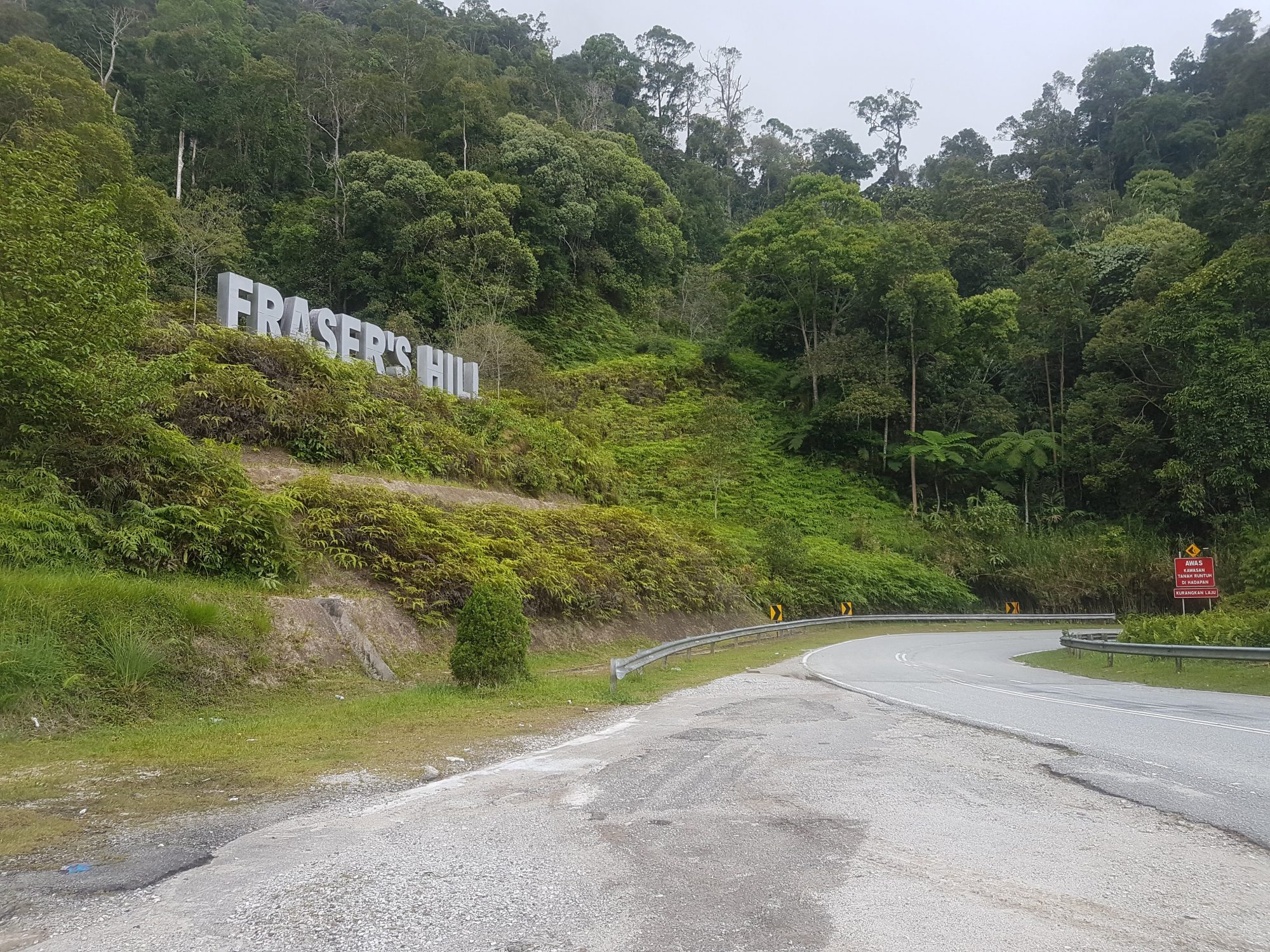
Bukit Fraser is a 37 km, Hors Category climb, starting out of Kuala Kubu Bharu and finishing at the Bukit Fraser Clock Tower. You will gain 1,155 vertical metres over the next 37 km. Making for a 3.1% average gradient from the bottom to the top.
Pressing on into Kuala Kubu Bharu you make a right turn towards the dam and almost immediately you start to climb.
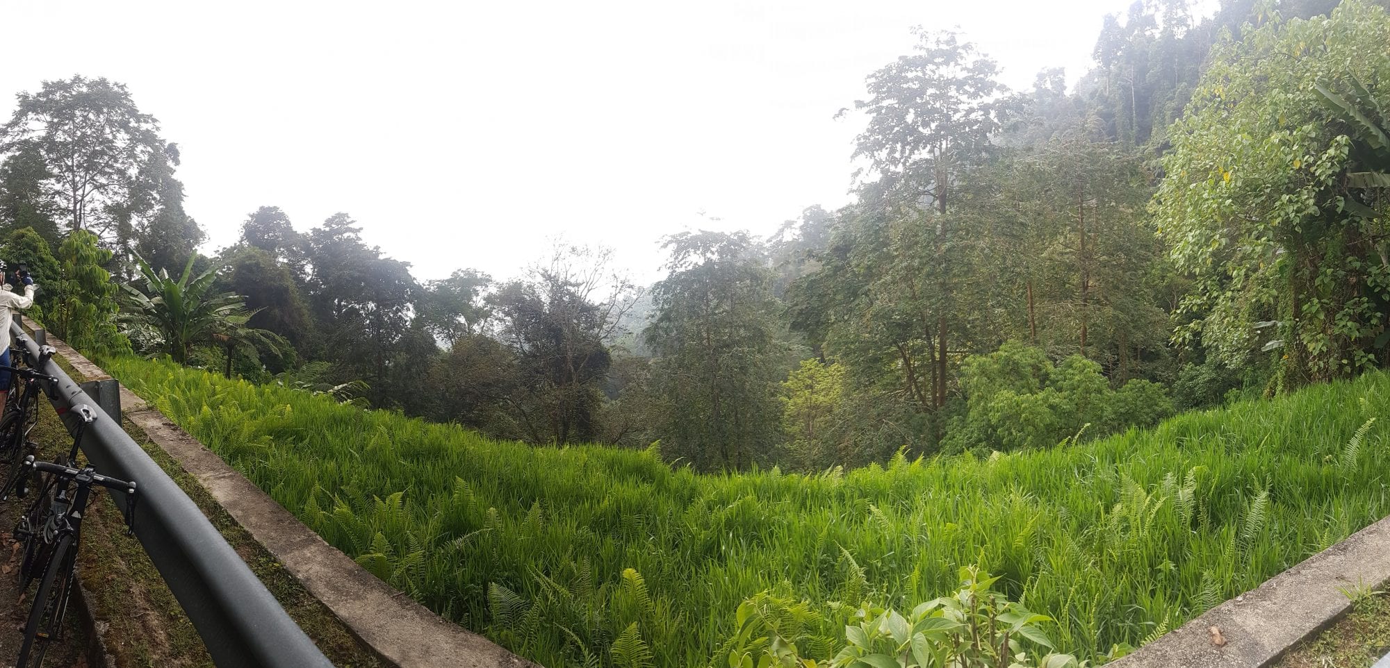
The Bukit Fraser climb starts gently as it winds through the vegetation before cresting the dam. Enjoy the momentary level road for the next 5 km as it is the last respite you will have before reaching the summit at the Clock Tower.
After the dam, Bukit Fraser is a steady 3% for the next 20 km. You wind in and out of sunshine and climb the easy gradient until you reach the ‘Gap’ where you will find the Bukit Fraser signpost.
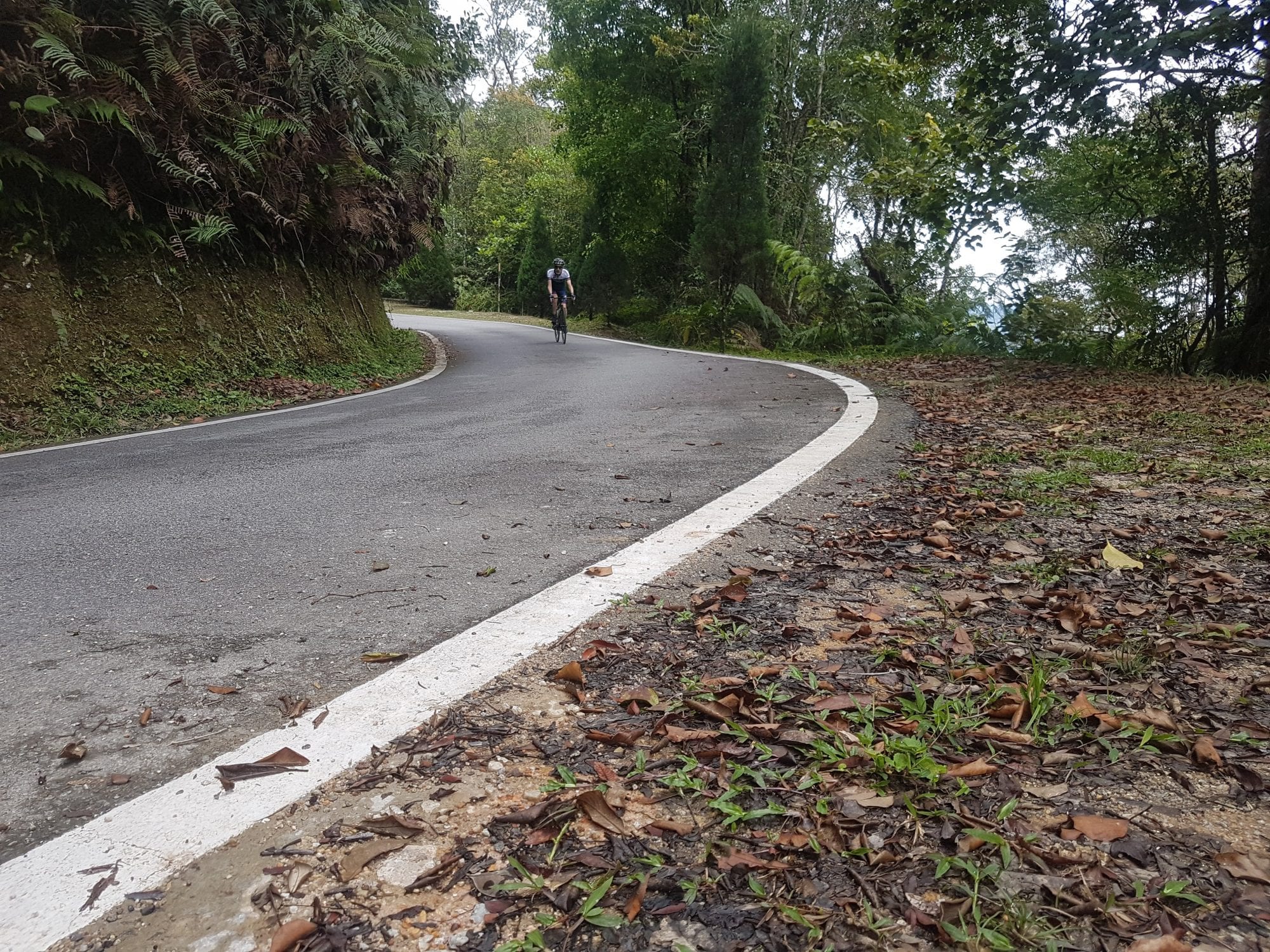
Passing the ‘Gap’ you will need to climb to the summit. Follow the road left at the gate which will lead you onto a one way road. This road loops to the Clock Tower and back.
The summit climb averages 5%, gaining 369 metres in the last 7.59 km.
Unlike the preceding 30 km the summit climb pitch changes often. The gradients are sometimes as steep as 11%, with stretches of 2%. Personally the pitch changes are a nice change to finish off the mammoth climb, as challenging as they are.
As your reach the top you will pass under the gantry to the Clock Tower, and complete the climb at the roundabout where the Clock Tower sits. There is a restaurant and after 100 km and already 1,484 metres of categorised climbing it is a great opportunity to stop for lunch. It can be cool at the top and along the descent, so best to pack a gilet or wind breaker to stay warm.
The Clock Tower marks the half way point of the ride in terms of distance, but further than half way in terms of climbing. After a bite to eat and a bit of rest it’s time to start your journey home. There are 2 roads which you can take from the Clock Tower roundabout. One climbs further but goes nowhere; and the other takes you back down the mountain.
You will need to climb one more pitch just past the roundabout before you can enjoy the lengthy descent off Bukit Fraser. Be careful on the 7.59 km descent off the summit as the road surface is pitted and weather torn. Also frequently off camber. If you are lucky enough to have a clear day the views out to the left are spectacular. Worthy of a picture. The view down the valley is a nice reward for the nearly two hour effort of a climb.
Reaching the base of the summit is less than half the descent. Here you have two options, with both options you have another 30 km to descend. You can turn right and head back the way you came through Kuala Kubu Bharu or turn left and head back to Kuala Lumpur via Bentong.
Heading back via Kuala Kubu Bharu is the reverse of the outbound leg. Both climbs are relatively equal when climbed from the North side. The ride distance will come in at 200 km when you arrive back in Kuala Lumpur. Riding back via Bentong the ride extends past the 200 km mark and you only tackle one more climb to get home. For this journey we are traveling back via Bentong.
Before reaching Bentong you first enjoy the 30 km descent which winds and weaves back down the mountainside. The gradient is much the same as the climb and barely breaks -3%. After the descent you will make a right turn as you reach the small township of Tranum. Continue along the open road between palm plantations for the 20 km before you arrive in Bentong. The road surface is not always so kind during this stretch.
Reaching Bentong you will have some 180 km of riding in the legs, take the opportunity to stop and fill up your water bottles, grab a snack and an ice cream. From Bentong you weave up the foothills of Genting Highlands following the river and ducking under the highway multiple times. Riding through the rain forest is a pleasant change from the open roads through the palm plantations.
The Genting Sempah climb is 15 km in length and climbs 600 vertical metres with an average gradient of 3%. Genting Sempah starts with a very shallow gradient and increases until you reach the crest. The bulk of the climb is between 3-4%. The top of the climb has two stretches which pitch greater than 10%. After 200 kilometres these two pitches really sting the legs. You won’t summit this climb, but rather crest in the foothills before the run back into Kuala Lumpur. Turning left at the service road at the Genting Sempah highway entry will lead you onto the descent. Be careful not to continue straight onto the highway.
A 15 km descent awaits. Again one must be cautious on the descent as the road is pitted in sections. The descent is a steady negative gradient of -3%. The ride down ducks in and out of tree coverage and sunshine. However if you are running late, or riding slow, you might be descending in the dark. Once you finish the descent it is another 15 km back into the centre of Kuala Lumpur and you can call the day finished!
Haute Route Qingcheng, China
Other countries had been considered for the first Haute Route in East Asia, but the opportunity to help develop the vast, largely untapped market for top-end cycling events in China was too big of a lure to ignore. With that decision made, the Swiss-based outfit that has transformed the amateur road racing sector since it debuted the Haute Route Alps in 2011 then had to find an ideal location, and from a large list of potential locations they settled on the city of Dujiangyan to host the October 25-27 event. It proved to be a good choice.
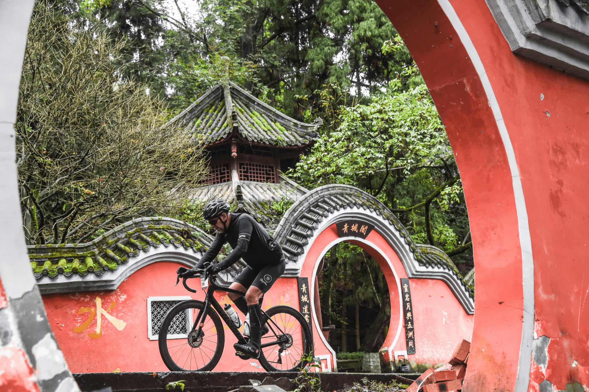
For one, Dujiangyan has mountains aplenty, the key geographical element for any Haute Route event. The city sits at the foot of an endless range of peaks and valleys that lead up to the mighty Qinhai-Tibet plateau. Within that range is a very special mountain that gave the three-day race its name: Mount Qingcheng, a peak revered within the ancient religion of Taoism. Its densely wooded slopes host a rich cultural kaleidoscope, from temples, palaces, pagodas, caves and other places of worship, to a diverse collection of unique flora and fauna, perhaps most famously the bamboo forests and the giant pandas who live among them.
Dujiangyan was also an ideal location in terms of logistics as it is less than an hour’s drive from Chengdu, the capital of Sichuan province. Chengdu is one of China’s biggest cities and its international airport is an aviation hub offering direct flights to/from most of Asia’s major population centres, as well as numerous daily links to Beijing and Shanghai; ideal to shuttle in the overseas riders who registered for the event.
While many of the 200+ competitors who gathered in Dujiangyan had come from afar (21 countries were represented), the lion’s share of the field were Chinese, which is exactly what the Haute Route people had been hoping for when they made the decision to come to China. It seemed like most of the foreign visitors were old Haute Route hands, but for the majority of the local riders this was their first exposure to the brand.
Haute Route began in 2011 as just a single event, the now classic seven-day trip down the spine of Alps from Geneva in Switzerland to Nice on the French Riveria. It then expanded into a series that centred around such iconic cycling destinations as the Pyrenees, the Italian Dolomites, l’Alpe d’Huez, Mont Ventoux and the Rocky Mountains of the United States. Knowing that riders were flying from all over the world to these events, the organisers then decided to cast their net much wider and this year saw Haute Route races in Oman, Mexico and now China. Next year the expansion continues with the inaugural Haute Route Brazil as one of 11 destinations on the 2020 calendar, and readers from Southeast Asia will be glad to know that plans for an event in that region are in the works.
Translating from French as “high road”, the Haute Route series delivers events that give amateur cyclists a glimpse of what it might be like to ride the mountain stages of the Tour de France and other pro races. Long, arduous days in the saddle are guaranteed in any Haute Route event, but so are stunning landscapes, superbly executed logistics, good accommodation, nutritious and tasty post-stage meals, professional level mechanical support, feed zones, a live timing system, daily post-race massages and much more. And while Haute Route Qingcheng might have been the latest baby in the series, it offered something than none of its elder siblings had ever done before … completely closed roads.
The scope of this was extraordinary.
Most amateur cycling events around the world secure varying levels of support from local authorities and police to try and keep their participants safe, but it’s almost unheard of to have closed roads. Instead volunteer marshalls and police outriders will try to shield the riders into a lane or two, but rarely are restrictions imposed on vehicular traffic coming in the other direction. For races that include a lot of climbing and descending, e.g. all Haute Route events, this can make going downhill precarious at times as the temptation to take the apex line and drift over the central divider is ever-present.
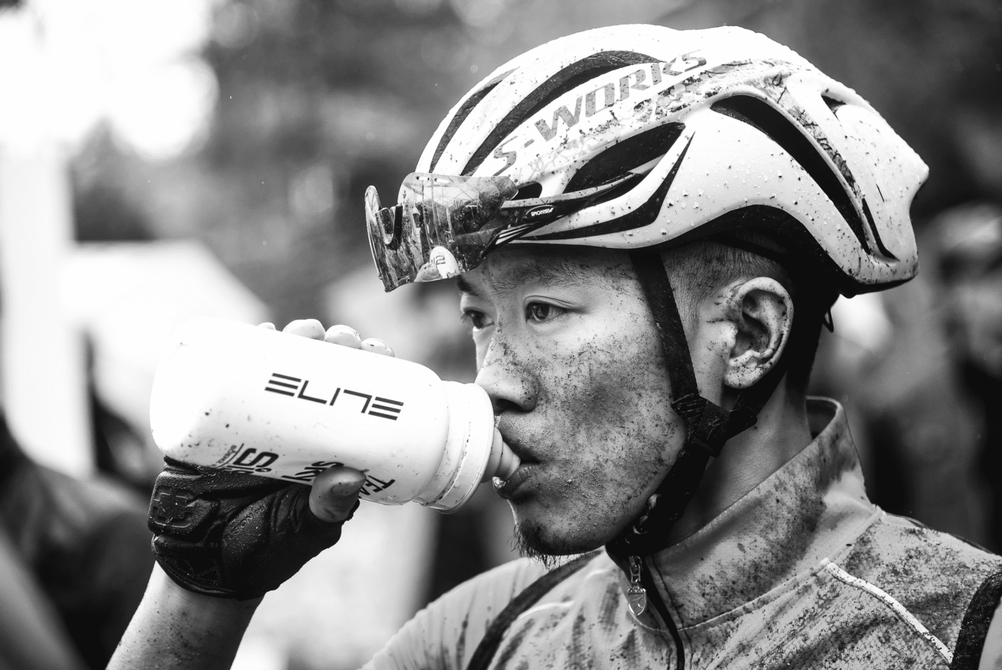
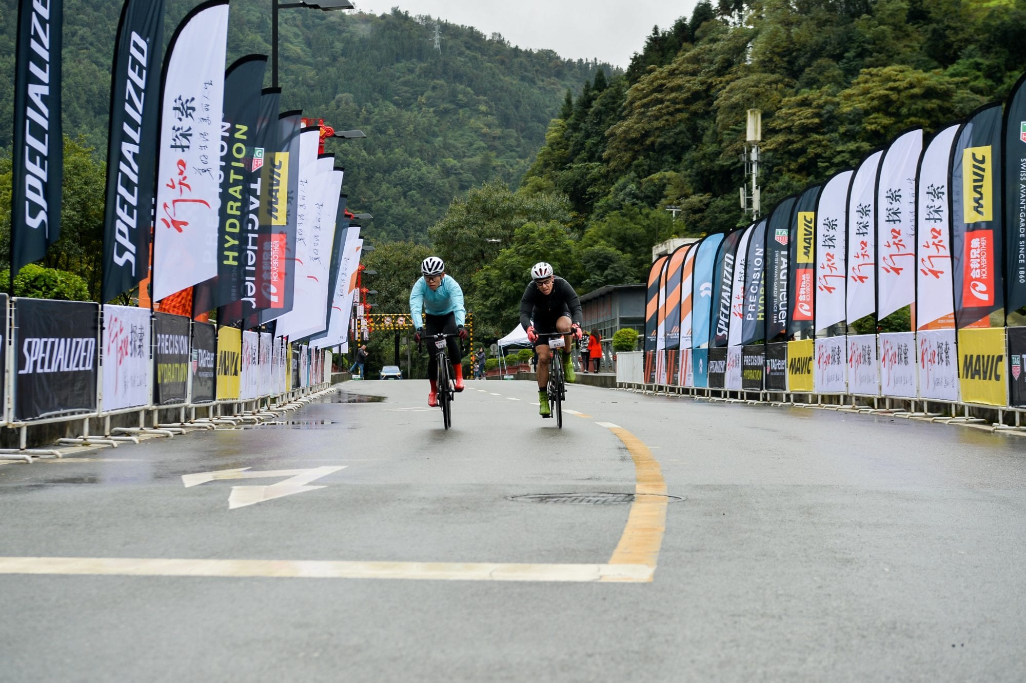
For Haute Route Qingcheng, the authorities in Dujiangyan and the other districts the race travelled through had got behind the event 100 percent and every major junction was blocked off and guarded by police or army officers. But even more impressive was the army of ordinary people, at least one of whom stood at every little road or lane that led onto the race routes. No cars, tractors, farm animals or errant pedestrians were going to spoil the show (although a few dogs did wander into the line of fire). The organisers estimated there were around 900 of these red-vested volunteers manning the routes on Stages 1 and 2, and it seemed as if every one of them had a smile and a shout of encouragement as the racers roared by, more often than not in the pouring rain. The marshalls weren’t the only ones lending vocal support, as what must have been the entire populations of each village and hamlet on the routes were standing roadside chanting “jaiyou, jaiyou” (go go!)

The Racing
Like all the “compact races” in the series, Haute Route Qingcheng comprised of three stages; two mass-start road races and an individual time trial. The total accumulative elevation gain for the three days was around 5,000m, with the highest point of the race the Stage 3 finish at 1,435 metres. By Haute Route standards neither of those numbers was exceptional but it still promised to be a challenging three days. Stage 1 covered 82km with 1,600m of climbing, Stage 2 was a proper queen stage at 132km and 2,400m of elevation gain, while the Stage 3 mountain individual time trial climbed over 700m in just over 13km, making it a fitting test on which to finish the race.
More than a year of preparations had gone into making sure the race was a success, including a test event in 2018 which saw a small group of riders tackle some of the roads that have made it into the final routes. That ground work paid off as the participants were provided with a set of superb racing parcoursand an unforgettable cultural experience. The scenery on all three stages was breathtaking, even when the clouds and rain were hiding the full majesty of the mountain vistas. That Haute Route Qingcheng would feature picturesque peaks and valleys was a given, but a network of raging rivers provided an unexpected visual and aural spectacle. The very best of Chinese hospitality on the course and in the city of Dujiangyan, and a first-class host hotel in the shape of the Minjiang Xinhao added to the event’s lustre … but there was nothing the Haute Route people could do about the weather.
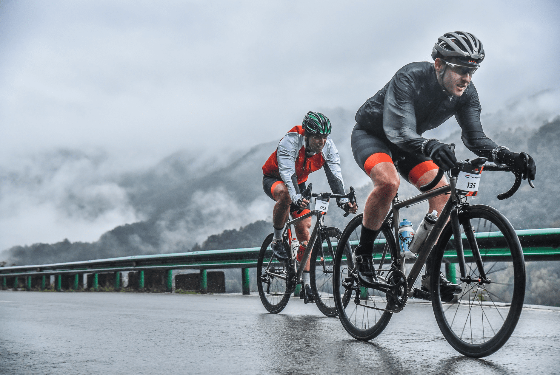
As the participants began to gather at the Minjiang Xinhao on the day before the race began, they were, like this writer, wondering where the mountains were. It was cold, it rained the entire day and the dark clouds from which the precipitation fell also kept the nearby peaks shrouded in a foreboding cloak. Unfortunately, the short-term forecast was for more of the same.
Still, people had travelled to the race from afar, both internally from all over China and from those 20 other countries, and so there was no real choice but to suck it up. At least the advances in wet- and cold-weather cycling gear in recent times meant that some protection from the elements was readily available … if, that is, people remembered to bring their knee- and arm-warmers, rain jackets, full-fingered gloves, overshoes, etc, with them. Some poor souls didn’t, or the fact they were riding unprotected from the elements meant they were just super hard.
Stage 1
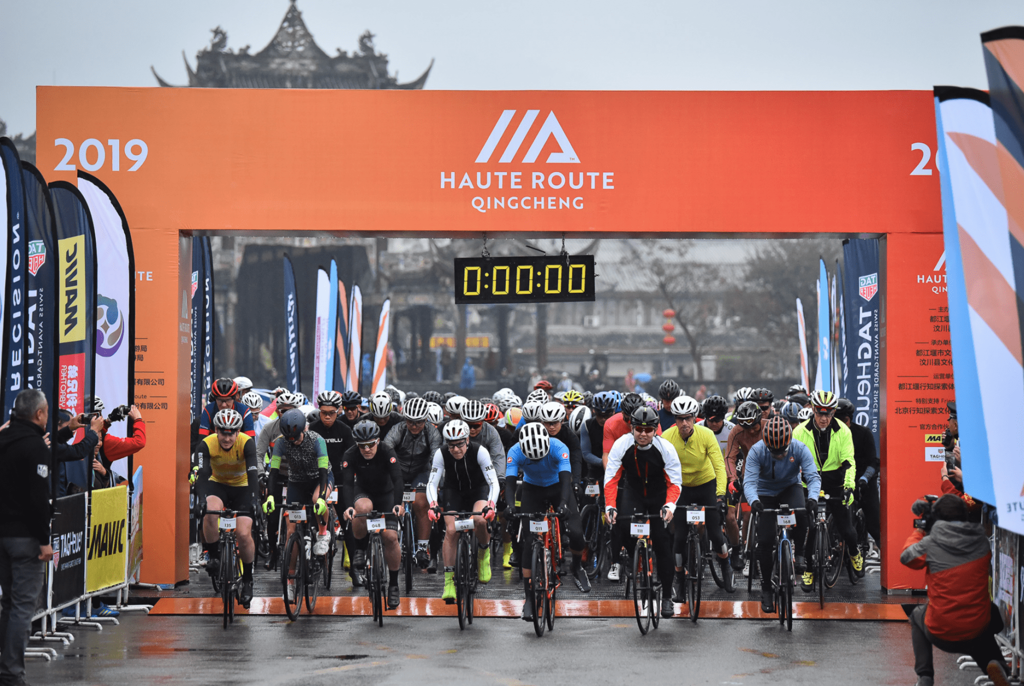
While the hills were still hidden from view when the riders gathered in front of the hotel at 7am on race day, the heavy rain of the day before had been replaced by something more akin to drizzle. But it was still fairly miserable as the peloton made its way to the Southbridge area of Dujiangyan where a pro-level stage-start infrastructure had been set up. A short, neutralised section led to the first climb at the 3km mark and from there the racing was on. A group numbering about a dozen riders got away on this punchy 1.5km climb and it was from this bunch that the stage honours were contested.
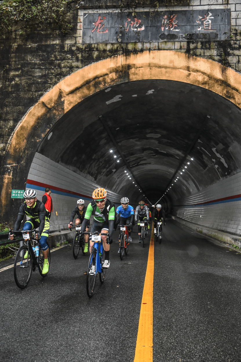
Like in all Haute Route races, though, the majority of the riders aren’t there to win, they’re there to challenge themselves on what they know will be exceptional routes. This relatively short stage had it all; short punchy climbs, longer uphill slogs, more than a few eerie tunnels, magnificent bridges spanning the roaring rivers, and a mix of fast, straight and twisty, technical descents. The feed zone at the 57km was a highlight too. Situated at the centre of the ancient town of Shuimo, riding bikes through its narrow, cobbled alleyways was like stepping back in time. The best of Stage 1 was to come immediately after leaving Shuimo, though, with the section known as the Balcony Road. This was a climb that twisted its way up narrow, tree-lined roads and through a series of small villages and had a picture-postcard stunning view of the valley, river and mountains to the right, even if the image was still partly shrouded in clouds. Aside from a few short downhills, the climb was about 7km in length and was followed by another sweeping descent before a short run into the finish in Yingxiu village, where miraculously the rain had stopped.
Stage 2
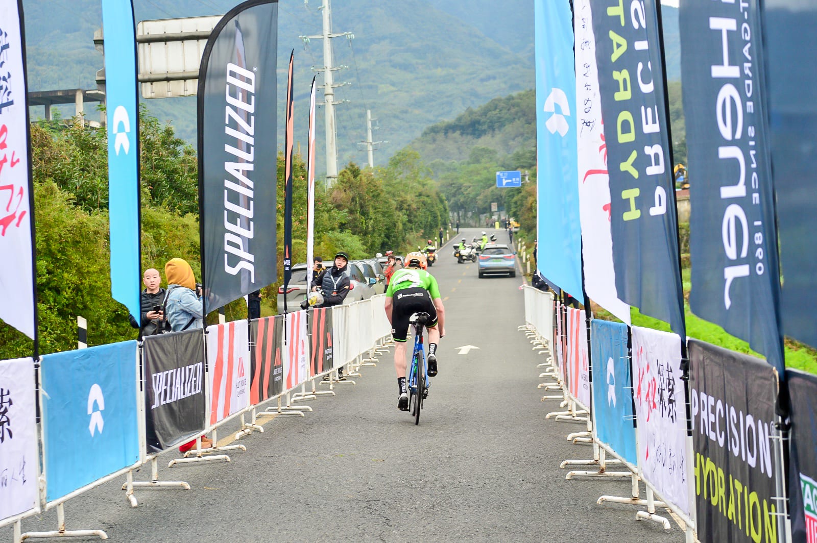
The Saturday morning saw the queen stage and a fittingly grand opening ceremony at the Southbridge square start area had been organised. The local authorities had even put on an additional event so that some 500 Dujiangyan cyclists of all stripes and sizes could take advantage of the closed roads in their city on a shortened version of the Haute Route race. Unfortunately, the rain was much heavier than the drizzle of the previous day and with the first 40km basically flat, the riders struggled to warm up. But the first of the hills, a 4km climb, did that job well enough and also split up the field again. A short but tricky descent followed and then it was onto the main course of the day, an 8km-long climb to the Xiange-Hongkou Pass, the high point of the stage at 1,268m. The route of the climb meandered up a tiny road half hidden by foliage and included a few super steep ramps where getting out of the saddle wasn’t an option due to the slippery conditions under tread. A feed zone just over the summit was a place to rest, refuel and recover, and then it was a long, fast 20km descent, which while no doubt was a relief and a thrill for all after the punishing climb, was also a bone-chilling affair. Another 20km of flat followed before a final set of five hills brought the riders to within 10km of the finish. A right-hand corner with 200m to go revealed a downhill roll to the finish under the impressive Qingcheng Mountain Gateway. The conditions really had been miserable throughout the day, so kudos to all the riders who finished the 132km course.
Stage 3
It was announced at the Stage 3 briefing on the Saturday night that the Sunday morning ITT course had been cut from the advertised 24km length to just over 13km. What was chopped was 11km of flat, urban roads leading to the main climb up the Puhong Road Pass, which was unaffected. No big loss to a race that is built around the “high roads”. Those 13km rose at an average grade of 5 percent, which classified it as a Cat 1 climb, and topped out at 1,435m, the high point of the entire race. Like most mountain ascents, hidden within that relatively tame 5 percent were shallower sections, false flats and steep ramps. And as is the case with all time trials, the course was as tough as the individual riders made it.
The weather finally played nice and while it was still a chilly morning for the competitors as they waited for their turn to climb onto the famous Haute Route time trial ramp, the rain had finally stopped. The much clearer skies, with even the odd touch of blue peeking through, allowed Dujiangyan to show off the full splendour of the mountains that had been mostly hidden for the previous few days. Despite the short, sharp dose of pain the riders had just gone through, a festive vibe hung in the air at the top of the climb, with the cyclists happy to be have completed what was a challenging but rewarding cycling experience.

And so, the inaugural Haute Route Qingcheng was over bar the closing ceremony and one last Sichuan feast back at the Minjiang Xinhao. Despite the weather, the event was a success and a second edition is already on the 2020 Haute Route Calendar, although there is a rumour it might move from the published October 16-18 dates. And with the promise of further events to come in China and the wider region, it looks like Haute Route is in Asia for the long haul. Chapeau mesdames et messieurs
*The three GPX files have been combined for the three stages. The statistics underneath the map are not accurate.
The Route des Grandes Alpes
The Route des Grandes Alpes (Great Alpine Road) is a 700 km long route through the French Alps devised by the French Touring Club and constructed between 1909 and 1937. It runs from Lake Geneva to Menton on the Mediterranean and includes some of the highest and most beautiful mountain passes in Europe.
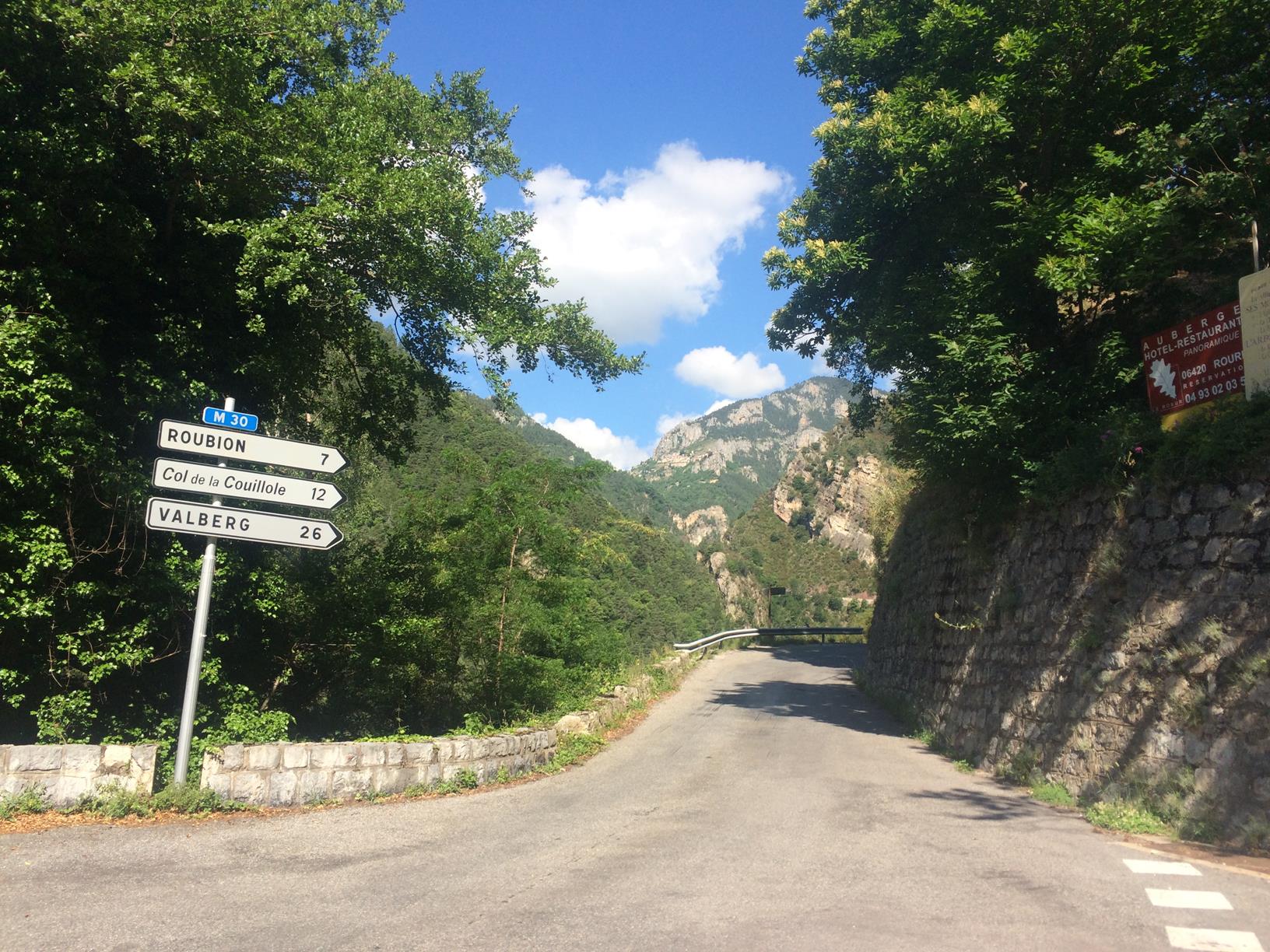
The route takes in 16 of the French Alps’ highest passes: Col des Gets (1,170 m), Col de la Colombière (1,613 m), Col des Aravis (1,486 m), Col des Saisies (1,650 m), Col de Méraillet (1,605 m), Cormet de Roselend (1,968 m), Col de l’Iseran (2,770 m), Col du Télégraphe (1,566 m), Col du Galibier (2,645 m), Col d’Izoard (2,360 m), Col de Vars (2,108 m), Col de la Cayolle (2,326 m), Col de la Couillole (1,678 m), Col Saint-Martin (1,500 m), Col de Turini (1,604 m) and the Col de Castillon (728 m).
Day 1: Geneva to Thonon-les-Bains
Geneva proved to be reasonably easy to navigate and we were soon on the fairly quiet roads that follow the southern shoreline of Lac Leman. We made good progress leaving Switzerland into France, stopping just after the border for food in a village where a local rock band was setting up for the evening. Thonon was very busy with live music playing in most of its many squares. I’m guessing there was some sort of festival on. I don’t imagine it’s this lively every Saturday.
Day 2: Thonon-les-Bains to Beaufort
Near Flumet
First day of the ride proper. We had a good breakfast in the hotel and went into town in search of the plaque which commemorates the start of the Route des Alpes. It was easy to find because around 100 riders were already there, complete with a film crew, support vehicles, and photographers. They were riding the 2015 Cyclo des Grandes Alpes which navigates the route to Menton (and back again).
The Col de la Colombière (1,613 m) was probably the toughest climb of the day. It was decidedly hot in the sunshine and I was soaked with sweat at the summit. A cola flavor Calippo ice lolly went down well with my coffee.
We were passed a few times today by a convoy of classic cars and they stopped in the same café as us on the Col des Saisies (1,650 m). Plaques on their cars said they were doing the Route des Alpes this week too. They were drinking beer at most of their café stops.
We found ourselves a reasonable hotel in Beaufort, showered, changed, enjoyed a couple of beers, before heading into town for supper. The meal was fine, but one of the problems with touring in the mountains is that restaurant portions aren’t always adequate for hungry cyclists, so we followed up dinner with extra chips from an outdoor bar. The chips came with beer.
Day 3: Beaufort to Modane
The first two hills of the day (Col de Méraillet (1,605 m) and Cormet de Roselend (1,968 m)) are pretty much the same climb. From the top of Méraillet there’s a short descent around the Roselend Lake before the relatively short climb to the summit of the Cormet begins. The Col de Méraillet takes a picturesque route through forests and the view across the lake is stunning. The Cormet de Roselend took us above the tree line and has an amazing descent to Bourg Saint Maurice.
At 2,770 m, the Col de l’Iseran is the highest point we reach on this tour, in fact, it’s officially the highest pass in the Alps*. It connects the valley of the Isère and the valley of the Arc River between Val-d’Isère in the north and Bonneval-sur-Arc. Before tackling the climb, we stopped in the ski resort of Val-d’Isère for lunch, which turned out to be more difficult than we thought. Almost everything was closed. We eventually found a restaurant that was open and paid too much money for not enough food. It was better than nothing though.
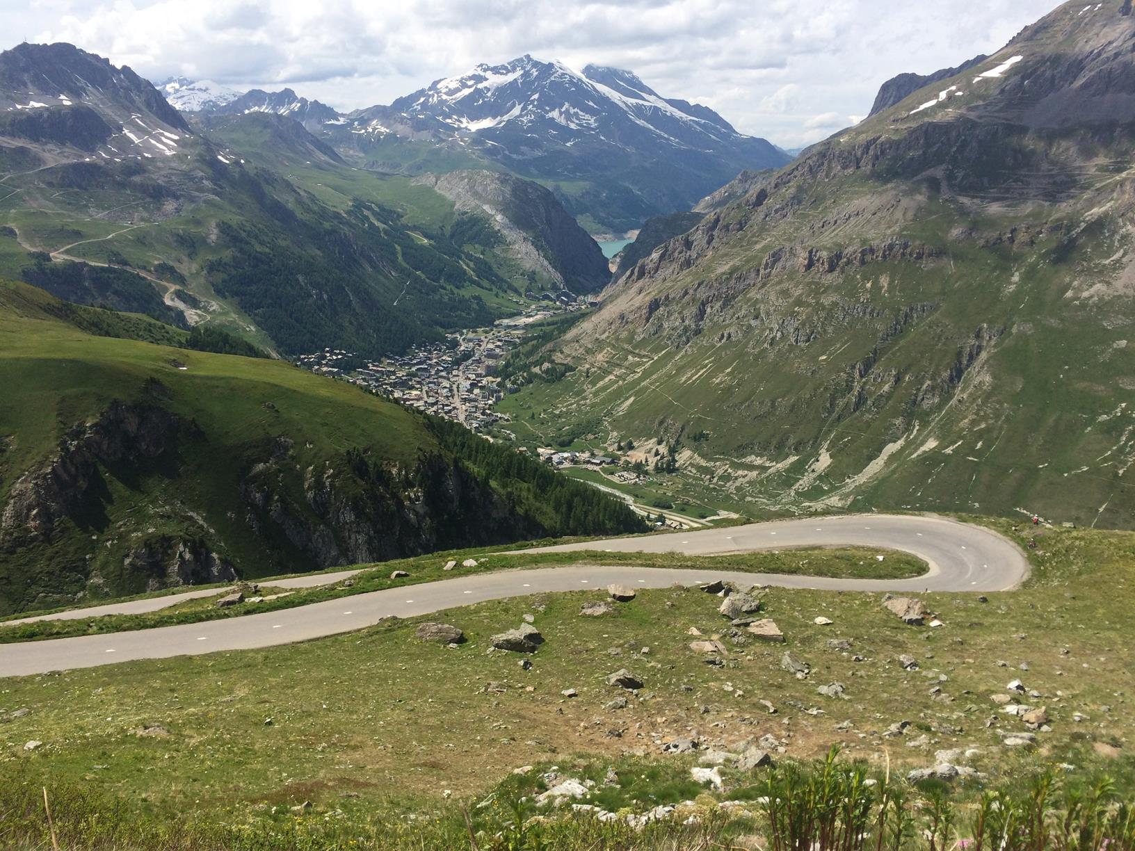
The road to Val d’Isere
The Col de l’Iseran is a nice ride with plenty of stunning views and quite a lot of snow around near the top. The ride down the Maurienne valley to Modane was tough with a strong headwind and having found a hotel we sank a few beers before heading up to the rooms to shower and change. Dinner was in a local pizza restaurant where we munched our way through a full three courses.

The top of Col de l’Iseran
Day 4: Modane to Guillestre
Starting from Saint Michel de Maurienne, the Col du Télégraphe (1,566 m) ascent is 12 km long with 14 hairpins and a vertical gain of 856 m. It’s a nice climb with plenty of tree cover to shade you when it’s sunny. That didn’t matter today. This was my fifth time up this side of Télégraphe and it took us just under an hour.
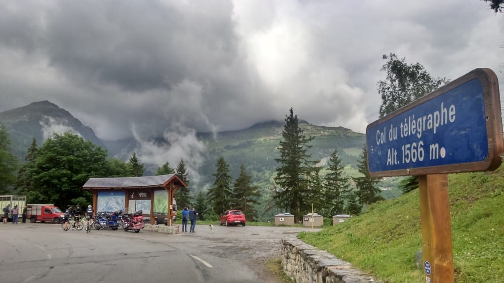
Col du Télégraphe
In Valloire, we stopped in a bar for coffee and snacks. Next up was the Galibier, one of the supercols from the Tour de France. Starting from Valloire, the Col du Galibier is 18 km long to its summit at 2,645 m. The maximum gradient is 12%. The wet weather made the climb easier, it was certainly easier than I remember it from the Marmotte, but the descent was murder in the cold.
We bought some lunch in an E.Leclerc supermarket and stuffed our faces in its foyer before heading to the 19 km long Col d’Izoard (2,360 m). This was a tough climb. The weather had improved so it was hot again and the flies were out in force. The Col d’Izoard has some long steep straight sections that are psychologically tough and climbs over 1,300 m from Briancon to its summit at 2,344 m. The decent to Guillestre is a real treat though, very fast, with a nice gorge to enjoy.

Col d’Izoard
Guillestre is a fantastic little town. It only has two hotels and the first we tried was full. Fortunately, the second hotel was enormous and we had nice rooms with balconies overlooking the mountains.
Day 5: Guillestre to Valberg
The Col de Vars (2,108 m) from Guillestre was a pleasure to ride up and the last of the climbs I’ve done on previous trips. The Vars ski stations are attractive villages and the views back towards the high Alps are spectacular.
We were held up by a serious accident on the descent. A motorcyclist had hit a car in a tunnel. The emergency services were there in force including an air ambulance. It looked pretty bad. The road was closed and we felt awful pushing our bikes past the scene, but there was space and we wouldn’t have achieved anything by waiting. The experience slowed us down on the rest of the day’s descents, we all felt quite mortal.
We bought lunch in a supermarket in the market town of Barcelonette which we ate in one of the town’s many squares. Barcelonette is a vibrant little community with shops and a street market. It looked like it would have been a good place to stay had it not been lunchtime.
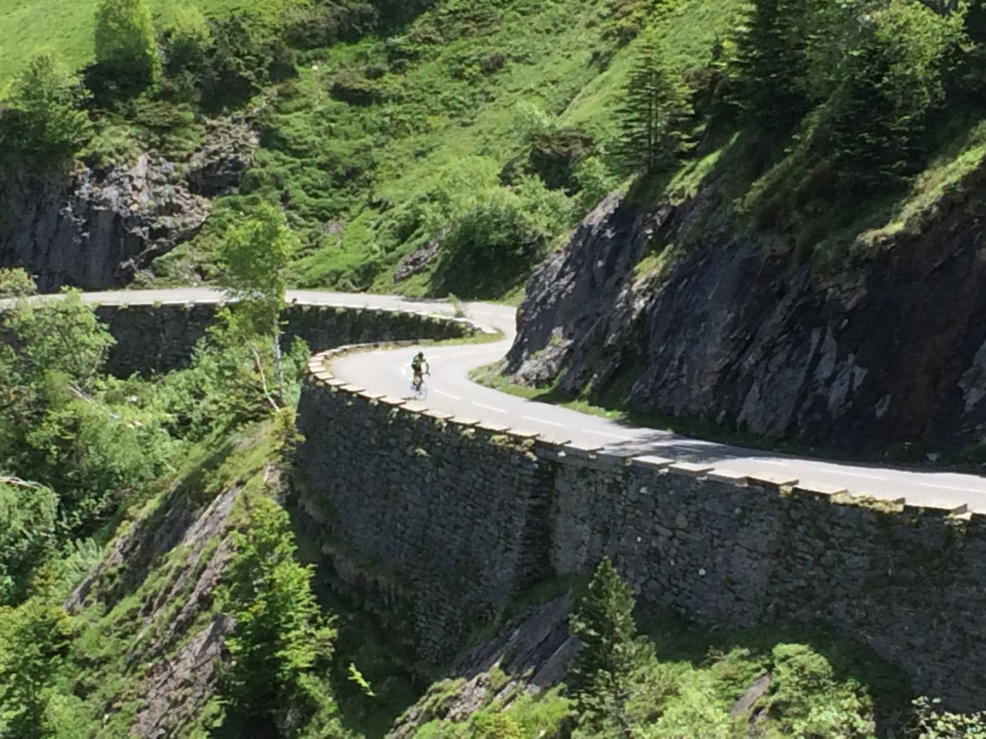
The early part of the Col de la Cayolle takes you through a steep-sided gorge before climbing through fields to its summit at 2,326 m. We saw our first celebrity of the trip here, Oleg Tinkov, the owner and main sponsor of the Tinkoff-Saxo pro cycling team. He was riding down the col towards Barcelonette. The descent is one of the most famous balcony roads in the Alps. Balcony roads are the ones cut into the sides of sheer cliffs – not much fun for people with a fear of heights, but they’re great for photographs.
The Col de la Cayolle started in a picturesque gorge
We took a turn signposted to Valberg (1,430 m) which took us up a quiet climb through forests. We stopped in a reasonable sized town called Péone for refreshments before continuing the climb. It was blisteringly hot on the lower slopes and I started to suffer from the dreaded hot-foot. I poured water from my bidons on my shoes to try and cool my feet. The road to Valberg was very quiet and we can’t have seen more than two cars in the space of an hour. I began to wonder whether there was going to be anything up there when we arrived. Just realised why I started this paragraph the way I did. The turn we took to Valberg wasn’t part of the official route, we should’ve taken the next turning. The route we took was probably better through, almost traffic free.
Valberg is a purpose built ski station and although it does have a short summer season in July and August it was almost deserted in June. Almost all of the restaurants and bars were closed as was the local supermarket. Encouraged by a sign saying “Ouvrir tout l’année” we tried a pizza restaurant only to find this was closed too. The busiest place in town appeared to be a hotel called Le Chalet Suisse where the convoy of classic cars that had been shadowing us were parked outside. The hotel’s restaurant was fairly busy and the atmosphere buzzing. We ate well.
Day 6: Valberg to Menton
Last day of the Route des Grande Alpes and on paper the easiest with a net altitude drop from Valberg at 1,500 m to the Mediterranean at, sea level.
The Col de la Couillole (1,678 m) was a fairly easy climb because we started so close to the top, and the descent was absolutely amazing with around 16 km of winding hairpins through forests and cliffside roads. The views were out of this world.
Descending the Col de la Couillole
The combination of lower altitudes and the fact that we’re now much further south meant that it was hotter than ever today. This made climbing the hills much harder. I found the Col de Turini (1,604 m) particularly tricky. This pass is famous for a stage of the Monte Carlo Rally and there were lots of photos of the race in the café on the summit.
Then it was all downhill to Menton, almost. We descended to Sospel, a very picturesque town and gateway to the Alps from the Med before heading over to what was signposted Le col de Castillon towards Menton. It turns out we were on the cars only version of the pass which took us via a tunnel through which bikes were not allowed. We went through it anyway.
Once in Menton we checked into an adequate hotel and hit the town in search of dinner. Menton is a lovely little town on the French-Italian border, on the edge of a bay between Monaco and the Italian Riviera. The tourist brochures claim that there’s sunshine here 331 days of the year and no mosquitoes. Seems no-one told the mozzies this though as I had a bite on my knee, one of my shin, and another on my thumb.
My Strava data says that, despite the net drop in altitude, we did more climbing today than on any of the previous days. I can believe it.

The Shutt Velo Rapide Team
Established in 2009 during a ride in the Yorkshire Dales between two avid cyclists, Shutt Velo Rapide began with a simple mission; to create a well-designed, high quality brand of cycling garments using modern fabrics that offer accessible performance.
The company headquarters has since moved to Oxfordshire. Everyone at Shutt is still as passionate as we were back then; continuing to stay true to our core values of authentic craftsmanship fused with clever technical solutions. We strive to give our customers a reason to come back time and time again to our small and personable business.
All our products are designed in Great Britain. Many of our jersey ranges are handmade in Leicestershire. Our other products are made by hand by specially selected partners in Italy, Portugal and Czechia. We have the unique privilege of being involved in every aspect of the production process allowing us to continually improve and develop our product range regardless of the season.
Everyone at Shutt is involved in grass roots cycling: we race, we ride audax, we commute, we cycle tour. So we understand that the hours spent on the bike have to be as comfortable as possible – it helps if you look good too! Our range really is tailored for the road and fits the needs of all cyclists – young, old, male or female, the average rider, sportive racer or out and out professional.
* There remains some debate around which is the highest pass in Europe, but I’m going with the Col de l’Iseran. The road around the Cime de la Bonette reaches an altitude of 2,802 m, but this is not a “pass”, but merely a scenic loop. It is, however, the highest asphalted road in France and is the highest through road in Europe. The actual Col de la Bonette rises to 2,715 m so there are three Alpine road passes whose altitudes are higher: Col de l’Iseran (2,770 m), Stelvio Pass (2,757 m) and Col Agnel (2,744 m). The highest paved road in Europe is the access road to Veleta in the Sierra Nevada, Spain which reaches 3,392 m, but it is not a through road (or a pass).
Il Lombardia, Lombardy, Italy
The star-studded field (Nibali, Roglic and Gilbert to name a few) will race over 243 km from Bergamo to Como but our ride was a loop of approximately 110 km, taking in several of the landmark climbs from the race and over 2,000 m of climbing.
Starting from our base in Cernobbio on the west side of the lake we rolled through Como lakeside before heading in the direction of Erba. A steady climb warmed up the legs for the more serious challenges to come and there was plenty of excited chat about really how difficult could a 1.7 km long climb (the Muro di Sormano) be?… Before the infamous section could reveal itself we still had the small matter of reaching Sormano village by way of a 6 km 6% climb.

The Hollywood-esque signs give an indication of something big to come and the Muro doesn’t disappoint.
Passing through the village you quickly reach the well-marked turn for the Muro itself. Strava indicates the average gradient as 15.5% over the 1.7 km length and every altitude marker is helpfully/vindictively painted on the road. Previously described as a “spiral staircase. A torment. A joke. Impossible. Absurd” the climb is really not much more than a well surfaced forest path of not more than 2 m wide, on the steeper sections even the professionals will use the full width to ease the grade just a little. From our group one or two brave (looking back, foolish) souls went at it hard out of the blocks and pulled out an early 30 second lead, which on such a climb is actually just a painful, handful of metres.
Tackling the climb before provides little advantage over first-timers, other than the knowledge that for most riders it’s a case of putting it in the easiest gear and find your own survival pace to avoid the dreaded “foot-down”. It really is a climb that will give you a sense of achievement for completing it without stopping, trying to clip back in on 15%-20% gradients is no laughing matter either. Although objectively the last few hundred metres are less steep the damage done earlier means that for all the pained faces and heavy breathing, the result is little more than walking pace. Having finally conquered the seemingly interminable climb we reached the finish line of a barrier across the road and a small area of panting, exhausted cyclists and slightly bemused car drivers and motor-bikers.
After our group had reformed we rolled down the other side in search of sustenance and fortunately stumbled upon a fantastic lunch in Zelbio (Ristorante National) of regional charcuterie followed by hearty dishes of pizzoccheri and pennette alla norcina. Unlike the racers on Saturday you can then enjoy some of the most stunning views around the whole lake as you descend towards Nesso and the views continue all the way to Bellaggio where the next landmark climb awaits.
The views on the stretch down to Nesso and along to Bellagio are breathtaking.
Although Bellagio would make a fine coffee stop we forged on and in no time you reach the foot of the Madonna del Ghisallo climb. The climb is actually stepped, with 4 km at 8.5% then a mid-section which is flat and downhill before a final 1.5 km again at 8%. Coming after the Muro its easy to mentally underestimate this climb, but coming after the Muro your legs may protest more than you’d otherwise expect.
As you turn the final hairpin the summit offers cafes, incredible views, a cycling museum and monuments and even a chapel partly dedicated to cycling memorabilia. This is a spot that the race cameras if not the racers will dwell upon but if you’re riding for pleasure then take a few minutes to enjoy it. The inside of the chapel should not be missed by any cyclist.
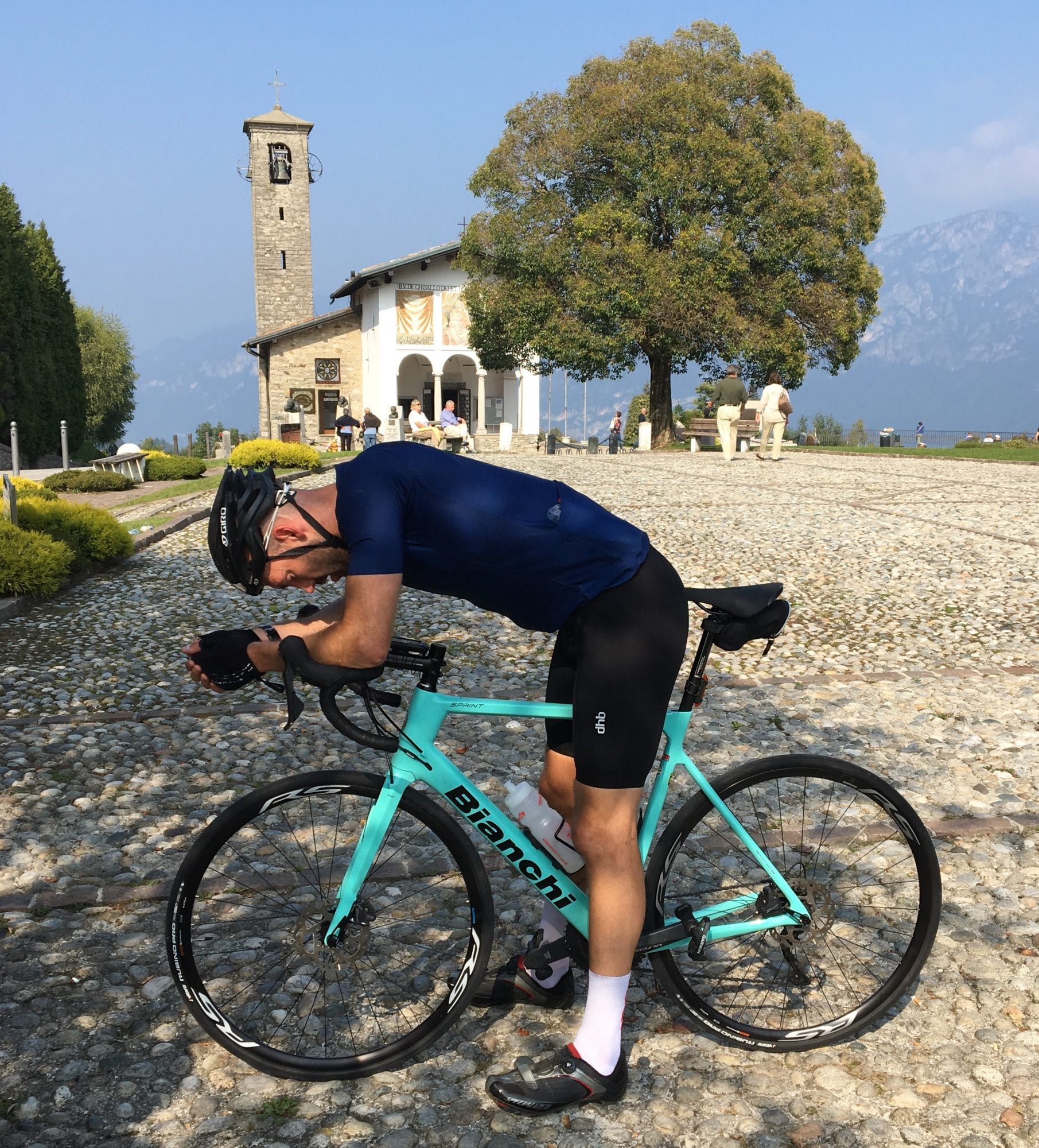
Praying/recovering by the chapel at the peak of the Ghisallo climb.
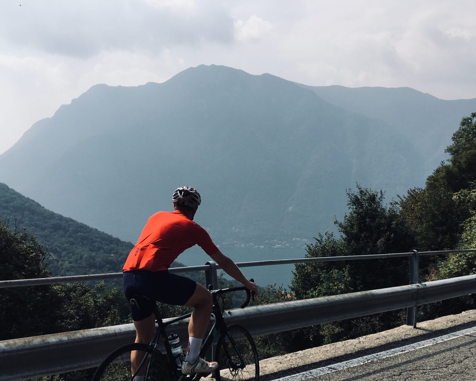
Once we had our fill we took the very fast descent off the summit and the predominantly down hill route back to Como for a well deserved gelato before looping back to our start point of Cernobbio. The racers instead will face a potentially decisive final ascent and descent close to Como town before the final kilometre. With good weather forecast Il Lombardia should provide stunning backdrops to an exciting and open race. As our ride showed the area also offers fantastic opportunities for mere mortals to experience memorable parts of the race route but also to enjoy the spectacular views and food and to create some new “war stories” to recount on our regular rides!
About INVANI
The unique INVANI clothing range provides all the benefits in terms of look, feel and function of premium cycling garments but with two reversible sides, such that each garment provides two colour options. The collection comprises short-sleeve and long-sleeve jerseys, gilet, sleeved base layer and arm and knee warmers, in each case with Male and Female options. The range is manufactured in the EU and constructed exclusively from premium Italian fabrics.
Development has taken place over more than two years with extensive testing of items in varied conditions. Feedback from highly experienced end users and customers has been extremely positive.
The range is available exclusively from www.INVANI.cc, where additional information on all the products can also be found. For any additional queries contact INVANI on the hub.
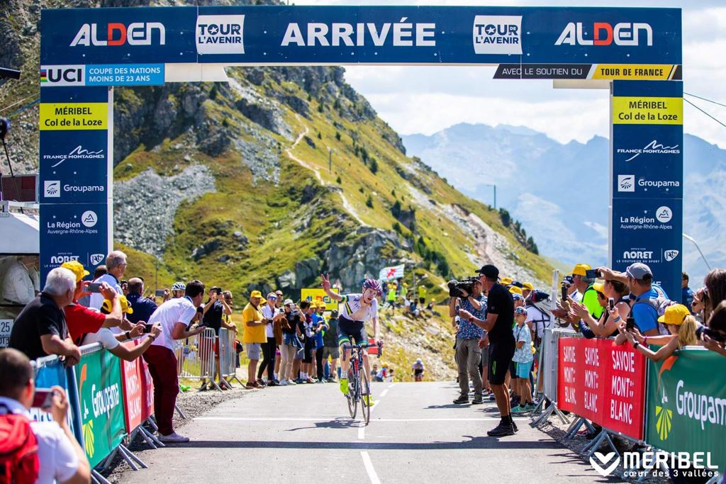
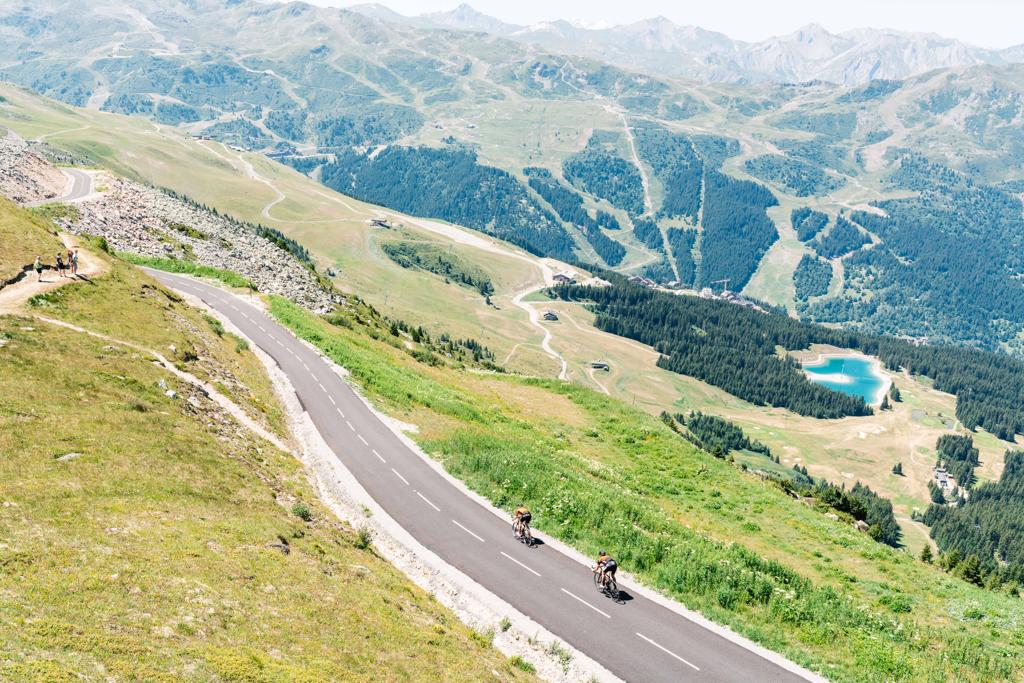
Col de la Loze – the Meribel Ascent
Since we first went up the Col de la Loze, there has been a lot of press and hype about the climb. We have regularly ridden it this year with Alpcycles clients. It has been getting great feedback and becoming a firm favourite amongst local riders due to it being traffic free. The col has had a good flow of cyclists from all over heading up to see what all the hype is about and there have also been regular Time Trials, a Haute Route summit finish and we have taken a magazine journalist up to check it out.
Then in early July it was finally joined to neighbouring ski resort Meribel to officially become the “first traffic free Col in the Alps”. I was away working on Alpcycles trips in other locations over the spring so didn’t get to ride the Meribel ascent until mid-July but had heard a few rumours about the climb so was pretty keen to hit it up.
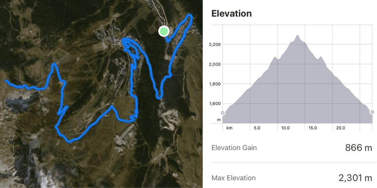
Well; I can quite honestly say that I was shocked at how steep the last 6 km of the climb were and would definitely rate it as one of the hardest I have ever ridden. As you can imagine I have been up a few climbs in the last 20 years! Its consistent average 10% gradient with savage pitches of 19% plus will give no respite at all. From the bottom of the valley the full climb is 23 km giving you +1,300 m of ascent with the last 6 km being the “new road” of the Loze. This is where the road really gets nasty. With only a few hairpins in the first 2 km thereafter the road has brutally long straights with a view of the summit for a good 2 km and a pure “wall like” ramp in front of you. I was actually cramping in my arms due to being constantly stood up as the front wheel would lift whilst seated!
A few of the group I rode with that day had to stop on the way up. These are all strong, experienced cyclists who ride locally. The climb was littered with riders slumped over their handlebars wishing for more gears. On reaching the summit (wanting to puke) most of our group agreed that we would not be rushing back for that much suffering over 6 km. Some vowed it was the first and last time they would be riding up there.
At the end of August, the Tour de l’Avenir (Under 23 TDF) tackled the full climb from Brides les Bains in a mass start Time Trial. The Tour de l’Avenir is often used to test the route and logistics around a finish before the World Tour riders and Tour de France are let loose the following year. The stage was won by Alexander Evans (AUS) in 0105’39 seconds! And as you will probably already know the 2020 Tour de France will tackle the Col de la Loze from the Meribel ascent on Stage 17 – Grenoble to Meribel/Col de la Loze (Wednesday 15thJuly) which will be a humdinger of a stage for sure.
So, if you’re in the French Alps in 2020 the Col de la Loze should definitely go on your bucket list. I prefer the Courchevel side but both sides are equally awesome but of course you will want to tackle the Tour de France side from Meribel before or after the race hits it in July. All I will say is get ready to engage that granny gear and maybe pack an ice-axe, rope and crampons! But the panoramic view from the summit is worth the pain & suffering for sure.
Of course, if you are in the area, and need somebody to show you the local roads give us a shout!
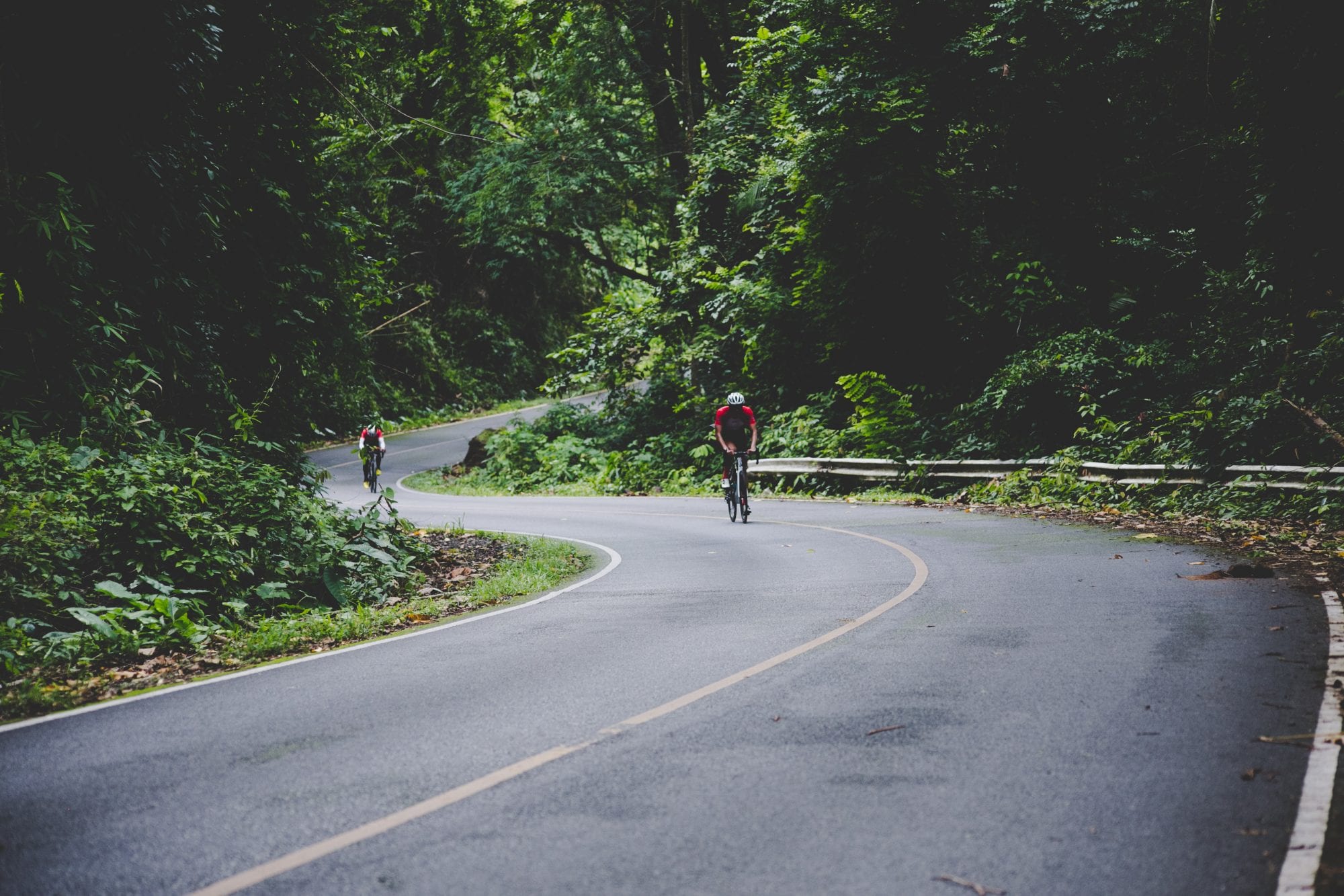
Khao Yai, Nakhon Nayok, Thailand
It may require an early rise to avoid traffic but Khao Yai or ‘The Big Mountain’ is undoubtedly one of the locals preferred training choices when it comes to getting in some quality climbing. From the entry gate to the top, you are set to gain over 1,500 m over 37 km. Surely not as tough as most Pyrenean or Alpine climbs, but again; in none of those do you get the chance of an encounter with a five-tonne wild animal.
When approaching in our van over the flatlands of central Thailand Khao Yai can be seen from 30-40 km away. A green giant rising majestically over the morning tropical mist. It’s 8am when we park in the resort a few hundred meters down from the Khao Yai National Park gate where we assemble our bikes and drink some espressos. It’s the beginning of the rainy season but we get away with just a cloudy sky, the perfect conditions to tackle a long climb in this part of the world.
The road stretches into the jungle in a way that it doesn’t feel like we are climbing …
Before crossing the gate, paying up a fee of THB 60 for locals and THB 400 for foreigners, we decide to take a left turn and spin our legs for 10 km to warm up, as once inside the park it will be climbing from the gun with the first km at 6%. After this kicker, a succession of long uphill drags follow. The road stretches into the jungle in a way that it doesn’t feel like we are climbing, even though for a few hundred meters our computers are displaying a constant 7-8% gradient. Humidity starts to fill our lungs as we penetrate the thick green walls of Khao Yai. The sun gets out for a brief moment but it doesn’t make much of a difference, we are climbing our way deeper into the heart of the jungle and it feels like we are being swallowed by giant waves of fresh tropical foliage.
At this point, we hear nothing but our own deep breathing and the odd chant of local birds. The road turns a bit rugged at times and every now and then it’s dotted with elephant faeces. No sight of these giants though, we just see groups of cheeky monkeys resting in the hairpin ends, not even bothered at our unfamiliar presence.
One hour into the ride and we have gained over 750 m. From here, the climb flattens considerably with a couple of rollercoaster-like dips that allow us a slight respite. At 28 km we find the guard’s hut where we top up our bidons, and then take a right-hander that gets us into the real test of the day, Khao Keaw, a 5.6 km climb at an average of 8%.
We realise now we are in for a twenty-something minute sufferfest.
If until this point we barely had a reference that gives us the impression of climbing, that’s about to change now. ‘The Green Mountain’ welcomes us with double-digit gradients, beautiful hairpins and open sections where we can have visual confirmation of what our legs were already feeling, we are climbing high. The disappearing vegetation by the road gifts us with the finest views but also leaves us exposed to the fierce sun, that makes it even harder to find a comfortable tempo. We realise now we are in for a twenty-something minute sufferfest.
The gradient is never constant. In some sections, we must sit down to prevent the rear wheel from skidding in the humid tarmac. Our group is now in bits, all over the place. It’s a survival ride to the top, most of the time on the biggest cog. I have today a 34×28 that suffices, but in some sections I wouldn’t mind a 30 or a 32 at the back.
“If you reach the last part of Khao Keaw full gas you are going to set your new heart rate PB”
This climb has a cruel final act. Just as we think we are at the top we negotiate the last right turn only to find a never-ending wall that maxes at 18%, 400 eternal meters. I always remember what a local rider told me the first time I came to this climb: “If you reach the last part of Khao Keaw full gas you are going to set your new heart rate PB”. He was rightfully true.
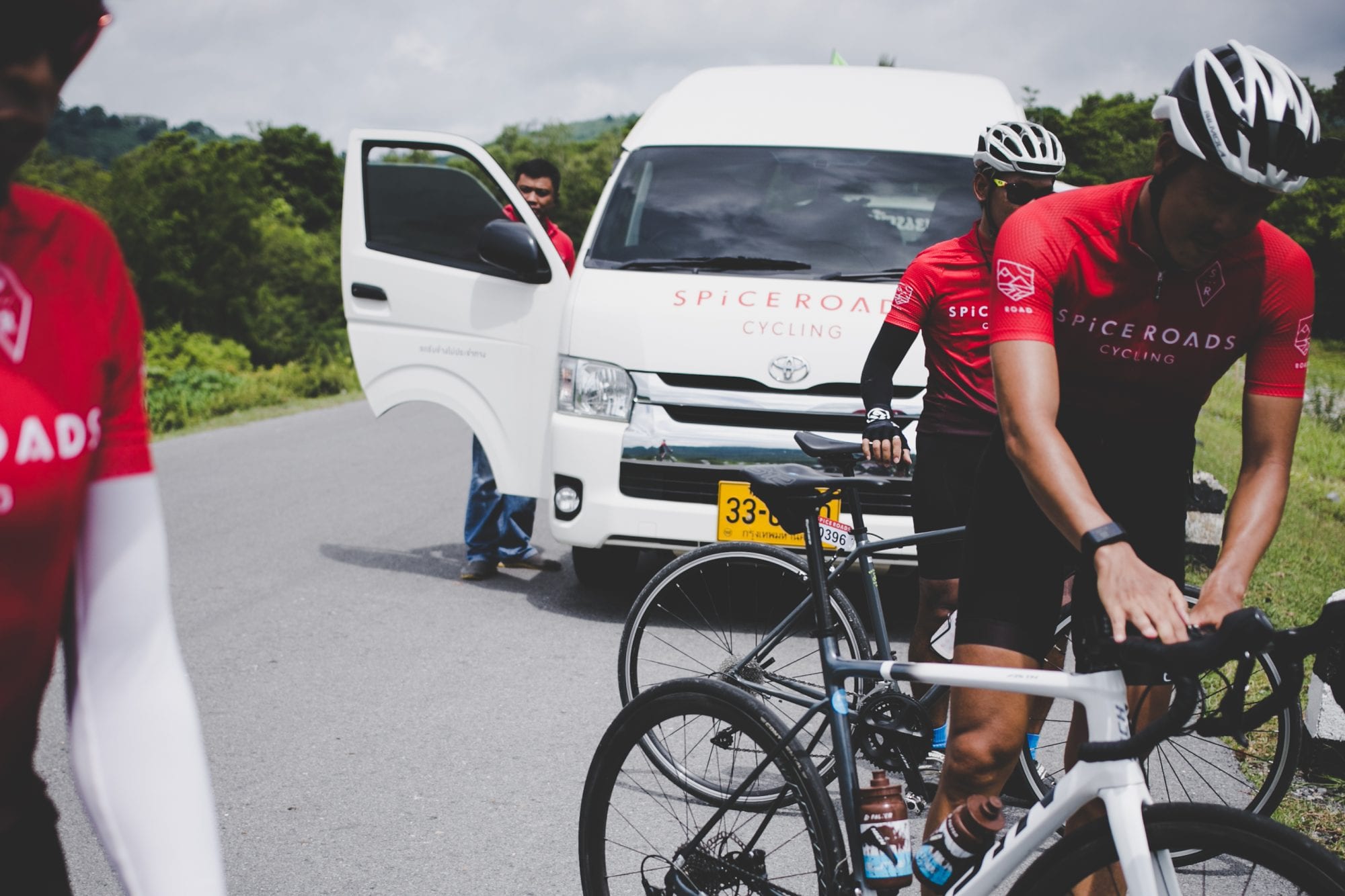
About SpiceRoads Cycling
Since 1995 we’ve been sharing our passion for traveling by bicycle. Curating extraordinary cycle adventures in over 30 countries that give you the opportunity to get up close and personal with remarkable cultures, characters and landscapes in a way that no ordinary tour could.
We offer rides all over the world, on every type of terrain, for all ages and experience. From classic tours to epic cross country voyages, SpiceRoads Cycling adventures are for anyone who believes what we always have…
That nothing good ever happened inside a comfort zone. That immersing yourself in different cultures teaches you things you would never learn in a textbook. That you get out of life precisely what you put in. And that traveling isn’t just about seeing the world, it’s about changing how you see it.
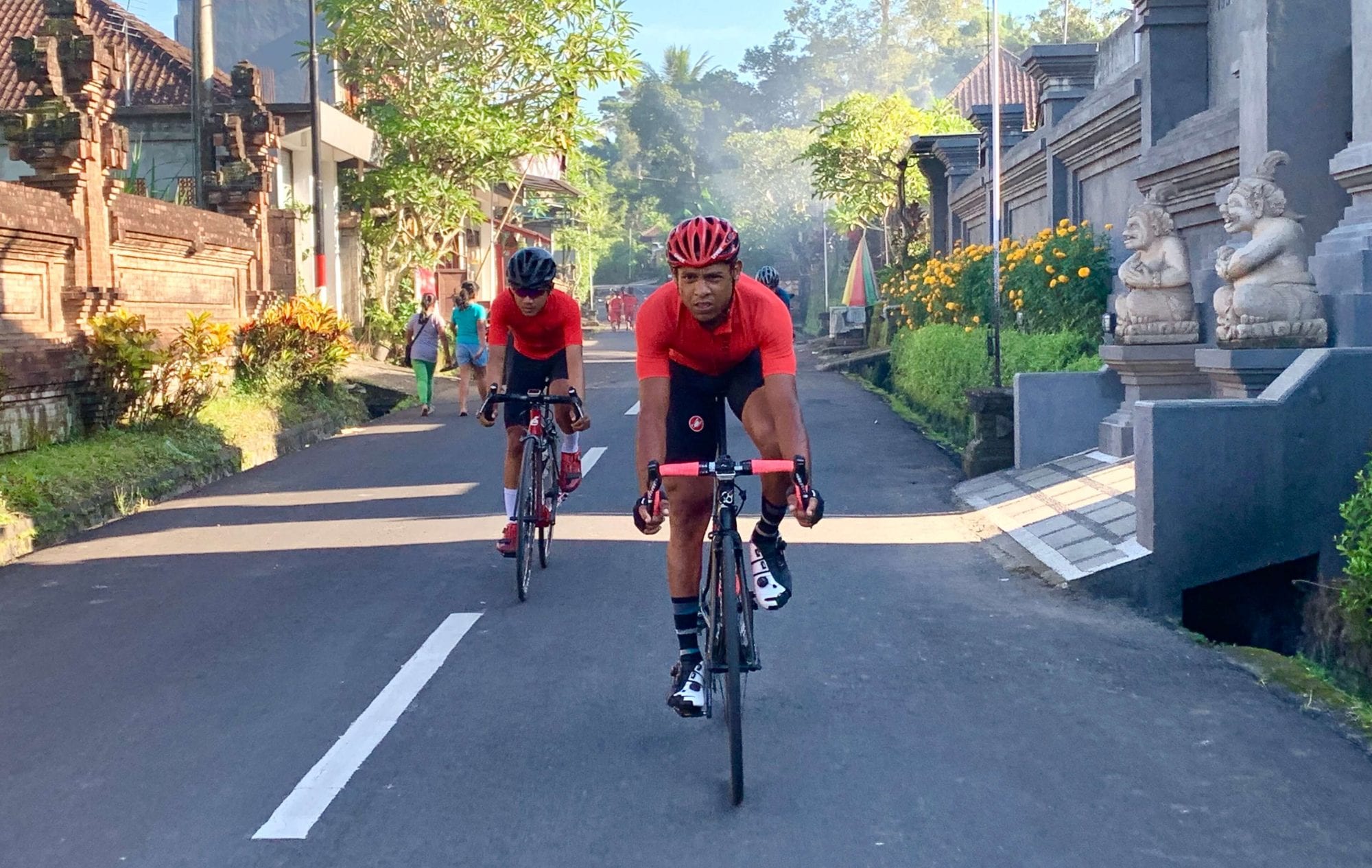
Bali 144 Challenge, Bali, Indonesia
Bali 144 Challenge is a four-member team adventure event, designed to encourage a culture of helping and supporting your teammates. Teams can decide whether they wish to ride or race the route, with prizes up for grabs for those who choose to race. Those wishing not to compete can take the challenge as an opportunity to complete a stunning bucket list ride in cycling heaven with their mates (within an eight hour cut-off time) with the support of road marshals, food/drink stations, medic, support vehicles, and in the company of fellow cyclists from the region.

Starting and ending in Ubud, in the foothills of the majestic Kintamani, the 144 km (12 Squared) 2,400 meter elevation route has been painstakingly designed by experienced cyclists to take riders through some of the best – if lesser known – areas for cycling in Bali. A lot of thought and research has been put into the design of the route to ensure that the roads used are as traffic free and smooth as possible.
The 144 Challenge starts at Sens Hotel and your first left turn is just before the bustling Ubud Market, straight down south through the main drag with its quaint cafes and restaurants. The riders may find it a little cold as Ubud will be around 17 degrees in the morning but the overall temperature will be comfortable – averaging 31 at the highest and 22 at the lowest.
As you head west and pass a popular river rafting drop off point, you will be greeted with gradual climbs, lush paddy fields, villages, sleeping dogs, and Mount Batur in the distance.
After you turn right up north, you might see people showering, doing morning ‘rituals’ and washing clothes by the river. You can ‘high five’ school kids who always get excited to see so many cyclists passing through, or even witness a mapeed (ceremonial walk bringing offerings to the Gods).
Coming up towards Petang, you will head back down south for a stretch of fast downhills and rollers after turning right by Sangeh Monkey forest. Unfortunately those little critters hang out a little further into the forest so you will not get to see them. It is however worth a visit after you finish the challenge.
Some cultural things you might notice when you’re cycling across Bali are offerings left on the roads, the locals call it “Sesajen”; big temples in Kintamani, a lot of statues that represent the Gods, Deities, and animals which are sacred to the locals.

Many interesting mixes of road surfaces and rollers will keep you entertained before making your way back north to Plaga, where your eyes can enjoy marigold fields. This is where the climbs get a little steeper, around 20 km from Plaga Bridge to Pura Puncak Penulisan. You will then have a little kicker as you pass a waterfall with lots of highly dense areas to keep you cool as the day progresses.
What can you do post-ride?
If you still have the legs after the challenge, you can stumble into Ubud Market to get that one shirt you’ve always wanted, gift-shopping for your friends, try some rujak buah (fruit salad with peanut sauce), eat Babi Guling (Bali’s infamous roasted pig) and also buy a wooden ‘lolok’ bottle opener. We bet everybody will try opening a bottle with it.
About Twelve Squared
Twelve Squared is an Indonesia-based premium cycling apparel and accessories brand.
Our activities are centred around creating fun avenues for cyclists to push their limits, whether through embarking on cycling adventures over challenging terrain or distances, or exploring new ideas and concepts in the world of cycling. As the sport of cycling is constantly changing, we believe cyclists should try to stay ahead of the game by thinking outside the box, challenging existing norms, and in the process growing in depth as cyclists.
With ‘Get Out of Your Square’ as our motto, we would like to challenge cyclists in their passion of cycling and getting out of their comfort zone.
Ariège Pyrénées, France
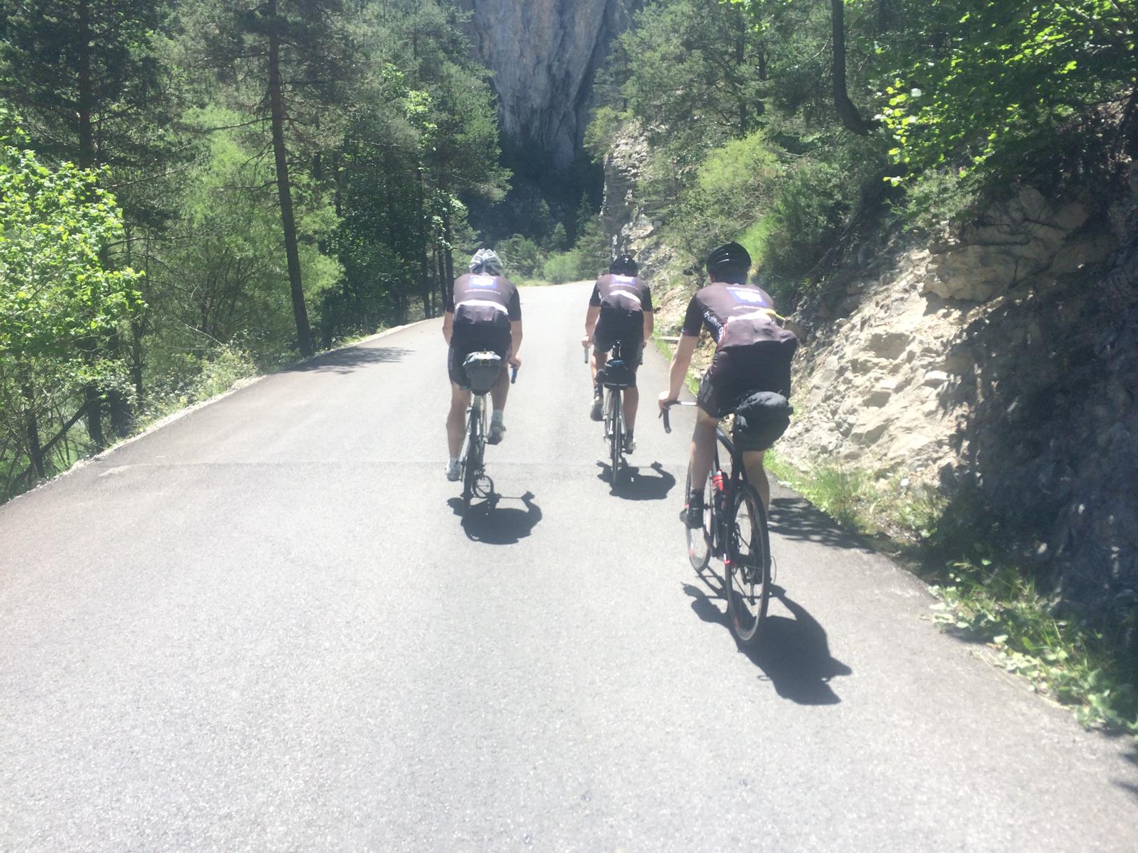
We leave from our doorstep and ride out along the gorgeous vallée de L’Hers, the imposing grandeur of the high mountains in panoramic view the moment you clip in. We ride due south in the direction of Foix and the first 30 km of the day’s ride are a perfect mix of flat and rolling roads. En route, we give the legs a reminder that the day’s terrain will soon rise high above sea level as we crest two 500 m cols, the Col de Calzan and the Col de Py. Both climbs are intrinsically linked with the Maquis resistance fighters of WWII and a humbling reminder of the sacrifices they made for the freedom of others. The amazing Château de Foix comes into view as we reach the outskirts of the town and we are soon winding our way through its medieval streets and making our approach to the day’s first major climb – the Col de Péguère.
Photo by Camille McMillan
Col de Péguère 1,375 m
Length: 18 km (from La Mouline)
Height Gain: 872 m
Max Gradient: 10%
The side we climb is not to be mistaken for the road used in the Tour de France – that’s the viscious Mur de Péguère and we save that for another day. This ascent is longer and the average gradient far more forgiving. The climb can be split into three distinct sections; first up is a fairly sanguine 10 km along the vallée de L’Arget and an opportunity to chat and enjoy the surrounding countryside. The second section is the toughest and the average kicks up above 7% for the next 4 km. The gradient is taxing but never a suffer fest and it is important to reign in any desire to push on at this point as we’re only now starting the day’s real climbing. The climb has several markers along its route and first up is the Col de Marrous at 1,000 m. There’s a lovely auberge nestled in the trees where we can refill any bidons for those running low. We push on through the dense forest where deer and wild boar roam and as we continue our upward trajectory and the trees begin to thin out, we get our first glimpse of the magnificent views stretching out across the Garonne flood plains towards Toulouse. The gradient has eased right off now and the average is little more than 2.5%; it’s a big ring finish for those feeling strong. As you crest the summit you are rewarded with what I think is one of the best views in the whole of the Pyrénées – a mind-blowing view across the Massat valley where, on a clear day, the whole range appears visible.
Photo by Camille McMillan
We’re up at 1,375 m now and ride west along a ridge past the ancient Laffont tower towards our next marker, the Col du Portel. At 1,432 m there is little in the way of climbing as we pass the summit marker and head down towards the village of Biert. The views are incredible; to the right you can see for miles as the mountains give way to plains and to the left the majestic high peaks of the Pyrénées and the Spanish border beyond. Passing the summit of the Col de la Crouzette, we continue our drop into the valley below. A word of caution – the middle section of the descent is narrow and in sections very steep – descend with caution. As we reach the village of Biert, we prepare ourselves for the day’s next ascent – the Col de Saraillé.
Col de Saraillé 900 m
Length: 5.4 km
Height Gain: 356 m
Max Gradient: 10%
We are very much on roads less travelled now as we head deep into the Massat valley. This climb is everything I love about riding in this part of the Pyrénées – undiscovered and different. The road is narrow with little or no traffic, the sound of mountain streams and birdsong your only company – it’s a real escape. The climb twists and turns through ancient forests, a great shade sail on hot days and the gradient is steady. As we reach the small hamlet of Le Saraille, there’s a break in the trees and the higher peaks show themselves as we close in on the summit. At just over 900 m and a mere 356 m height gain, the climb is a test for the legs but nothing more. The descent into the valley floor below is technical but opens up onto a glorious balcony at Camp de Caou and the old church in the hamlet of Coste sits in a glorious spot looking out across the Garbet valley below. Back on the valley floor we head towards the old spa town of Aulus-Les-Bains. Best known for its thermal springs, spa complex and several wonderful Belle Époque buildings, it’s the perfect place to stop for a shot of caffeine. Next up it’s the Col d’Agnès.
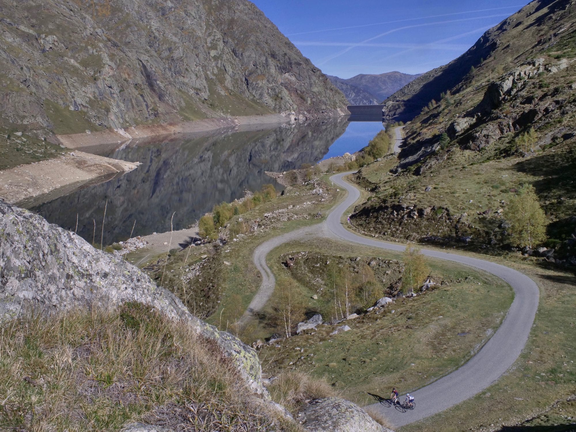
Photo by Camille McMillan
Col d’Agnès 1,570 m
Length: 10.5 km
Height Gain: 820 m
Max Gradient: 10%
From Aulus, it’s a tough climb and the first half particularly so with testing gradients above 8%. The road initially follows the ravine carved out by the river Garbet and for the first five kilometres the bends are long and the grandeur of the high peaks we are heading for dominate the horizon. The sound of cascading water is a welcome distraction from the testing ramps. At the 5 km mark the first of the hairpins begin and height is gained quickly. The reward is a stunning stretch of road around the 7 km mark that hugs the mountain side giving views of Aulus in the valley bottom and the Col de Latrape and Guzet Neige high up on the other side. As the increasing altitude takes the trees out of shot, the vista becomes more impressive with the Pic de Certascan dominating the horizon and the border with Spain. The summit is reached at 1,570 m and a chance to revel in that wonderful feeling you get when you summit a new climb. You can now enjoy a long and super fast descent, flying past the Etang de Lers to the village of Massat before the day’s final climb, the Col de Port.
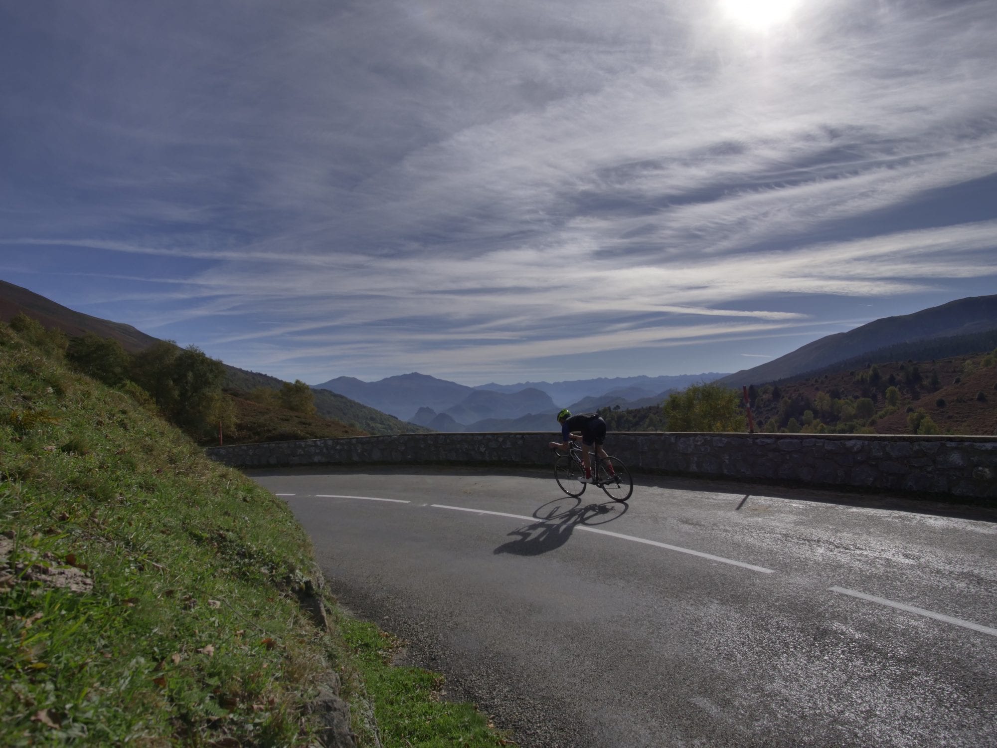
Photo by Camille McMillan
Col de Port 1,249 m
Length: 12.3 km
Height Gain: 619 m
Max Gradient: 8%
We normally make time for a quick stop in the delightful village of Massat, everyone buzzing after the descent – coffee not needed here. Despite some steeper ramps on its early slopes, the Col de Port is the perfect way to finish the day’s climbing. The steady gradient beyond the small hamlet of Espiés allows you to settle in and spin your way up the mountainside. With plenty to keep your mind occupied, from the old stone houses dotted along the roadside to the glorious views back across the valley, you’d be forgiven for thinking that riding cols is easy. The summit can be viewed from some way down the mountain but the easy gradient means the psychological torture sometimes felt in these situations is held at bay. The final 2 kilometres are fast and there’s a welcoming auberge at the top with a lovely terrace offering spectacular views down the valley which we will soon descend to Tarascon.
Photo by Camille McMillan
The top section of the descent provides photo perfect views and it’s worth knocking the speed off to enjoy them and get some pictures on your phone. On reaching the town of Tarascon the tough stuff is done and it’s a largely downhill run to Foix and for anyone with tired legs, our support car can be on hand to take you back to base. For those riding, it’s steady back to ZeroNeuf. Whether you ride back or drive back a dip in the pool and a craft beer in the bar awaits.
Our Ariège Pyrénées loop is a tough day on the bike but it’s a real favourite amongst guests and a hugely rewarding experience. The amazing thing is it’s merely scratching the surface of the seemingly endless quiet and maintained road network the region offers cyclists (of all abilities and ambitions). It’s surprising how few people have heard about the Ariège, let alone ridden here and we are intent on changing that.
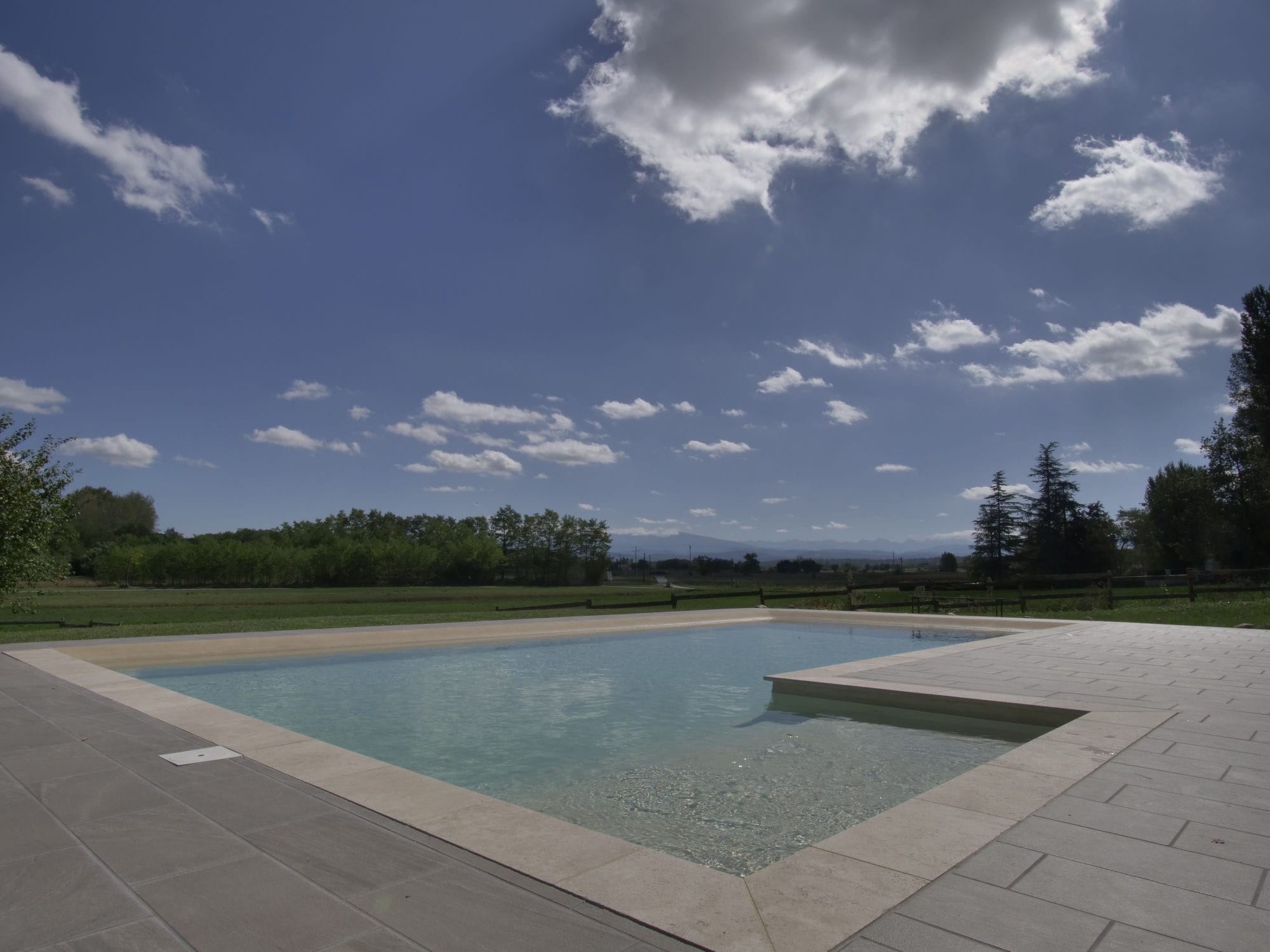
Photo by Camille McMillan
The idea behind ZeroNeuf was a fairly simple one; provide a fabulous base for cyclists but ensure there are ample facilities to entertain non riding partners and families. We have incredible cycling on our doorstep but we also want to make sure people can switch off and relax when they’re off the bike. We have renovated an old Ariège farmstead and it now provides stylish and comfortable accommodation, a swimming pool and garden with panoramic views of the Pyrénées and a café/bar serving fine coffee roasts, local craft beer & wine (and my wife Jocelyn’s amazing homemade cakes and snacks!)
You can choose from one of our tailored cycling escapes, we can build you a custom trip or you can stay and ride on your terms. We can look after groups, families (childcare is available on site), couples and singles on a fully catered, bed & breakfast or self-catered basis. We welcome cyclists of all abilities and ambitions and we adopt a strict no ‘rules’ policy. Our qualified ride leaders can guide you and high quality bikes (Giant TCR Advanced Pro Di2 Disc) are available to rent on site.
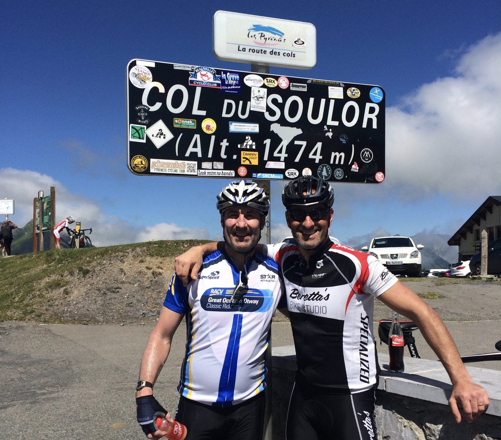
Col d’Aubisque from Lourdes, Pyrenees
This year (2018) we will see the Aubisque featured in the Tour after the pros climb the Col d’Aspin, Tourmalet, Col des Borderes and Soulor beforehand on Stage 19. Our tour in September will also cover all of these climbs – albeit over a week!
I’ve done this climb six times now and it never fails to please. After a coffee stop 20 km into our ride at Argelès Gazost where there are a few cafes that actually serve decent coffee, we leave the carpark with 30 km of climbing ahead of us to reach the top of Aubisque (thankfully it’s not all uphill!). After the initial pinch out of Argelès, we roll through the valley with the view of the glorious Pyrenees mountains right in front of us.
The small village of Arrens marks the start of the first real climb up to Col de Soulor. This 8 km climb is short and sharp but has fantastic views back down to the valley over your shoulder as you climb the quiet tree lined road. The road opens as you get closer to the top of the Soulor with the only sounds being your breathing or the occasional cow bell in the crisp mountain air.

Time for some pics at the first peak, perhaps fuel up with a Coke and a ‘Le Super’ Baguette before we briefly descend (yes descend!) for 2 km. After that, it’s another 8 km of magical riding though some short tunnels that open up to 360 degree views across the Ouzom Valley. The dude at the cafe at the Col d’Aubisque is a real character and always recommends the soup, spanish omelette matched with the house red wine.
Then the sweet descent back to our Château 50 km away.
About Bike France Cycling Tours
Stay in the heart of the Pyrenees with all the classic climbs just a short ride from our doorstep. Our cycling tours include delicious food and wine, exclusive Château accommodation and an epic cycling experience!